
Here’s what you need to know:
A wintry mix will cause messy travel today. More wet weather possible on Friday into the weekend.
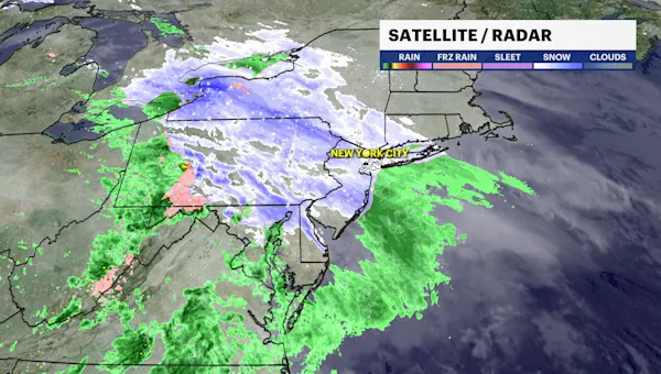
Wet snow showers is moving through the city this morning with sub freezing temperatures. Expect reduced visibility and slippery travel for the morning commute.
Snow will transition to cold rain after 12 p.m. through 2 p.m. A slushy coating to an inch of snow is expected.
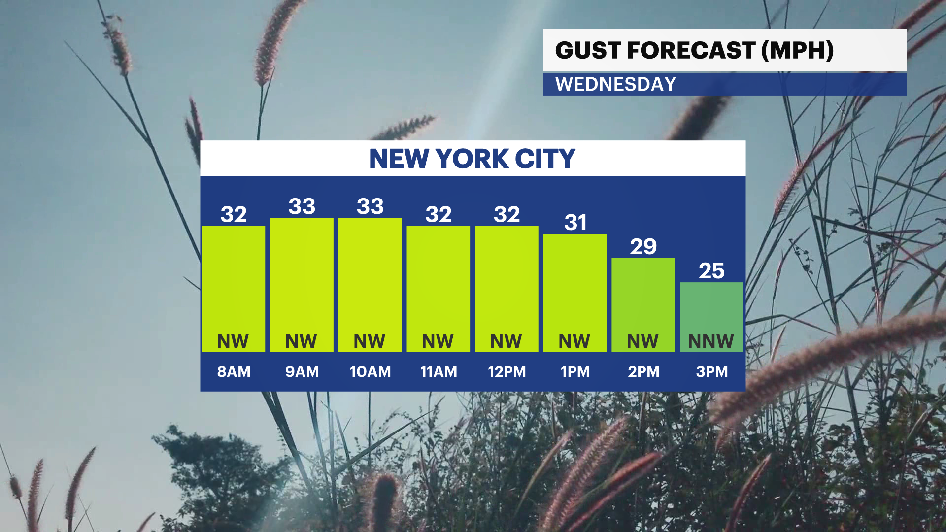
Behind this storm system, winds turn gusty on Christmas Eve. Temperatures are chilly in the mid 40s and plenty of sunshine.
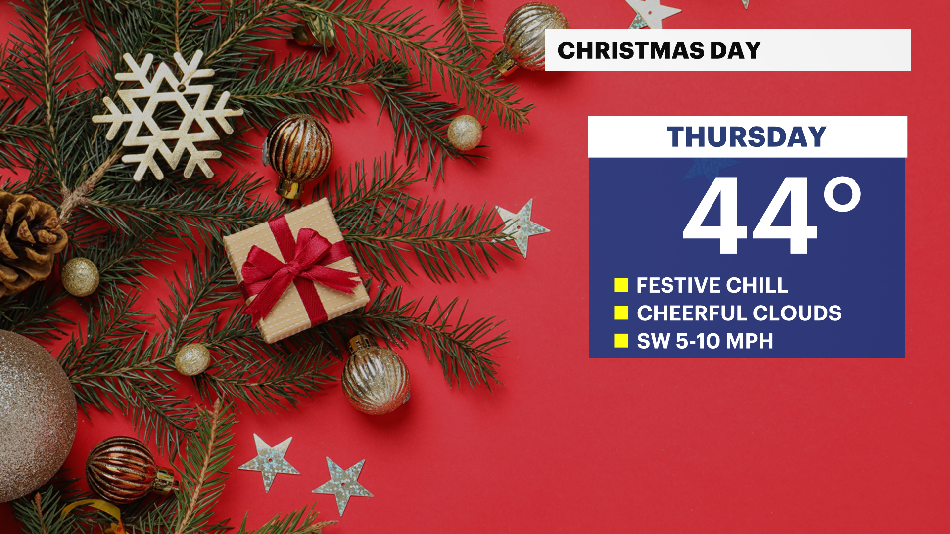
Christmas Day will be cloudy, calm and chilly with near seasonable temperatures in the low to mid 40s.
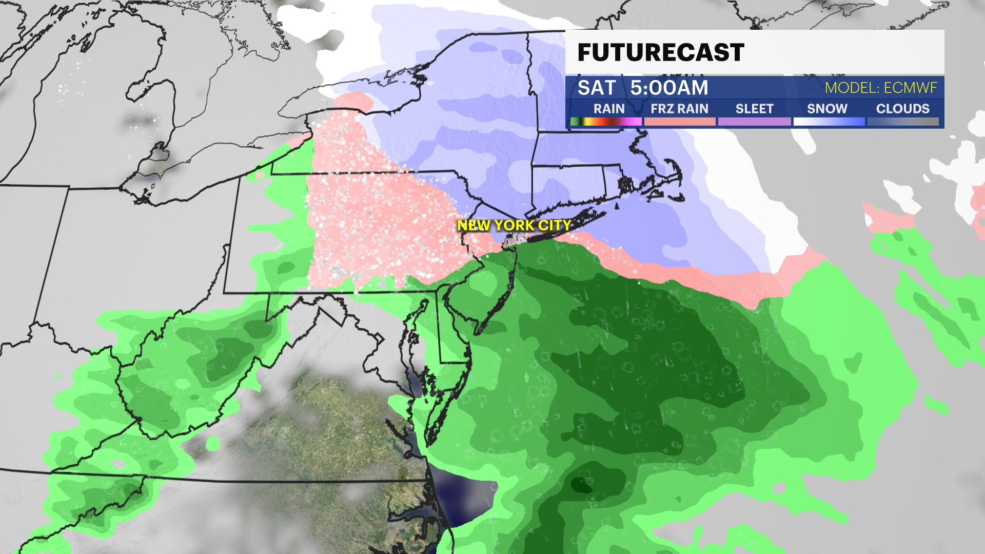
Another storm system will move into the city on Friday. The timing has shifted with this storm system, trending later in the afternoon with colder air in place. There’s a chance of a post-Christmas wintry mix. This will likely impact any post-holiday travel plans. Stay tuned for updates.
It gets colder this weekend with chances of rain and snow. Stay tuned for updates!
Today: Morning snow changeover to rain, cold with light winds. Highs near 40.

Tonight: Mostly cloudy, cold, and becoming breezy. Late light snow. Lows near 35.
Christmas Eve: Brighter, breezy, and chilly. Highs near 43. Lows near 32.

Christmas Day: Cloudy and festive chill. Calmer winds. Highs near 44. Lows near 31.
Friday: Cloudy and cold. Chance of afternoon wintry mix. Highs near 32. Lows near 30.
Saturday: Mostly cloudy and cold. Chance of rain and snow. Highs near 35. Lows near 32.
Sunday: Cloudy and chilly. Chance of rain and snow. Highs near 42. Lows near 29.
Monday: Mostly sunny, colder with light winds. Highs near 35. Lows near 25.