
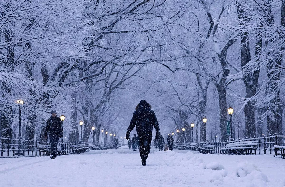
A wintery combination of snow and sleet is expected to cover the area throughout Saturday morning. Snow is expected to fall dry and powdery during the day before becoming wet overnight
17:12 ET, 25 Dec 2025Updated 17:12 ET, 25 Dec 2025
 Meteorologists warn that while most places will receive 4 to 8 inches of snow, some locations may receive 10 inches(Image: Accuweather)
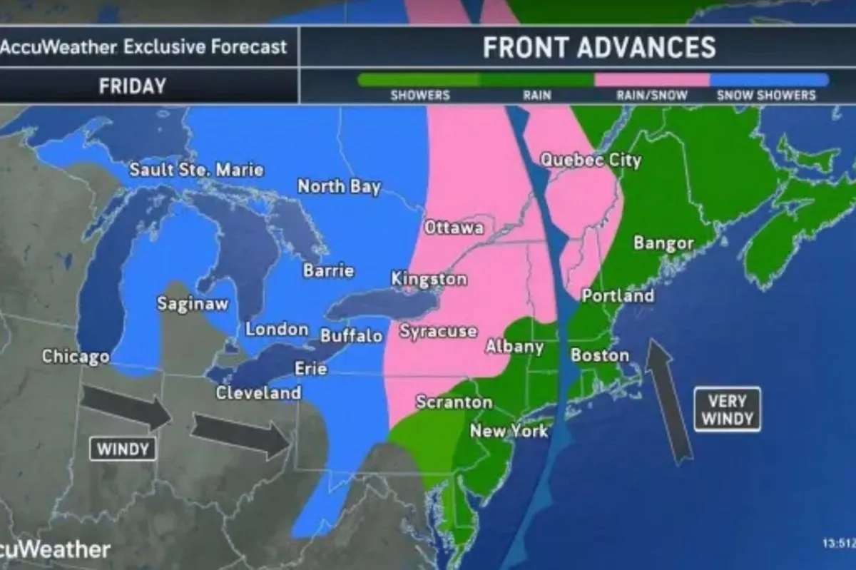
A winter storm is expected to batter the Northeast’s mid-Atlantic states on Friday, mostly affecting portions of Pennsylvania, New Jersey, and New York, with up to 10 inches of snow in some regions.
Meteorologists warn that while most places will receive 4 to 8 inches of snow, some locations may be hit with 10 inches. Less will probably be seen throughout the remainder of the area, ranging from 2 to 5 inches, with isolated spots seeing up to 8 inches.
“New York is no stranger to snow and cold weather, and given the Christmas holidays, it’s important to be extra prepared before getting on the road,” New York Governor Kathy Hochul said.
READ MORE: Snow blankets Saudi Arabia desert as temperatures plunge below freezingREAD MORE: California on high alert as Christmas Day warning over life-threatening floods looms
“As always, I urge New Yorkers to monitor their local forecast and text their county or borough name to our weather and emergency alerts system. Stay vigilant, drive slowly if you need to travel, and have a safe holiday weekend,” she added.
The NWS reports that the storm watch will begin at 4 p.m. ET on Friday and extend until 1 p.m. on Saturday. A wintery combination of snow and sleet is expected to cover the area throughout Saturday morning. Snow is expected to fall dry and powdery during the day before becoming wet overnight.
 A major winter weather advisory is also in effect for the Midwest(Image: AFP via Getty Images)Which areas will be impacted most?
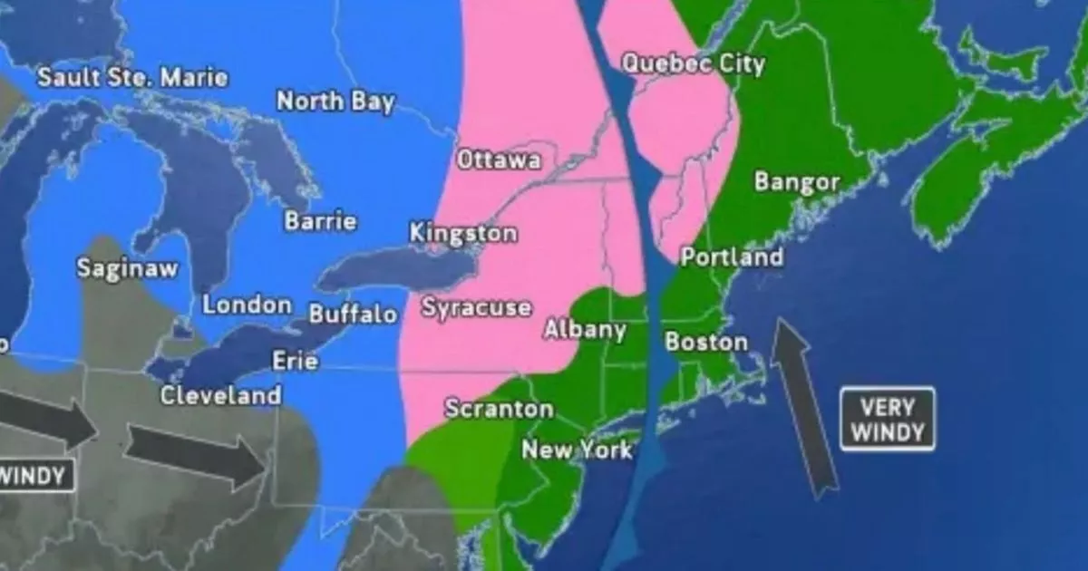
The majority of Pennsylvania, northern New Jersey, and the New York City metro region are affected by the storm watch. Winter storm conditions are also anticipated in several areas of southern New York.
According to local outlet PIX11 News, the following areas in New York are most likely to be affected:
The BronxBrooklynManhattanQueensStaten IslandLong IslandWestchesterRockland The majority of Pennsylvania, northern New Jersey, and the New York City metro region are affected by the storm watch(Image: Accuweather)
In New Jersey:
Bergen CountyEssex CountyMonmouth CountyPassaic CountyUnion CountyHudson CountyMiddlesex CountyMorris CountySomerset County
However, if temperatures drop down to about 40 degrees on Saturday, the snow is probably going to arrive before cooler weather. According to meteorologists, another storm is predicted to come overnight on Sunday and into Monday. However, it is likely to bring rain, which might remove all of the snow that has fallen over the past several days.
 According to meteorologists, another storm is predicted to come overnight on Sunday and into Monday(Image: Getty Images)Midwest weather
A major winter weather advisory is also in effect for the Midwest: according to NWS Chicago, a cold front is predicted to pass over the region and bring chilly weather on Sunday afternoon, even though Christmas Day is bringing moderate temperatures.
There will be a gloomy Christmas before further rain, drizzle, and fog appear tonight and into Friday morning. A cold front on Sunday will bring frigid temperatures into next week, even if moderate temperatures are predicted through at least Saturday.
Click here to follow the Mirror US on Google News to stay up to date with all the latest news, sports and entertainment stories
According to NWS Chicago, the temperature will drop quickly overnight and reach the 20s on Monday.
A “freezing drizzle” is predicted over the weekend in Minnesota, a little further west, ahead of a comparable dip in temperature overnight on Sunday.
Sign up to our FREE newsletter and get the top stories to your inbox
DAILY NEWSLETTER: Sign up here to get the latest news and updates from the Mirror US straight to your inbox with our FREE newsletter.