
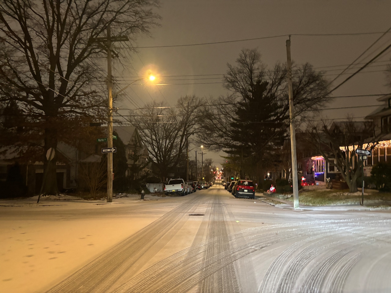
STATEN ISLAND, N.Y. — While a post-Christmas winter storm brings more snow to the borough than it has seen in several years, officials are asking Staten Islanders to stay safe by staying home.
At least until after the last flakes—or sleet—have fallen and the streets are clear.
“If you must travel, use public transportation,” Mayor Eric Adams said on Friday. He continued, “I want to make clear: the city is ready.”
The storm, which started on Staten Island early Friday evening with a mix of sleet ahead of the heaviest snow, is the first big test for the city’s updated snow removal plan, despite the new approach and technology being announced in 2023.
Since then, the city has not seen a significant snow over 4 inches; and even as the system moved in on Friday, forecasters began to lower anticipated snow totals due to the amount of sleet on the front edge of the storm.
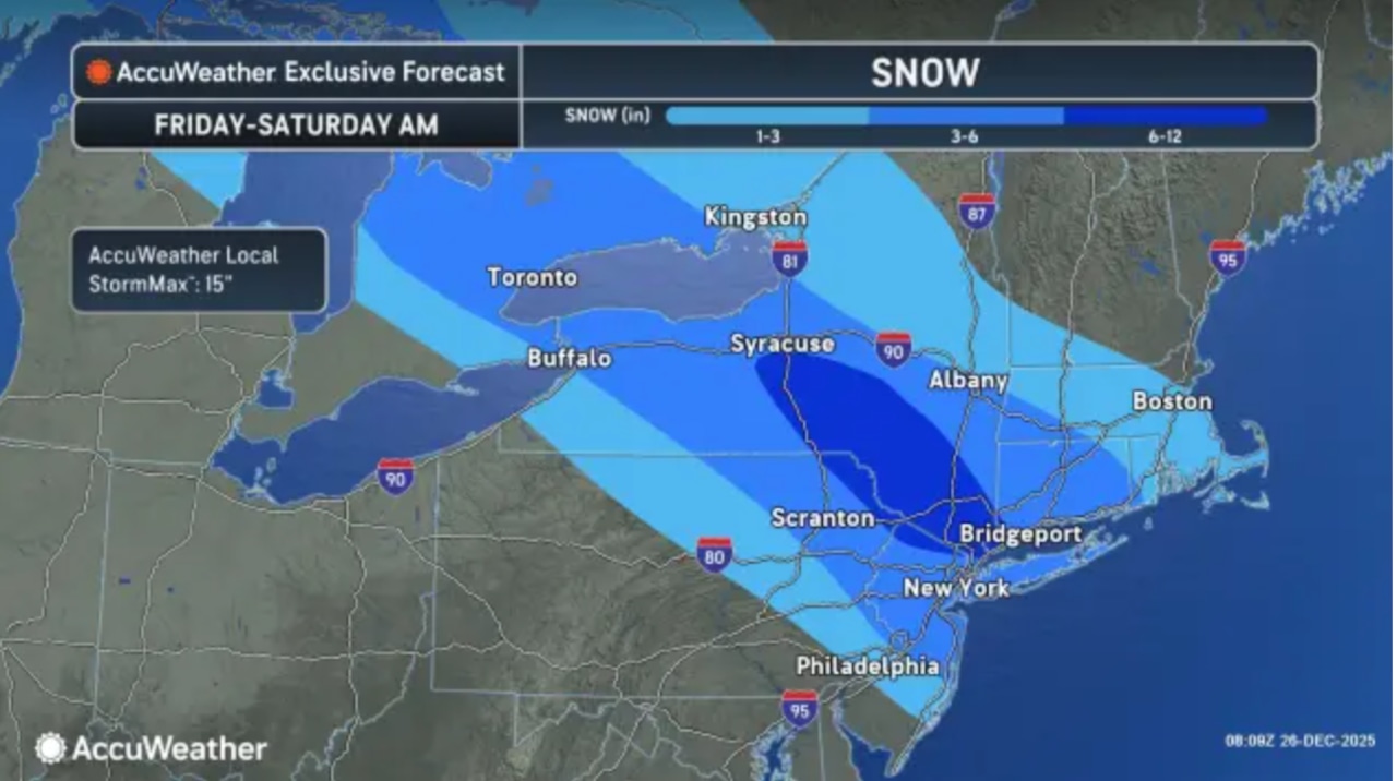 AccuWeather’s forecast map for the storm.AccuWeather.com
Still, Gov. Kathy Hochul, as she declared a state of emergency, also urged New Yorkers to avoid travel after 6 p.m. on Friday.
And she, too, emphasized preparedness, telling 1010 WINS the state was positioning to, as much as possible, keep mass transit moving.
“(W)e’re literally putting, for example, chains on the tires of our MTA buses that’ll help them have better traction in the snow. We’re already positioning people to clear the subway platforms and the outdoor stations. We have 220 miles of outdoor track that has to be maintained and cleared in the storm events.
“You can imagine what a nightmare that can be when the snow comes down in heavy volumes and we have to manage that. So we’re ready for it. We’re experienced. We know how to deal with this.”
On the waterways, the NYC Ferry shut down as the storm began Friday evening; at the start of the storm, the Staten Island Ferry was operating on a 20-minute schedule during the evening rush.
Snow to wrap up early Saturday
A clipper storm, as defined by the National Weather Service, is a fast-moving storm that drops into the U.S. over the Great Lakes from Alberta, Canada.
Ahead of the storm, Peyton Simmers, a meteorologist with AccuWeather, predicted the city would see 3-6 inches of snow before the storm was done.
“We do expect a pretty good thump of snow to come in about after sunset, a little after 7 o’clock – around 7 o’clock – when the heaviest snow might get started in New York City,” Simmers said. “It’s not out of the question there could be some inch-per-hour snow rates within that band, so it could come down pretty quick and lay pretty quick in that 3-6 range that we have.”
Simmers predicts the snow will cease falling on the city by 8 a.m. Saturday. Only a tenth of an inch is expected to come down after 7 a.m., according to the weather service.
Any snow that does fall will not be around for very long, as temperatures will reach into the upper 40s going into early next week and a storm on Sunday is expected to aid the melting process.