
Weather conditions are keeping us on our toes all week after a post-Christmas storm plunged our region into a wintry wonderland.
A heavy fog kicked off the work week, triggering an advisory for low visibility concerns. That advisory was scheduled to expire around 10 a.m.
While a morning fog called attention to the skies, there are still plenty of concerns on the ground. Leftover snow and ice from Friday and Saturday snowfall have hung around — and with a few morning showers and warming temps — slick sidewalks and roads could pose a problem.
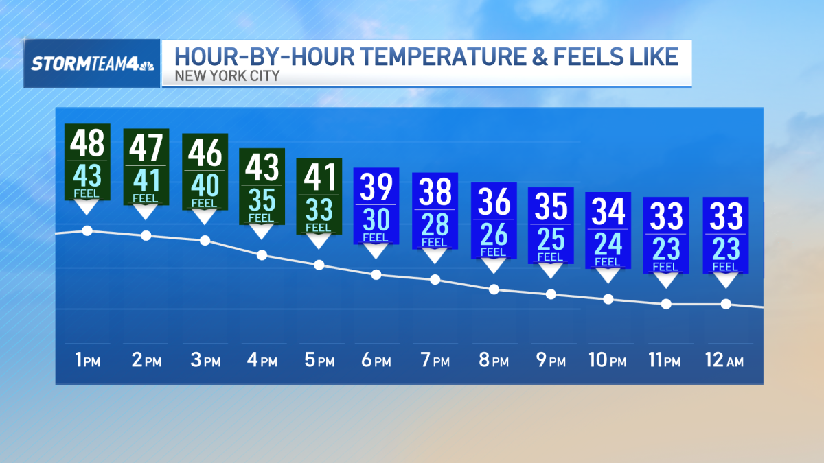
Did you notice a slight warm up in the morning? Maybe you needed one less layer. Well the Monday morning temperature spike will not last. The same warm front that brough the fog will clear as temps start to taper off after lunch, before real-feel temps eventually plunge down into the lower 20s overnight.
Freezing temps will continue on-and-off throughout the week.
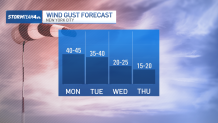
By the afternoon, wind gusts will become the headline and a serious concern across the area. Gusts could reach heights of 40 mph. Many of those strong gusts could linger into Tuesday.
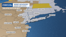
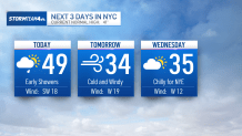
The winds eventually die down by Tuesday evening but it won’t save the day from freezing temperatures. Highs will hover around freezing all day and wind chills could be in the teens.
Our next shot at rain comes Wednesday night (New Year’s Eve) and into Thursday morning. With the expectation of freezing temps, we could see some snow flurries as we usher in the new year.
Either way, don’t expected a washout.