
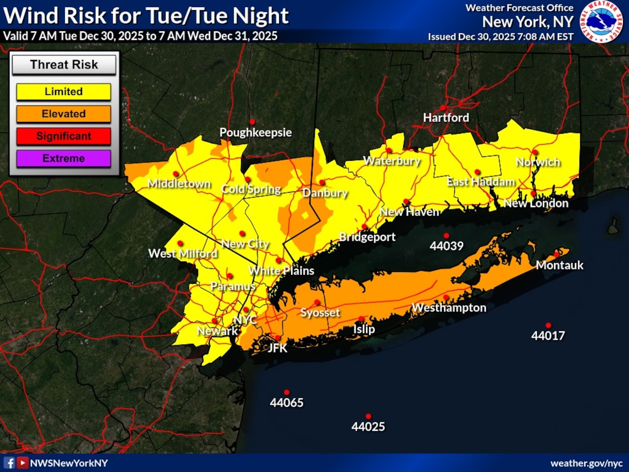
Staten Island residents should prepare for dangerously strong winds Tuesday as a wind advisory remains in effect until 6 p.m. Gusts up to 50 mph are expected, particularly during the morning hours, with temperatures only reaching the lower 30s.
According to the National Weather Service, the strongest winds will occur Tuesday morning before gradually diminishing through the day. Some flurries are possible across the New York City area from 10 a.m. through 1 p.m., though no significant accumulation is expected. Temperatures will remain cold, with highs only reaching the upper 20s to lower 30s.
The windy conditions are the result of a strong pressure gradient following a cold front passage, with the weather service reporting that some gusts in the New York City metro area have already exceeded 50 mph. Residents should secure loose outdoor objects and be cautious of potential power outages or falling tree limbs.
Tuesday night will remain cold with lows in the lower to mid 20s. While winds will diminish below advisory levels, gusts of 20-30 mph will still be possible overnight.
Wednesday will bring another cold day with highs in the lower to mid 30s. A cold front will move through Wednesday evening into Wednesday night, bringing a chance of snow showers. While no significant accumulation is currently expected, cold conditions could lead to slippery surfaces.
The cold pattern will continue through the weekend with temperatures running 5-10 degrees below normal. A brief moderation in temperatures is expected early next week.
Looking ahead to the weekend, a fast-moving clipper system may bring another chance of snow late Sunday into the overnight hours, potentially affecting weekend travel plans.
A draft of this story was generated using AI. It was reviewed, edited and approved by Advance/SILive.com staff.