
NBC5 meteorologists are tracking a weak clipper system set to bring accumulating snow across Vermont and Northern New York during Monday afternoon and evening.Light snow showers will begin in the Adirondacks as early as noon, turning steadier as the afternoon continues. Steady snow arrives in the Champlain Valley between 2 and 4 p.m. Snow begins east of the Green Mountains in the late afternoon.Periods of light to moderate snow are expected during the evening commute, with widespread slippery travel likely.Snow will quickly taper overnight, largely gone by Tuesday morning.Most areas add up a couple of inches of snow; slightly less in the Northeast Kingdom and slightly more in the central/southern Green Mountains, as well as St. Lawrence County in New York.Temperatures turn warmer for the rest of the week, leading to more chances for rain and mixed precipitation — especially Wednesday and Friday into Saturday.Want more local news? Download our NBC5 mobile app for iOS and Android.STAY WEATHER-AWAREFor the latest weather coverage for your area, click here. Stay updated with alerts in the myNBC5 app, which you can download here.For the best weather information and Vermont and northern New York’s Certified Most Accurate forecast, watch NBC5 News by streaming at this link.Don’t forget to follow NBC5 News on Facebook, X (formerly Twitter), and Instagram.Follow the NBC5 First Warning Weather team on social media:Chief Meteorologist Tyler Jankoski Facebook | X | InstagramMeteorologist Ben Frechette Facebook | X | InstagramMeteorologist Matt DiLoreto Facebook | XMeteorologist Andrew Grautski Facebook | XMeteorologist Marissa Vigevani Facebook | X
SOUTH BURLINGTON, Vt. —
NBC5 meteorologists are tracking a weak clipper system set to bring accumulating snow across Vermont and Northern New York during Monday afternoon and evening.

Hearst Owned
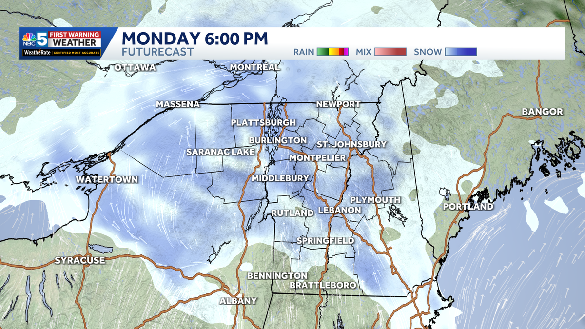
The latest run of FutureCast.
Light snow showers will begin in the Adirondacks as early as noon, turning steadier as the afternoon continues. Steady snow arrives in the Champlain Valley between 2 and 4 p.m. Snow begins east of the Green Mountains in the late afternoon.
")
NBC5 News
Timeline of travel impacts through Monday afternoon.
Periods of light to moderate snow are expected during the evening commute, with widespread slippery travel likely.
Snow will quickly taper overnight, largely gone by Tuesday morning.

NBC5 News
Snowfall forecast through Monday night.
Most areas add up a couple of inches of snow; slightly less in the Northeast Kingdom and slightly more in the central/southern Green Mountains, as well as St. Lawrence County in New York.

Hearst Owned
Our latest extended forecast.
Temperatures turn warmer for the rest of the week, leading to more chances for rain and mixed precipitation — especially Wednesday and Friday into Saturday.
Want more local news? Download our NBC5 mobile app for iOS and Android.
STAY WEATHER-AWARE
For the latest weather coverage for your area, click here. Stay updated with alerts in the myNBC5 app, which you can download here.
For the best weather information and Vermont and northern New York’s Certified Most Accurate forecast, watch NBC5 News by streaming at this link.
Don’t forget to follow NBC5 News on Facebook, X (formerly Twitter), and Instagram.
Follow the NBC5 First Warning Weather team on social media: