
Staten Island residents should prepare for deteriorating conditions Tuesday evening as dense fog and light rain move into the area. The National Weather Service forecasts temperatures to remain above freezing in New York City, with lows in the upper 30s to lower 40s.
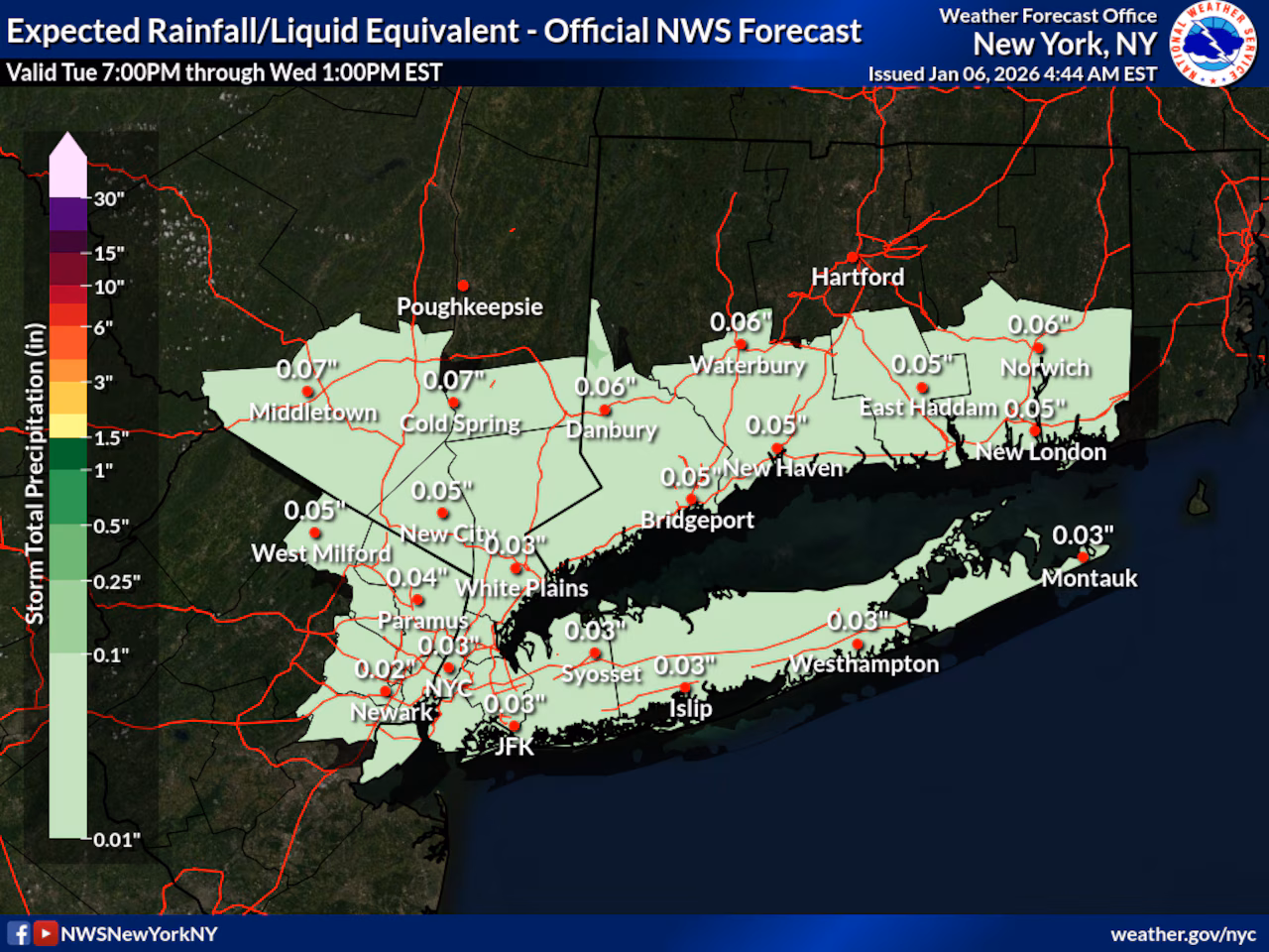
According to the weather service, fog will develop Tuesday evening and could become dense overnight, potentially reducing visibility to a quarter mile or less. Light rain is expected to begin after sunset, with precipitation amounts of less than a tenth of an inch. Daytime temperatures Tuesday will reach the lower 40s before leveling off and possibly rising slightly toward Wednesday morning.
The fog and rain are associated with a low-pressure system passing to the north of the region late Tuesday night into Wednesday morning. While most of Staten Island will experience only rain, the weather service notes that areas well north and west of the city could see a brief period of freezing rain.
Wednesday will bring improving conditions with gradual clearing, though winds will increase with gusts of around 25 mph possible across Staten Island. High temperatures will reach the mid to upper 40s, about 5 to 7 degrees above normal for early January. Wednesday night will be dry with lows in the upper 20s to lower 30s.
Thursday continues the warming trend with highs in the 40s under high pressure, before clouds increase Thursday night as a frontal system approaches.
Looking ahead to the weekend, a frontal system will bring another round of rain Friday through Saturday with significantly warmer temperatures. Highs are expected to reach the 50s on both days before colder air returns by the end of the weekend.
A draft of this story was generated using AI. It was reviewed, edited and approved by Advance/SILive.com staff.