Here’s what you need to know:
After a rainy and breezy weekend, wintry weather returns later this week.
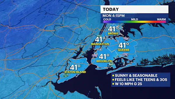
Today will be seasonable, sunny, and windy with highs near 40.
It turns milder by the midweek with chances of rain returning late Tuesday into early Wednesday and Wednesday evening.
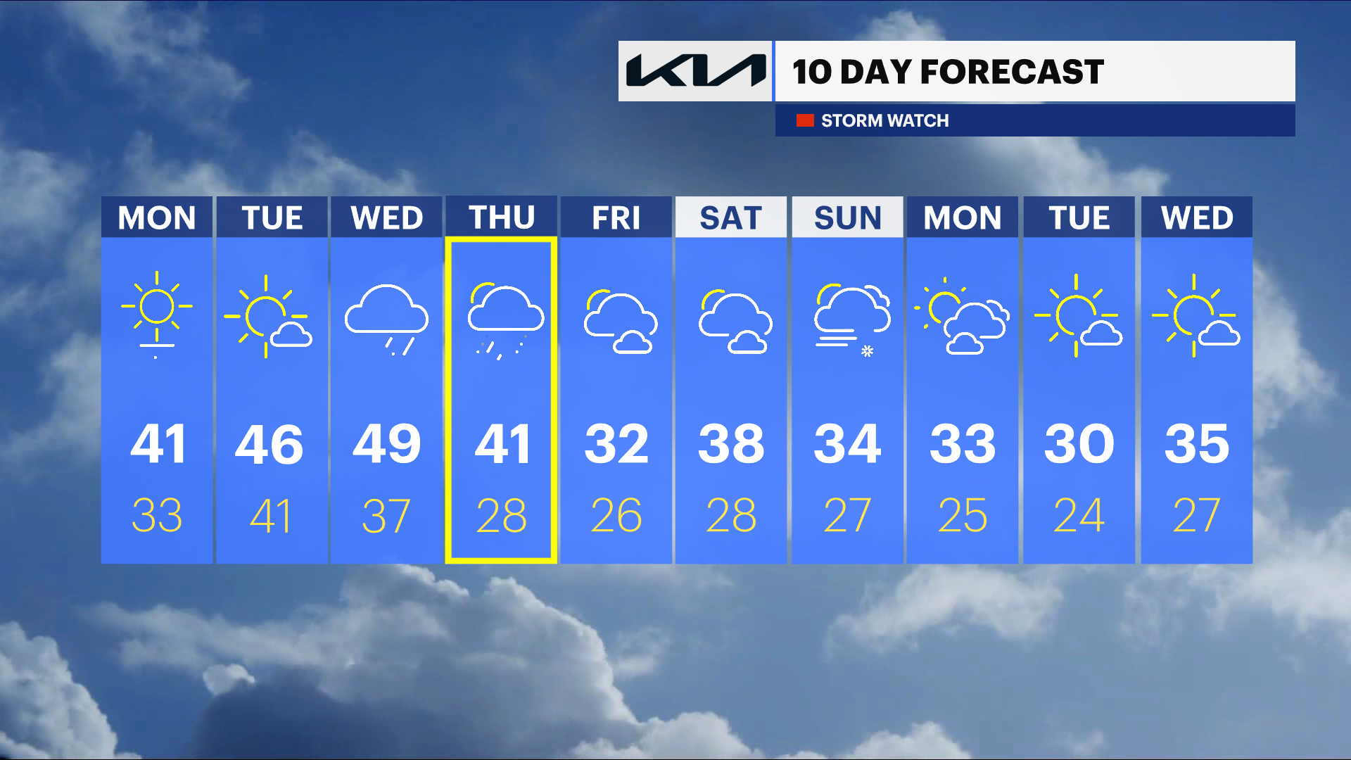
A storm system will bring a chance of rain and snow showers on Thursday. It will possibly start as rain and changeover to snow. There are still a lot of uncertainties when the changeover occurs, for how long, the exact track and totals. Stay tuned for updates.
Today: Mostly sunny, cold, and breezy. Highs near 41.
Tonight: A few clouds, cold with lighter winds. Lows near 33.
Tuesday: Sun fades to evening clouds, chilly. Overnight spotty showers. Highs near 46. Lows near 39.
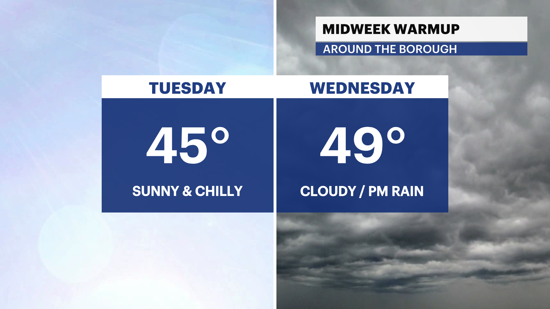
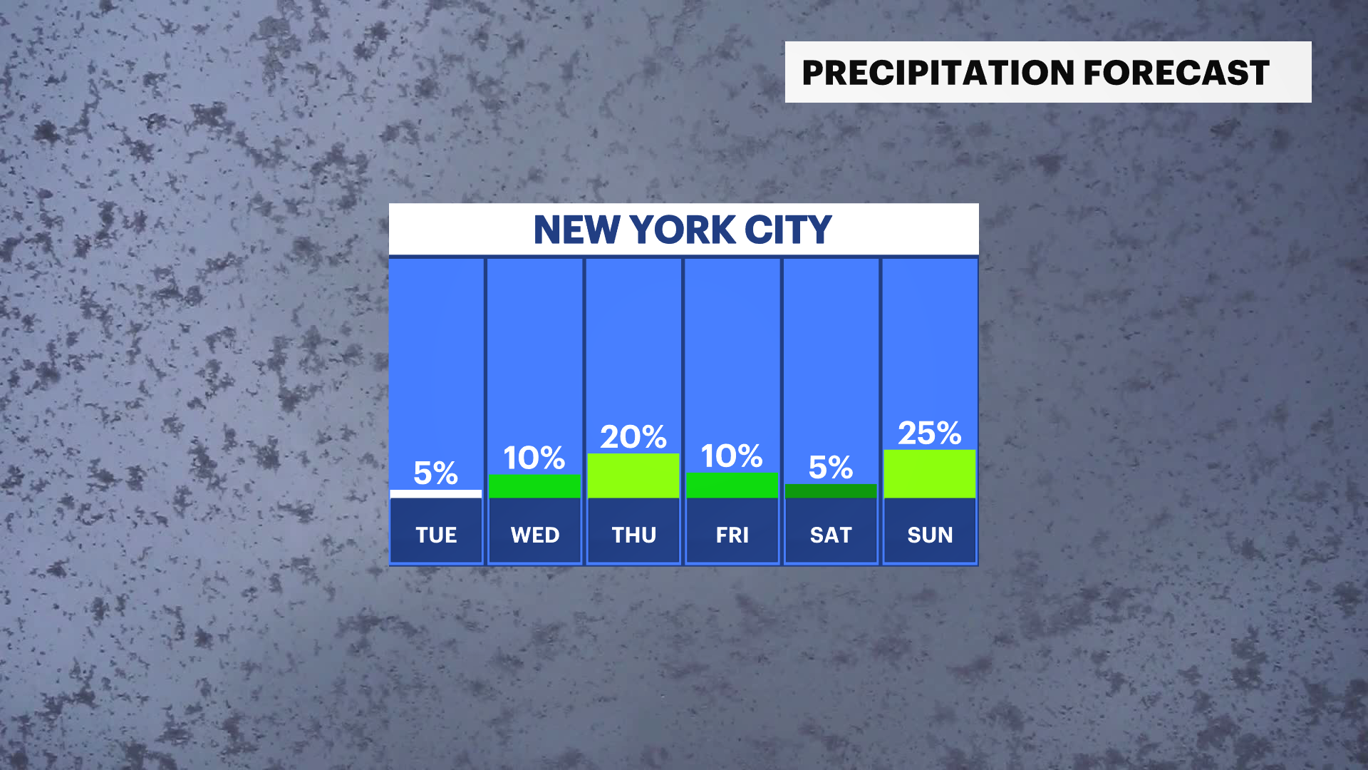
Wednesday: Damp start. Cool and mostly cloudy. Chance of afternoon rain. Highs near 49. Lows near 37.
Thursday: Cold, cloudy, and breezy. Falling temperatures. Chance of rain and snow. Highs near 41. Lows near 28.
Friday: Back to winter! Frigid start. Sun, clouds, and freezing. Highs near 31. Lows near 25.
Saturday: Mostly sunny and cold. Highs near 37. Lows near 28.
Sunday: Partly sunny with a cold wind. Chance of snow. Highs near 34. Lows near 26.