
Trails are a common way for bikers and walkers to travel around Easton, and an effort is underway to use trailways to better connect Lafayette College’s campus, its College Hill neighborhood, and areas of Forks and Palmer Townships.
Lafayette College held a community meeting Wednesday evening to gather public input on a proposed trail connection project in College Hill and Forks Township. The meeting marked the first public session of a feasibility study examining how to improve trail connectivity between Lafayette’s campuses and surrounding communities.
The primary focus of the project is creating a continuous trail between Lafayette’s College and the college’s Metzgar Campus along Sullivan Trail in Forks. This corridor is the central spine of the project, intended to serve both daily transportation and recreational use.
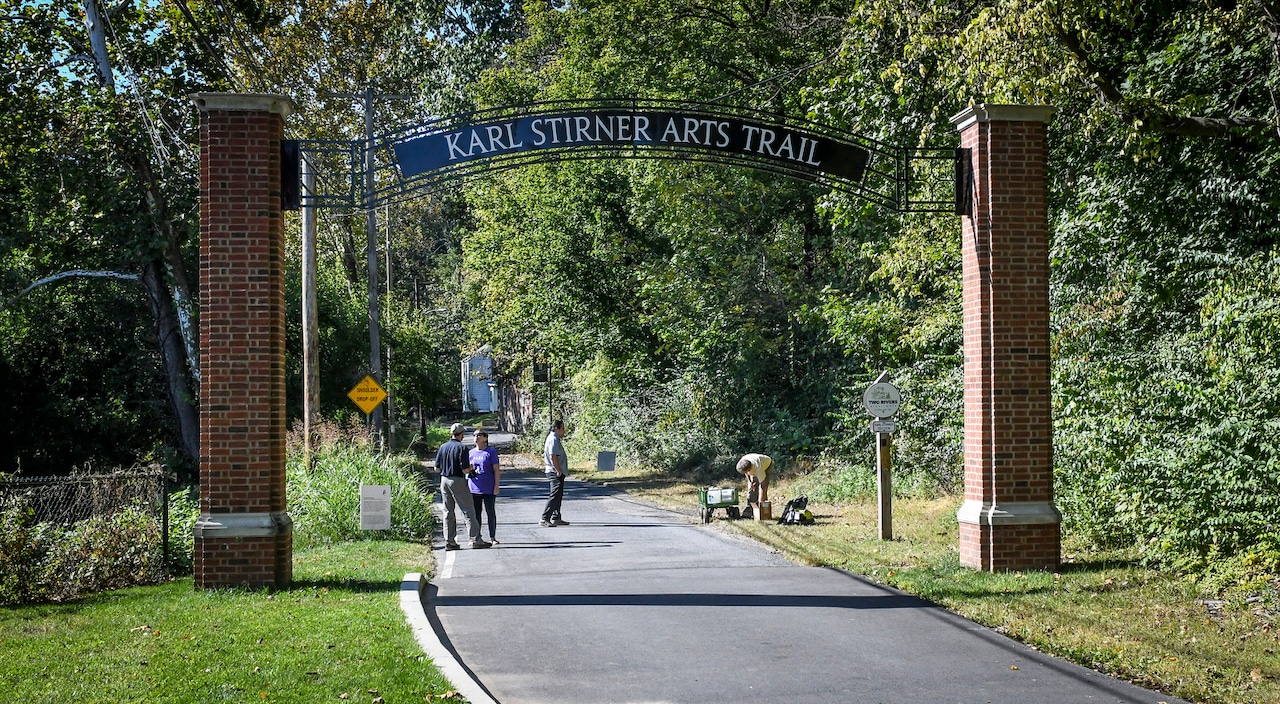
The project also aims to strengthen connections between the campus and Easton, including improving and expanding access to Lafayette’s North Third Street arts campus. The city’s Karl Stirner Arts Trail is a key component, with opportunities for enhancements, extensions and stronger connections to surrounding trail segments.
The project is also evaluating how the Metzgar Campus could function as a regional node linking Easton, Forks Township and existing regional trail systems.
Still another aspect of the project is connecting residents to Forks Town Center and the nearby shopping corridor, grocery stores, pharmacies, commercial centers, schools, parks, and other natural and community assets.
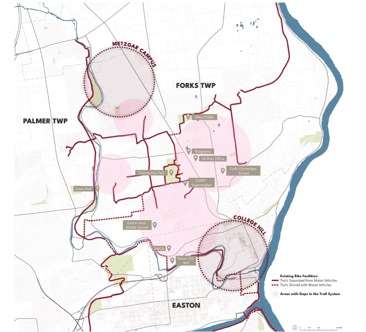 A map shows existing trails and roads shared by motor vehicles. The school is using this map as a reference in a plan to connect trail gaps in the area.Courtesy of Lafayette College
Lauren Daniels, project manager at Lafayette College, explained the study is focused on understanding how existing trails are used and identifying gaps in the system. She said feedback collected from residents will be analyzed to help guide future trail improvements and connections to community destinations.
“We’re gathering data and going to analyze that data in hopes to close these trail gaps along the system and provide access to other community areas as well, like grocery stores, retail and pharmacy, all while also creating a continuous trail from main campus to the Metzgar campus,” Daniels said.
Daniels said the project is currently in its early “understand” phase, which includes data collection and survey feedback. She noted the study will later move into concept development and legal feasibility before any plans are finalized.
Marisa Razi, a landscape architect with SmithGroup, said the trail project builds on priorities established in Lafayette’s campus master plan. She said those priorities include strengthening connections to Easton, cultivating partnerships with surrounding municipalities and integrating environmental sustainability into campus development.
“We’re focusing on visioning today, so gathering feedback from everyone on ideas, comments, suggestions and concerns they have in development of these different routes that we’re looking into,” Razi said.
Razi said part of the project’s long-term planning includes examining route alternatives and evaluating implementation and long-term impacts.
Oliver Kiley, a principal and landscape architect with SmithGroup, said the trail system is being evaluated as both a recreational amenity and a transportation network. He said planners are examining how trails could safely connect residents to daily destinations while accommodating a wide range of users.
At each of the tables during Wednesday’s meeting, attendees were provided a map with pens, markers, stickers and sticky notes where they could take notes and identify which areas they would like to see improvements in trail connections.
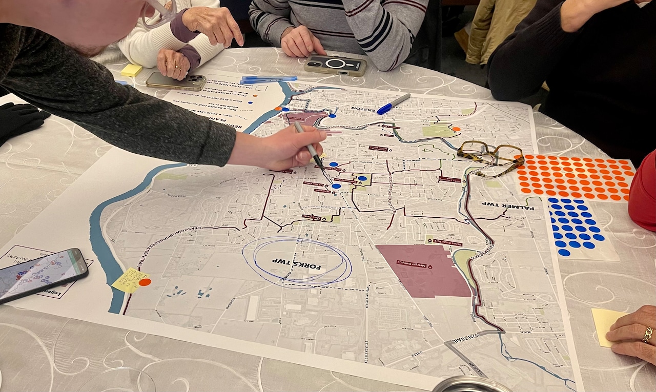 Residents participate in a community workship, marking where they want to see more trail connections near the school. The public meeting took place Wednesday, Jan. 28 at the Farinon College Center.Chelsea McClure | For Lehighvalleylive.com
Kiley said as he talked with residents and heard feedback, many see a gap in trail networks between College Hill and local resources like the Giant supermarket and a community park.
SmithGroup has been doing site visits and on‑site analysis, including potential routes and corridors, improvements and extensions to the Karl Stirner Arts Trail, opportunities to connect to the Silk Mill mixed-use development along North 13th Street, and integrating these with a broader multi‑functional trail network.
“We need to think about what kinds of bike facilities and trail facilities are going to be comfortable for the greatest number of people,” Kiley said.
Kiley said factors such as traffic speed, roadway conditions, steep slopes, maintenance and accessibility are central to the planning process. He explained that steep terrain and fast-moving traffic can discourage trail use and must be considered when evaluating potential routes.
Residents are encouraged to participate in a Lafayette College Multimodal Study available at survey.alchemer.com to provide their input.
More public meetings will be announced during the second and third phases of planning, with an estimated three more open houses to be scheduled in the spring and fall semesters.