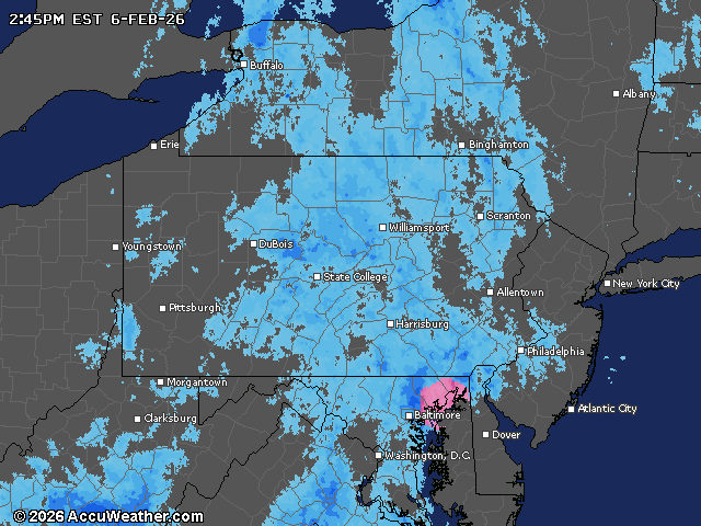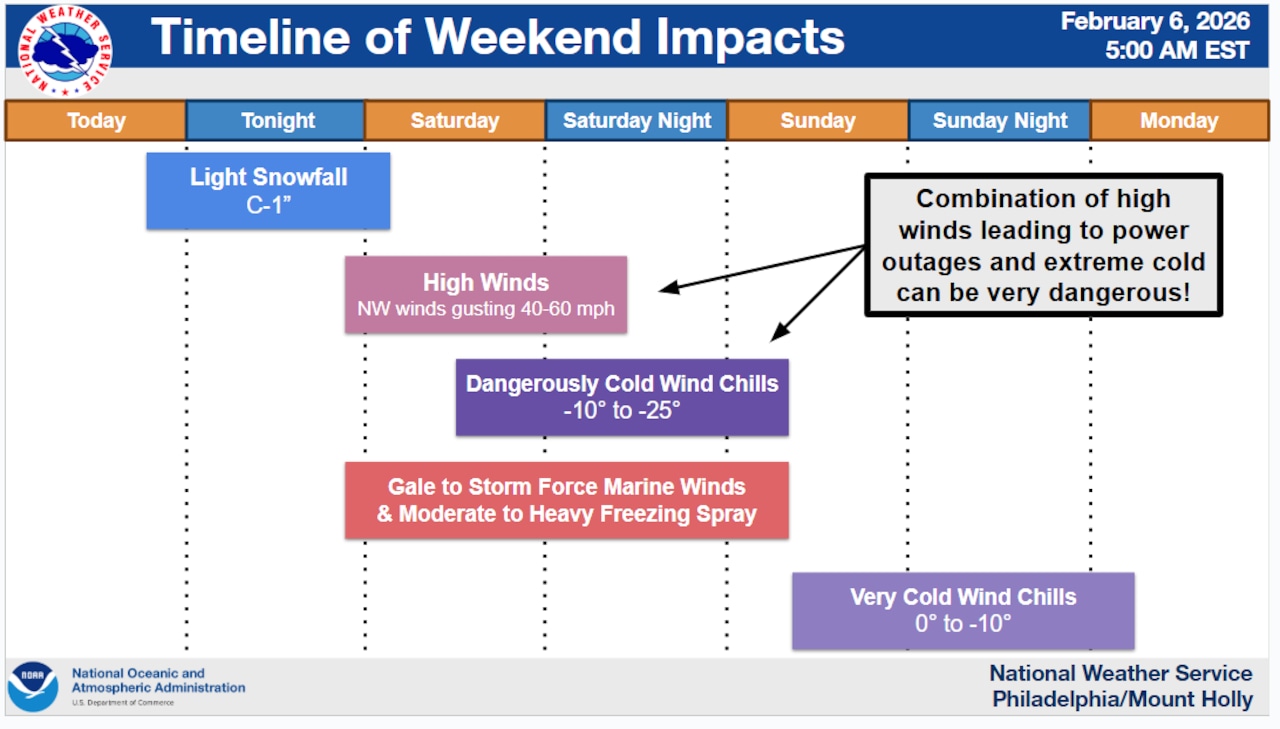
A clipper system will bring light snow to the Lehigh Valley region Friday night into early Saturday morning, but the more significant threat comes from brutally cold temperatures and damaging winds developing Saturday as Arctic high pressure builds into the Northeast.
Wind gusts could reach 50 mph across the region, with some areas experiencing gusts as high as 60 mph, accompanied by wind chills dropping to minus 20 degrees or lower Saturday night, according to the National Weather Service forecast.
Extreme Cold Warnings are in effect for Pennsylvania, New Jersey, Delaware and Maryland from 3 p.m. Saturday through 10 a.m. Sunday. A region including Berks, Lehigh, Northampton and Warren counties is under a Wind Advisory from 8 a.m. to 9 p.m. Saturday.
Light snow is expected to begin around 4 to 6 p.m. Friday in western Pennsylvania and spread eastward, reaching the I-95 corridor around 6 to 8 p.m. and coastal areas around or after 8 p.m.
Most areas will see only a coating to an inch of snow, though isolated accumulations up to 2 inches are possible in higher elevations of the Poconos and northern New Jersey. An isolated snow squall or two is possible early Saturday morning as the Arctic cold front crosses the region, though the overall threat remains low.
A snow squall is an intense, but limited in duration, period of moderate to heavy snowfall accompanied by strong, gusty winds. Squalls can severely limit visibility and quickly make travel treacherous.
The primary hazard arrives Saturday morning as the Arctic front clears and strong cold air floods the region.
Sustained northwest winds of 20 to 30 mph with gusts up to 50 mph will make outdoor conditions dangerous. Temperatures will crash from near freezing Friday night into the single digits and teens by Saturday morning, with the day’s high occurring just after midnight.
Saturday night will bring the most dangerous conditions, with lows dropping to minus 5 degrees in the southern Poconos and far northwestern New Jersey, while wind chills plunge to minus 20 degrees in the Poconos and minus 10 to minus 20 elsewhere.
The National Weather Service strongly recommends limiting outdoor exposure and protecting exposed skin during this period.
Cold conditions will persist into Sunday, with highs only reaching the single digits Sunday afternoon. Sunday night lows will remain in the single digits with wind chills as low as minus 15 across the region.
A gradual warmup is expected as the new week progresses, providing relief from the dangerous cold.
Current weather radar