
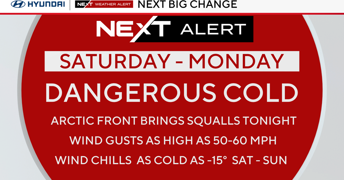
An arctic cold front is heading to the Philadlephia area overnight Friday into Saturday, plunging our temperatures early Saturday with windchills struggling to get above zero MOST of the weekend.

CBS News Philadelphia
NEXT big change
Winds themselves will likely gust upwards of 40-50mph for a time, with the strongest on Saturday during the day. Air temps may drop to the single digits by noon Saturday. A brutally and dangerously cold day.
Wind chills may approach or exceed -15° near the city, and at that level of cold, frostbite can develop within 30 minutes. Even colder wind chills in the Poconos (possibly exceeding -30°) Saturday and Saturday night. Winds are not as strong Sunday but windchills will stay below 10°, even during peak heating of the day.

CBS News Philadelphia
These are the coldest temperatures of the winter so far, as we haven’t yet dropped into the single digits in the city but may do so Saturday, Sunday and Monday.
We are tracking the potential for another winter mix on Wednesday after a possible high of 40° on Tuesday. Old man winter is not done with us yet.
Here’s your 7-day forecast:

CBS News Philadelphia
Saturday: NEXT Weather Alert. High 19, low 15.
Sunday: NEXT Weather Alert. High 19, low 5.
Monday: NEXT Weather Alert. High 29, low 7.
Tuesday: Not as harsh. High 40, low 19.
Wednesday: Wintry mix? High 39, low 27.
Thursday: Some sun. High 39, low 31.
Friday: Partly cloudy. High 36, low 27.
More from CBS News