
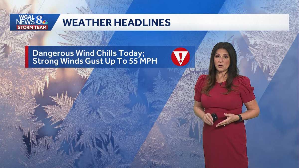
ALERT: Dangerous wind chills, strong winds over the weekend for South-Central Pennsylvania
Wind chills as low as -20° possible early and sub-zero winds the rest of the day. Strong gusty winds are expected all day today. They continue to be gusty on Sunday.
Good afternoon. It is an alert day today due to dangerous wind chills that are possible, especially because of those strong wind gusts. Close to 50 to 55 MPH at times. Wind advisories in effect, along with an extreme cold warning. We’ll continue with subzero wind chills into Sunday morning. Winds will diminish. But not until late evening on Sunday and then temperatures will turn around, but it may be *** bit more active as we head further into, uh, the work week. Cold weather alerts, as I mentioned, an extreme cold warning is in effect until 10:00 a.m. Sunday for the entire area. We also have *** wind advisory in effect until this evening at 10:00 p.m. Uh, when, when we look at the temperature versus the wind chill, we’re not going to see highs moving *** whole lot, only around 12 this afternoon. But look at this, this is what you’re dressing for. Temperatures will feel like -10, -15 at times during the afternoon hours. Uh, tomorrow, look at this, tomorrow morning again, we could have -15 to -2. 20 wind chill values in the morning and then in the afternoon slowly starting to improve. Still subzero wind chills early afternoon but single digits as we head into the late afternoon. So certainly *** weekend where you want to stay indoors today. Here’s *** look at predictor wind gusts. At times they could come close to 50 MPH, maybe even exceeding briefly. They’ll stay pretty elevated overnight tonight, anywhere from 35 to 40 MPH and continue quite strong in the morning hours, but it’ll be in the afternoon and the evening when they start to subside and diminish as high pressure builds on in. So your forecast for today, *** mix of sun and clouds. Temperatures only around 12, but again you’re dressing for those wind chill values anywhere from -5 to -15. Clear skies tonight allows temperatures to drop into the single digits, but with those gusty winds persisting. Wind chill values will range from -5 to -15 below. Lots of sunshine for the second half of the weekend. However, it is going to be *** frigid start to the day again with those wind chill values, uh, as cold as -15 below. And then in the afternoon we’ll slowly climb from subzero wind chills to the single digits as those winds continue to diminish. We finally see temperatures turning around as we head towards Tuesday. We come close to average on Wednesday, but as you can. For much of the next 7 days we stay just *** little bit below average all the way through Friday. We’re watching *** system on Wednesday that could bring us *** chance for *** mix, possibly to rain as temperatures climb into the upper 30s. It’s dry Thursday. Another system on Friday again, *** mix of rain possible with temperatures around 34. Valentine’s weekend, uh, it looks like another system that could clip us with some rain and snow showers. Of course we’ll keep you posted as we head through the week.
Good afternoon. It is an alert day today due to dangerous wind chills that are possible, especially because of those strong wind gusts. Close to 50 to 55 MPH at times. Wind advisories in effect, along with an extreme cold warning. We’ll continue with subzero wind chills into Sunday morning. Winds will diminish. But not until late evening on Sunday and then temperatures will turn around, but it may be *** bit more active as we head further into, uh, the work week. Cold weather alerts, as I mentioned, an extreme cold warning is in effect until 10:00 a.m. Sunday for the entire area. We also have *** wind advisory in effect until this evening at 10:00 p.m. Uh, when, when we look at the temperature versus the wind chill, we’re not going to see highs moving *** whole lot, only around 12 this afternoon. But look at this, this is what you’re dressing for. Temperatures will feel like -10, -15 at times during the afternoon hours. Uh, tomorrow, look at this, tomorrow morning again, we could have -15 to -2. 20 wind chill values in the morning and then in the afternoon slowly starting to improve. Still subzero wind chills early afternoon but single digits as we head into the late afternoon. So certainly *** weekend where you want to stay indoors today. Here’s *** look at predictor wind gusts. At times they could come close to 50 MPH, maybe even exceeding briefly. They’ll stay pretty elevated overnight tonight, anywhere from 35 to 40 MPH and continue quite strong in the morning hours, but it’ll be in the afternoon and the evening when they start to subside and diminish as high pressure builds on in. So your forecast for today, *** mix of sun and clouds. Temperatures only around 12, but again you’re dressing for those wind chill values anywhere from -5 to -15. Clear skies tonight allows temperatures to drop into the single digits, but with those gusty winds persisting. Wind chill values will range from -5 to -15 below. Lots of sunshine for the second half of the weekend. However, it is going to be *** frigid start to the day again with those wind chill values, uh, as cold as -15 below. And then in the afternoon we’ll slowly climb from subzero wind chills to the single digits as those winds continue to diminish. We finally see temperatures turning around as we head towards Tuesday. We come close to average on Wednesday, but as you can. For much of the next 7 days we stay just *** little bit below average all the way through Friday. We’re watching *** system on Wednesday that could bring us *** chance for *** mix, possibly to rain as temperatures climb into the upper 30s. It’s dry Thursday. Another system on Friday again, *** mix of rain possible with temperatures around 34. Valentine’s weekend, uh, it looks like another system that could clip us with some rain and snow showers. Of course we’ll keep you posted as we head through the week.
ALERT: Dangerous wind chills, strong winds over the weekend for South-Central Pennsylvania
Wind chills as low as -20° possible early and sub-zero winds the rest of the day. Strong gusty winds are expected all day today. They continue to be gusty on Sunday.

Updated: 12:09 PM EST Feb 7, 2026
Extreme Cold Warning in effect for all counties until 10 a.m. Sunday. Wind chills could be as cold as -20 early Saturday. Wind chills will stay below zero all day.Wind Advisory in effect for all counties until 10 p.m. this evening. Wind gusts 50-55 mph are possible.ALERT DAY TODAY: DANGEROUS WIND CHILLSIt is very windy as a bitterly cold air mass moves overhead. Northwesterly winds are sustained at 20-30 mph, with gusts between 45-55 mph. As a result, wind chills will range from -10 to -20 on this morning. Wind chills will hover between -5 to -15 throughout the afternoon. Look for partly sunny skies, with temperatures holding steady in the low teens in the afternoon.IMPACT DAY SUNDAY: BITTERLY COLD MORNING WIND CHILLSTemperatures will drop to the single digits tonight, and wind chills will range from -5 to -15. Highs will reach 20 degrees on Sunday, but wind chill values will hover in the single digits under partly sunny skies.Another round of sub-zero chills is in store Sunday night into early Monday. Then, as high- pressure builds, winds will diminish Monday afternoon. Highs will reach the upper 20s.Temperatures will gradually moderate to 36 degrees on Tuesday under a mix of clouds and sunshine.There’s a chance of a wintry mix to rain on Wednesday, as low pressure passes, then expect windy and cold conditions behind that system at the end of the week. Highs will reach the low-to-mid 30s, but it will feel like the 20s.We are watching the chances for an additional winter storm late next week into Presidents Day weekend. Right now, signals suggest a developing system, but chances, timing, and confidence in a developing storm are still low currently. We’ll update as we go through next week.Stay warm!
Extreme Cold Warning in effect for all counties until 10 a.m. Sunday. Wind chills could be as cold as -20 early Saturday. Wind chills will stay below zero all day.
Wind Advisory in effect for all counties until 10 p.m. this evening. Wind gusts 50-55 mph are possible.
ALERT DAY TODAY: DANGEROUS WIND CHILLS
It is very windy as a bitterly cold air mass moves overhead. Northwesterly winds are sustained at 20-30 mph, with gusts between 45-55 mph. As a result, wind chills will range from -10 to -20 on this morning. Wind chills will hover between -5 to -15 throughout the afternoon. Look for partly sunny skies, with temperatures holding steady in the low teens in the afternoon.
IMPACT DAY SUNDAY: BITTERLY COLD MORNING WIND CHILLS
Temperatures will drop to the single digits tonight, and wind chills will range from -5 to -15. Highs will reach 20 degrees on Sunday, but wind chill values will hover in the single digits under partly sunny skies.
Another round of sub-zero chills is in store Sunday night into early Monday. Then, as high- pressure builds, winds will diminish Monday afternoon. Highs will reach the upper 20s.
Temperatures will gradually moderate to 36 degrees on Tuesday under a mix of clouds and sunshine.
There’s a chance of a wintry mix to rain on Wednesday, as low pressure passes, then expect windy and cold conditions behind that system at the end of the week. Highs will reach the low-to-mid 30s, but it will feel like the 20s.
We are watching the chances for an additional winter storm late next week into Presidents Day weekend. Right now, signals suggest a developing system, but chances, timing, and confidence in a developing storm are still low currently. We’ll update as we go through next week.
Stay warm!