
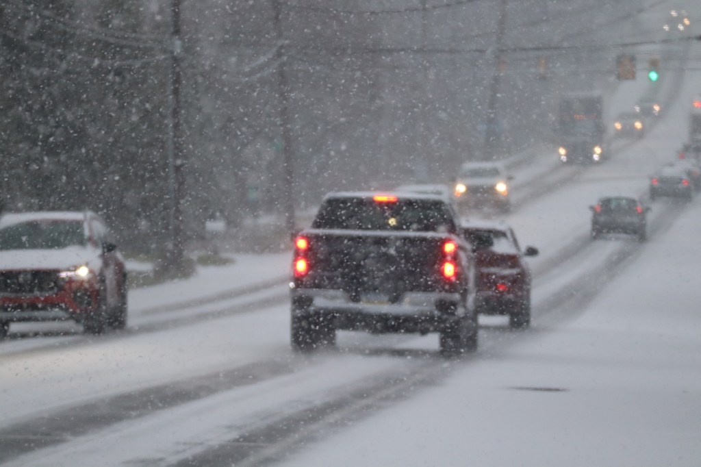
The Lehigh Valley is now expected to get up to two inches of snow Sunday into Monday as a storm system passes south of the region, according to forecasters.
Initially, the region was only expected to have a slight chance of snow from the storm, which could also bring rain. By Saturday afternoon, however, the National Weather Service’s Mount Holly, New Jersey, forecast office said the potential for snow has increased. There is now a 57% chance of at least an inch of snow falling Sunday into Monday morning.
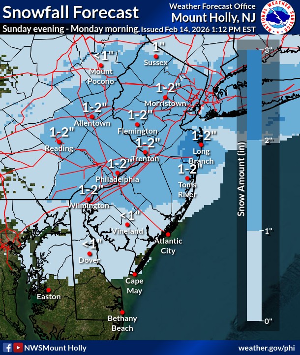 The latest snowfall total projections from the National Weather Service’s forecast office in Mount Holly, New Jersey. (NWS)
The weather service’s projected snowfall map shows the Lehigh Valley getting between 1 and 2 inches of snow, though forecasters said confidence in the totals remains low.
The snow will be wet and slushy on roads, but could cause slippery conditions during the Monday morning commute. The snow will more easily stick to trees, grass and power lines, the weather service noted.
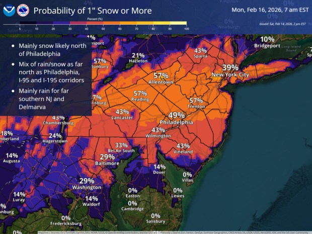 The Lehigh Valley now has a 57% chance of getting at least an inch of snow.
The snow follows the warmest weather in several weeks Saturday. The high temperature at Lehigh Valley International Airport reached 44, according to the weather service.
Following Sunday’s storm, temperatures are expected to warm up to well above normal for several days. Highs in the mid to upper 40s are likely through Friday.
“The temperatures should allow for some of the abundant snowpack to start to melt, but it may not melt as much as it could due to the cloudy skies,” meteorologists wrote Saturday in the daily forecast discussion.
Additionally, there is a chance of rain Wednesday through Thursday. Any rain that comes will be beneficial while both Lehigh and Northampton counties are under a drought watch. Rainfall totals have been about 9 inches below normal over the past six months, according to weather service data.
Here is the extended forecast from the National Weather Service:
Sunday: A slight chance of rain after 4 p.m. Patchy freezing fog before 10 a.m. Mostly cloudy, with a high near 41. Calm wind. Chance of precipitation is 20%.
Sunday Night: A chance of rain and snow before 7 p.m., then snow likely. Cloudy, with a low around 29. Northeast wind around 5 mph. Chance of precipitation is 60%. New snow accumulation of 1 to 2 inches possible.
Monday: Mostly cloudy, with a high near 41. Northeast wind around 5 mph becoming calm in the morning.
Monday Night: Mostly cloudy, with a low around 30. Calm wind.
Tuesday: Partly sunny, with a high near 44.
Tuesday Night: Mostly cloudy, with a low around 32.
Wednesday: A chance of rain. Mostly cloudy, with a high near 43. Chance of precipitation is 40%.
Wednesday Night: A chance of rain before 1 a.m. Mostly cloudy, with a low around 36. Chance of precipitation is 40%.
Thursday: A chance of rain. Partly sunny, with a high near 49. Chance of precipitation is 30%.
Thursday Night: A chance of rain. Mostly cloudy, with a low around 33. Chance of precipitation is 40%.
Friday: A chance of rain. Mostly cloudy, with a high near 45. Chance of precipitation is 50%.