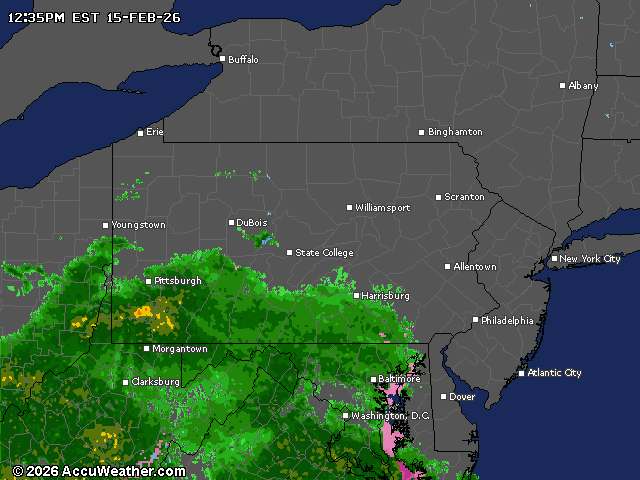
A mix of rain and wet snow will move across central Pennsylvania later today into tonight, with minor accumulations of up to one inch possible, primarily in east-central regions.
The precipitation is expected to have a limited impact as temperatures remain relatively mild.
The weather system will develop this afternoon as two atmospheric disturbances merge, bringing precipitation that will start primarily as rain before transitioning to wet snow in some areas.
With temperatures starting around 40 degrees, any snow accumulation will be limited to a coating up to one inch, mainly in east-central Pennsylvania. Snow rates are expected to remain below a half-inch per hour.
The National Weather Service is calling for less than an inch in Harrisburg, York and Lancaster. It should all be over by midnight, the NWS says.
Travelers should be aware that visibility may decrease during periods of precipitation, with aviation conditions lowering to MVFR (Marginal Visual Flight Rules) and IFR (Instrument Flight Rules) by late afternoon and overnight. Monday morning may still see lingering lower cloud ceilings even after precipitation ends.
The mid-February thaw will continue through most of next week with temperatures remaining above historical averages. Highs will reach the 40s to lower 50s through midweek before a more seasonable cooldown arrives by next weekend.
After a mainly dry start to the week, additional rounds of precipitation are likely on Wednesday and again Friday into the weekend. Rain will be the dominant precipitation type, though some mixed precipitation is possible primarily in northern areas.
An Air Quality Alert remains in effect until midnight tonight for several counties in central Pennsylvania — Dauphin, Cumberland, Lebanon, York and Lancaster.
Current weather radar