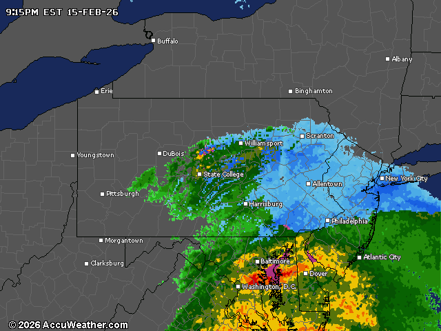
A mix of rain and wet snow will move across central Pennsylvania on Sunday night, with minor snow accumulations up to an inch possible in east-central areas, particularly in Schuylkill County.
Temperatures will remain near or slightly above freezing in most locations.
The precipitation was expected to begin as mostly light rain Sunday afternoon across south-central Pennsylvania, transitioning to snow in higher elevations and expanding to the Susquehanna Valley and eastern regions as temperatures cooled tonight.
Any accumulation will likely be wet and slushy with limited impact on travel, though visibility might be reduced.
Fog development is anticipated overnight, especially in areas that received rain earlier today, with IFR conditions (low ceilings and reduced visibility) expected across the region through Monday morning.
Conditions will gradually improve on Monday afternoon with brightening skies and dry weather returning.
The mid-February thaw will continue through most of this week with above-average temperatures. Highs will reach the 40s to lower 50s degrees through midweek before a more seasonable cooldown arrives by next weekend.
After a mainly dry start to the week, additional rounds of precipitation are likely on Wednesday and again Friday into the weekend.
Rain will be the dominant precipitation type, though some mixed precipitation is possible primarily over the northern tier of Pennsylvania.
Current weather radar