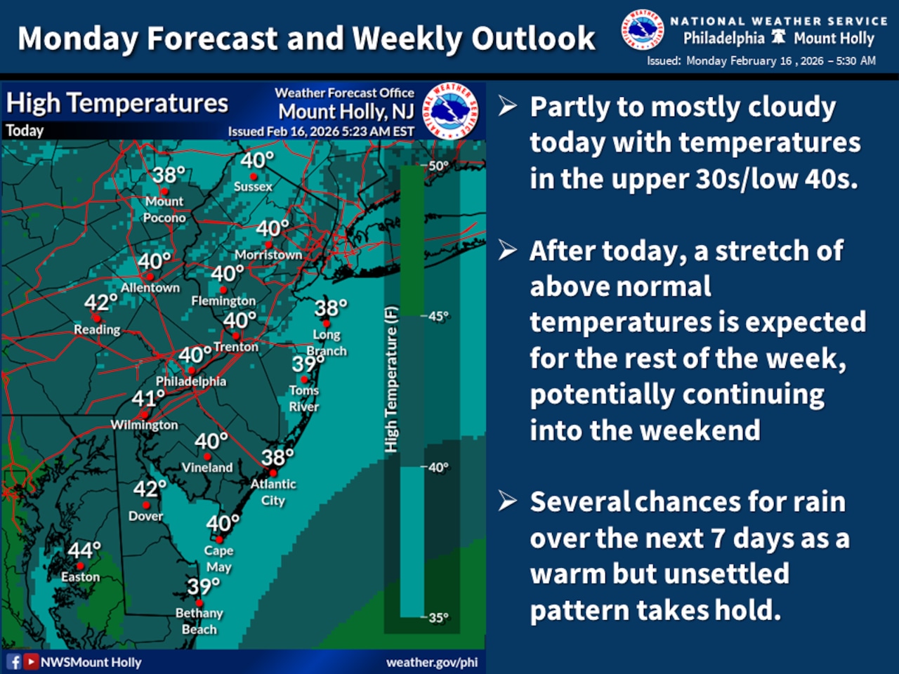
High pressure moves into the Lehigh Valley region Monday, but a weak low pressure system passing to the north at night could bring light mixed precipitation to northern areas.
Snow, freezing rain or drizzle are possible, according to the National Weather Service forecast. Overall, precipitation impacts from this system are expected to be minimal.
Snowfall that moved into the area Sunday night totaled 1.1 inches as of midnight at Lehigh Valley International Airport, the National Weather Service said. The precipitation there ended by about 4 a.m. Monday.
Temperatures will trend significantly above normal for most of this week and into next weekend. Highs on Tuesday through Saturday will reach the mid 40s across much of the area, with some locations south of the Lehigh Valley potentially reaching 60 degrees Wednesday through Friday.
Overnight lows are forecast in the low to mid-30s.
A system moving through Wednesday into Wednesday night will bring rain to the area Wednesday afternoon through Wednesday night.
Model guidance increasingly suggests this will be an all-rain event for the Lehigh Valley. The highest rainfall amounts are expected north of Interstate 78, with a quarter to half inch possible in those areas and diminishing amounts to the south.
The probability of rainfall exceeding half an inch is 15 to 30% north of I-78 and less than 10% south. This could be the first measurable rain for some locations in nearly a month.
Another low pressure system is expected to approach the region Friday into Saturday. Like the midweek system, this should primarily bring rain to the area, though higher elevation areas in the southern Poconos and far northern New Jersey could see mixed precipitation if precipitation occurs during overnight hours.
The extended forecast shows potential for yet another system toward the end of the weekend, though significant uncertainty remains regarding timing and precipitation type.
Overall, the week’s pattern will bring primarily beneficial rain to most of the region, with no moderate or major impacts currently expected.
After more than two weeks of snow cover, the above-normal temperatures will allow the snowpack to melt quickly, with most areas largely snow-free by this weekend.
Current weather radar