
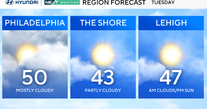
Tuesday morning in the Philadelphia region starts with mostly cloudy skies and light winds. There will also be a bit of patchy fog. By the afternoon, we’ll see a return to some sunshine, with highs around 50 in the city.
Suburbs and areas along the Jersey Shore will be in the 40s, but a lack of strong winds will make the day feel rather comfortable.

CBS News Philadelphia
NEXT big weather changes
Expect average (45 degrees) or greater highs throughout the week and into the first part of the weekend, which will significantly help to melt the remaining snowpack.
We’re also tracking multiple rain chances starting Wednesday, so be sure to grab the umbrella and keep it handy for the remainder of the week.

CBS News Philadelphia
Finally, on Sunday, we’re watching another storm that could bring rain showers, a mix or snow.
It’s way too early to make a call but the NEXT Weather Team will whittle down the uncertainties and have you ready for whatever Sunday brings.
After all, it is still winter.
Meteorological spring is in 12 days on March 1, while astronomical spring, aka the vernal equinox, is in 31 days on March 20.
Here’s your 7-day forecast:

CBS News Philadelphia
Tuesday: Decreasing clouds. High 50, low 32.
Wednesday: Chance of rain. High 50, low 36.
Thursday: A few showers. High 45, low 39.
Friday: Rain likely. High 45, low 37.
Saturday: Scattered showers. High 50, low 39.
Sunday: Rain and snow mix. High 42, low 35.
Monday:Partly cloudy. High 38, low 30.