
The work of 11 Lafayette College civil engineering students has become the foundation for an ambitious trail connection plan proposed by their school.
The college recently announced the plan to close local trail gaps, connecting College Hill residents and Lafayette students to other area resources.
The students are gratified to see that the months of work that went into their senior-year capstone project is making an impact in the real world.
The students examined how to create a continuous trail between Lafayette’s main campus and its Metzgar Campus along the Sullivan Trail corridor, while also improving connections to the city and regional trail networks.
They also considered strengthening links to the college’s North Third Street arts campus and enhancing connections to Easton’s Karl Stirner Arts Trail. Connecting the community to local shopping centers and grocery stores are also considered.
The work originated as part of Lafayette’s civil engineering capstone sequence, a required culminating design experience in the ABET-accredited program, according to Lafayette Professor Michael McGuire. He explained that the year-long course prepares students in the fall with professional and technical training before shifting in the spring to a focused design project selected from several options.
Students chose a trail-planning effort that became known as “Connecting Communities,” reflecting a decision to look beyond campus boundaries. McGuire said the project expanded as students recognized opportunities to link neighborhoods, services and regional destinations rather than focusing solely on a campus-to-campus route.
The class wrapped up in the spring of 2025.
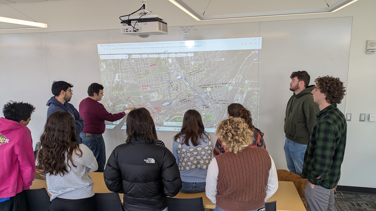 Civil engineering students at Lafayette composed a capstone project focusing on closing trail gaps around Easton, especially College Hill and Forks Township.Courtesy of Michael McGuire
According to Lafayette alumna Shana Peck, the class , targeteed three primary routes between the main campus and Metzgar Campus. There was a scenic route connecting existing trails, a more direct corridor toward commercial areas and downtown, and a route designed to meet accessibility standards.
The class divided into smaller groups to develop trail concepts and later combined their findings into a unified plan, according to Naomi Shertzer, another alumna who was a student in the class.
“All the options kind of follow the same mindset: if we were still here at Lafayette College, what’s something that we think would be beneficial for everyone, and also, what do we think the community would like the best?” Peck explained.
Peck said the class approached the work like an early-stage consulting project, focusing on feasibility rather than a fully engineered design. Students used mapping and modeling tools and applied knowledge from across their coursework, including environmental, geotechnical and zoning considerations.
The process required revisions as students discovered constraints such as steep slopes, environmental impacts and alignment conflicts that made certain routes impractical. Peck noted that the scope of the project grew as the team encountered the number of stakeholders, regulations and technical factors involved in trail planning.
Shertzer said many students sought to address transportation gaps affecting local residents. She explained that the class broadened the project’s purpose to consider people beyond the college, including residents with limited access to transportation, grocery stores or other services.
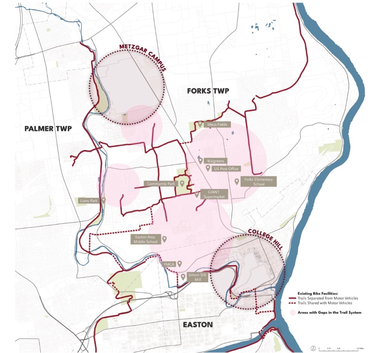 A map shows existing trails and roads shared by motor vehicles. The school is using this map as a reference in a plan to connect trail gaps in the area.Courtesy of Lafayette College
“One of the biggest challenges was learning to use software that we didn’t know how to use,” she said. “I think something that was really beneficial was, through this class, learning how to use that and kind of taking matters into our own hands to teach ourselves those software.”
The project was grounded in Lafayette’s campus master plan, particularly goals to strengthen connections to Easton and enliven the arts campus, according to alumna Jillian Landon. She said students mapped existing trails, sidewalks and major routes to identify gaps and constraints, creating a map that guided decisions about where new links could be feasible.
“We learned throughout the whole course how many different groups of people are involved in things, how many ordinances, zoning codes and all the different ideas and concepts that you have to consider when taking on a civil engineering project, something that I think really was a great culmination of the end of our education,” Landon explained.
She described the class as an opportunity to see how classroom concepts fit together in practice. Presenting their work to college leadership demonstrated that student research was being taken seriously, she said.
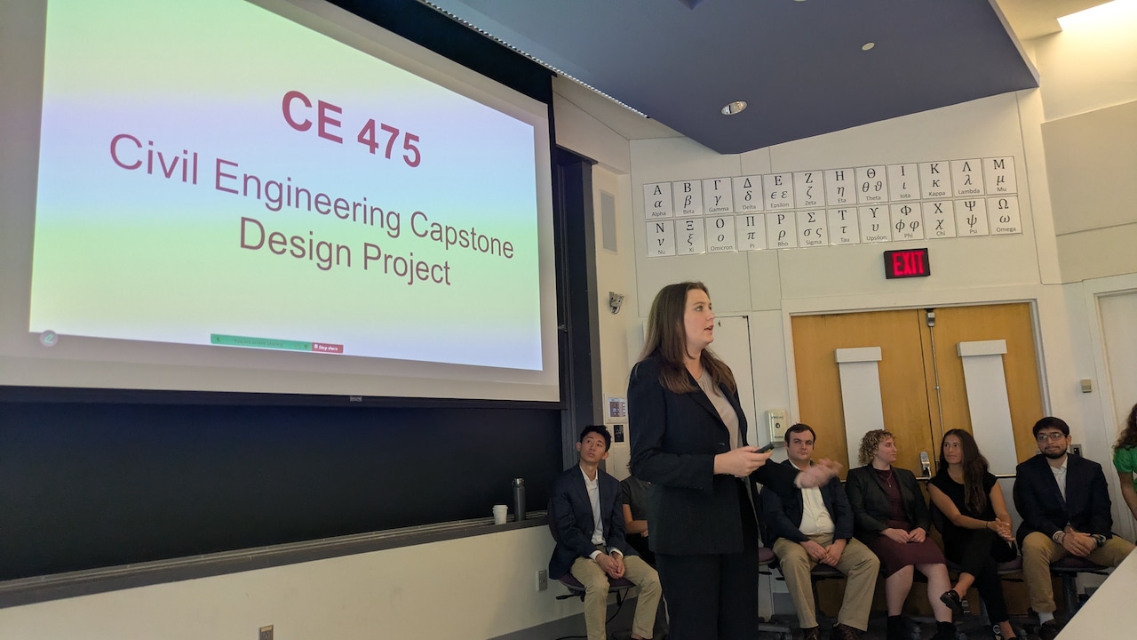 Jillian Landon helps present a civil engineering capstone project, centered around closing trail gaps in Easton.Courtesy of Michael McGuire
McGuire, who serves on groups working with consulting firms SmithGroup and Langan, said materials from the students’ final presentation are being used to inform the current professional study, including questions about routing, priority areas and potential landowners.
He said the student work provided a starting point that inspired early planning. College administrators also indicated that the priorities identified by the class align with institutional goals for future trail development.
The students said seeing their academic work influence a real planning process has been one of the most meaningful aspects of the experience. Peck described pride in knowing that months of work contributed to a project that could continue for years, and it could result in a trail they may one day use as alumni.
Now graduated, Peck, Shertzer and Landon all work in the civil engineering field, applying what they learned in their projects to their everyday work.
“This was one of the most rewarding experiences I’ve ever had in a classroom,” McGuire said. “And it really felt like we’re working towards something that has people’s attention.”
McGuire said the momentum created by the class has continued, and he is optimistic that the planning effort will move forward toward eventual construction.
The students said their understanding of the community was shaped by time spent in Easton through classes, service work and public meetings. Peck said those experiences helped the team think about how the trail could serve both students and residents of Easton.
“It’s a home,” Peck said. “Even if it’s four years only for some people, it’s home and it always will be.”