
SYRACUSE, N.Y. — We’re getting closer to the end of October and our weather pattern is starting to look and feel like it.
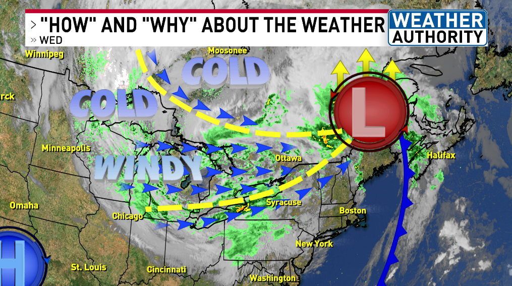
Colder than average air continues to cross over all of the Great Lakes over the next three days.
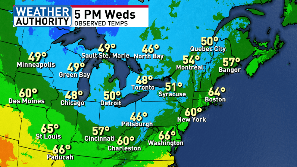
5 PM WEDS GREAT LAKES OBSERVED TEMPS
This colder air aloft moving over the relatively warmer lake surface temperatures has created lake effect clouds and lake effect rain too.

LATEST SURFACE MAP
The lake rain will impact kids and grandkids at the bus stop Thursday morning and a only a little bit Thursday afternoon.
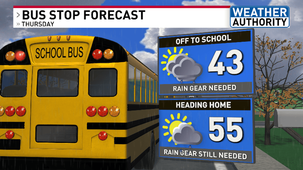
BUS STOP FORECAST THURSDAY
Trying to get one of the last cuts of the grass in for the season? It’s looking pretty for Thursday and Friday.
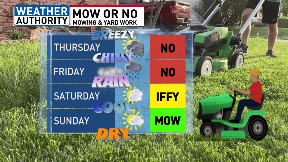
MOW OR NO NEXT FEW DAYS
Let’s track the lake effect rain and cold temperatures over the next couple days:
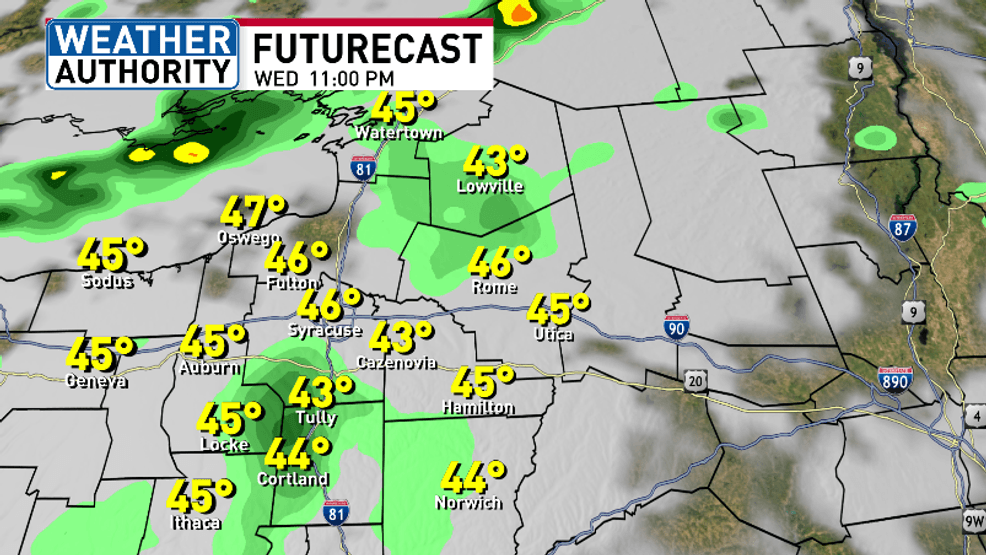
FUTURECAST 11 PM WEDS
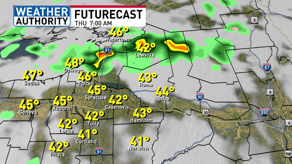
FUTURECAST 7 AM THURSDAY
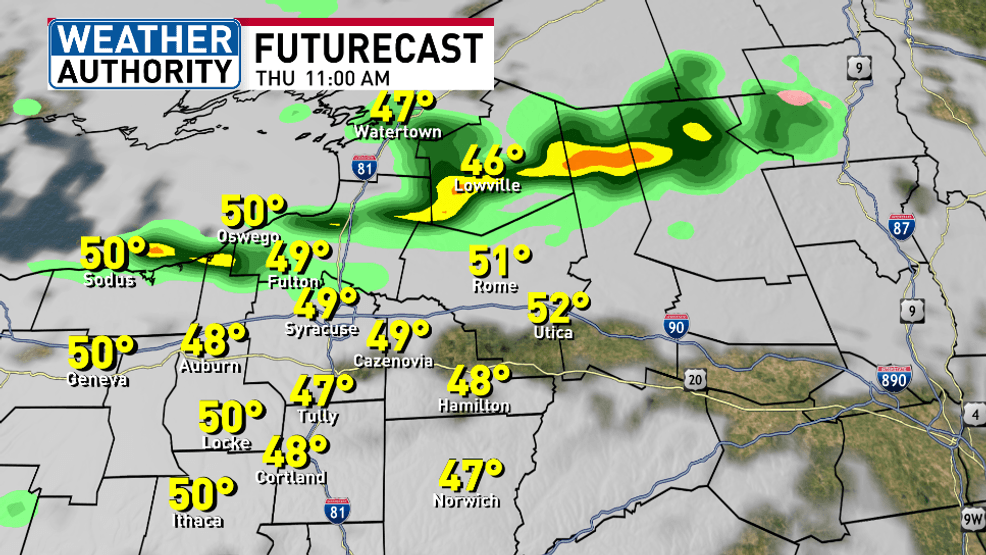
FUTURECAST 11 AM THURSDAY
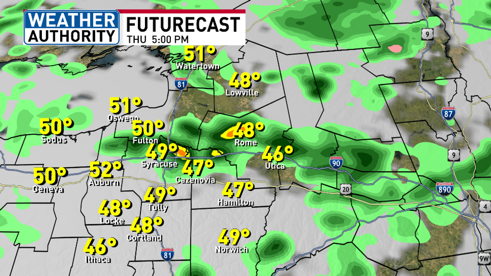
FUTURECAST 5 PM THURSDAY
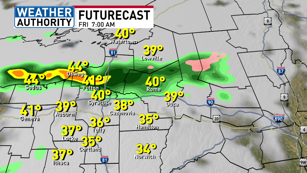
FUTURECAST 7 AM FRIDAY
Computer models continue to show lake effect rain east and southeast of Lake Ontario through Saturday midday then fall apart.
Here’s the hourly forecast for this evening, Thursday morning and Thursday afternoon:
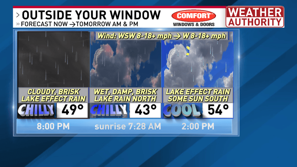
HOURLY FORECAST
In case you are trying to make weekend plans or look at how next week looks here’s our latest thinking:
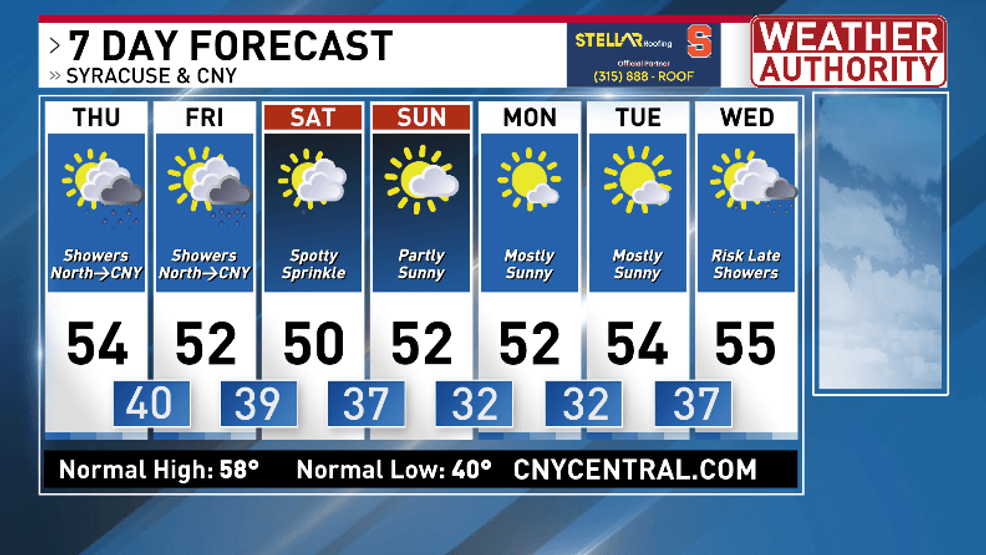
EXTENDED OUTLOOK
Comment with Bubbles
BE THE FIRST TO COMMENT
For more specific daily weather information head over to our Weather Authority forecast page here.
Have a good rest of the week!