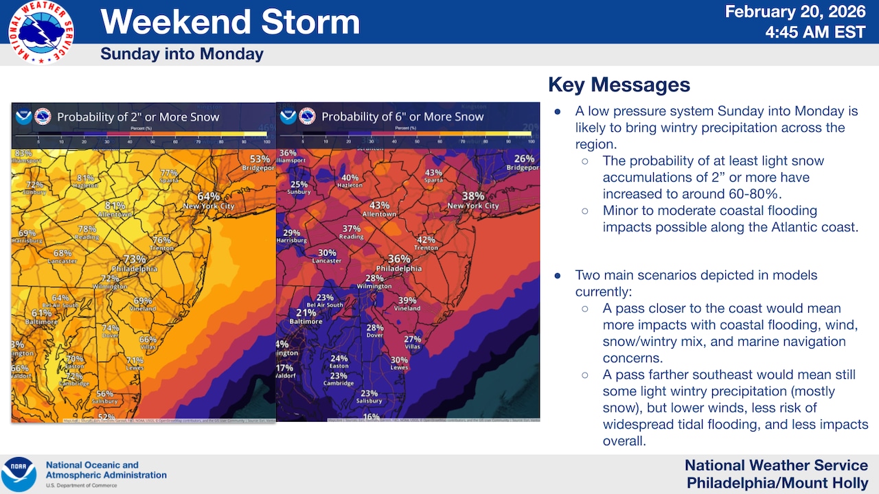
A winter storm is forecast Sunday into Monday, bringing moderate to heavy snowfall with widespread accumulations of 2 to 6 inches across eastern Pennsylvania and New Jersey.
Exact snowfall amounts remain uncertain due to the storm’s variable track and intensity, but confidence is high that precipitation will affect the area, according to the National Weather Service.
At Lehigh Valley International Airport, the weather service forecasts around 4 inches of total accumulation Sunday morning into Monday morning.
Rain continues through Friday morning for the Lehigh Valley region, with light wintry precipitation expected primarily north of the Interstate 80 corridor. A Winter Weather Advisory is in effect until noon for Carbon and Monroe counties in Pennsylvania and Sussex County in New Jersey.
Up to an inch of snow and ice accumulation of up to 0.2 inch are possible across the advisory region in the Pocono Mountains and northern New Jersey.
Temperatures will remain cold in the mid to upper 30s across most of the region through Friday morning before a warm front brings rain and higher temperatures reaching the 40s during the afternoon.
Saturday in the Lehigh Valley is forecast as partly sunny with highs in the mid-40s and a west wind around 5 mph.
The winter storm system will develop late Saturday night or Sunday as low pressure moves off the Southeast or Mid-Atlantic coast and strengthens offshore by late Sunday into Monday.
The National Weather Service notes that model guidance shows significant variability in the storm’s track and intensity, which will determine final snowfall amounts, coastal flooding potential and wind impacts.
Precipitation is expected to begin Sunday and continue into Monday, with the heaviest snow likely during Sunday night into Monday morning. Northeast winds will increase and become gusty, particularly closer to coastal areas.
Following the storm, a colder air mass will settle into the region Monday and Tuesday, with high temperatures mostly in the 30s and lows in the teens and 20s, with colder conditions in the Poconos.
Conditions will turn milder for the second half of next week.
The National Weather Service advises residents to monitor updates closely as additional details about the storm’s track and intensity become clearer, which will refine snowfall forecasts and other impacts.
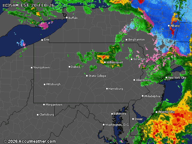
Current weather radar