
After a warm week, our temperatures will get closer to normal with highs in the low to mid 40s today and partly sunny skies.

Temperature trend through the weekend
KDKA Weather Center
With the warmer weather we’ve seen, we are now only about 2 degrees below normal for the month. We are still sitting at 40″ of snow for the season, but more is on the way tomorrow!
The Flood Advisory for the Ohio River at Pittsburgh goes until tomorrow afternoon. It’s about 19 feet, which is when water begins to flow onto the North Shore Riverwalk between the stadiums.

Areas under a Winter Storm Watch
KDKA Weather Center
A light mix starts southwest tonight, and then scattered snow showers overspread the region all day tomorrow. There is a Winter Storm Watch for the ridges of Westmoreland and Fayette County through late Monday night. Somerset County, Garrett County, Maryland, and Preston and Tucker County, West Virginia, are also included.

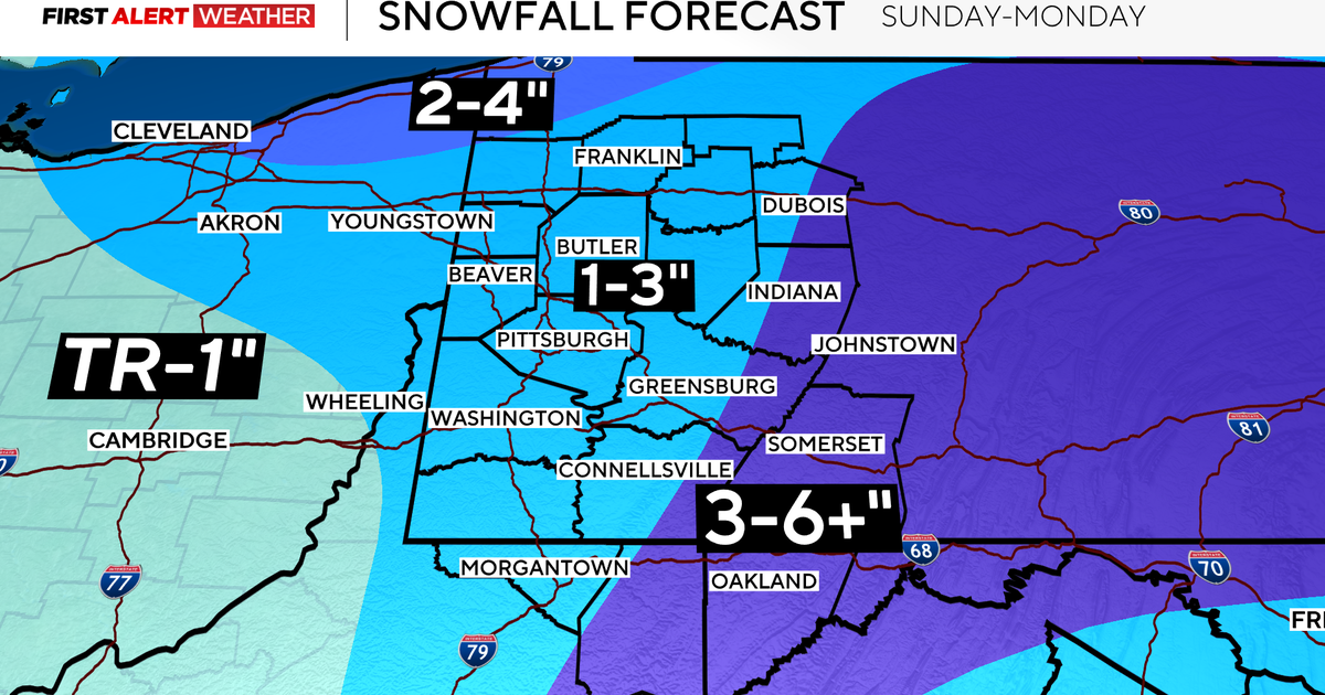
Expected snowfall throughout the region
KDKA Weather Center
Those areas could get 3-6″ starting tonight through Monday night. Pittsburgh is still sitting at a 1-3″ possibility.
On Tuesday, we dry out, but our highs will be below normal in the low 30s. Our lows will be back in the 20s, with a wintry mix returning on Wednesday and highs in the 40s. Then, we finally inch back to the 50s with mostly sunny skies by Friday!

7-day forecast: Feb. 21, 2026
KDKA Weather Center