
A major winter storm will impact the Lehigh Valley and northeastern Pennsylvania Sunday through Monday, bringing heavy snow accumulations and blizzard conditions to portions of the region, the National Weather Service predicts.
Winter storm warnings are in effect for the region, with the heaviest snowfall expected Sunday evening through Sunday night.
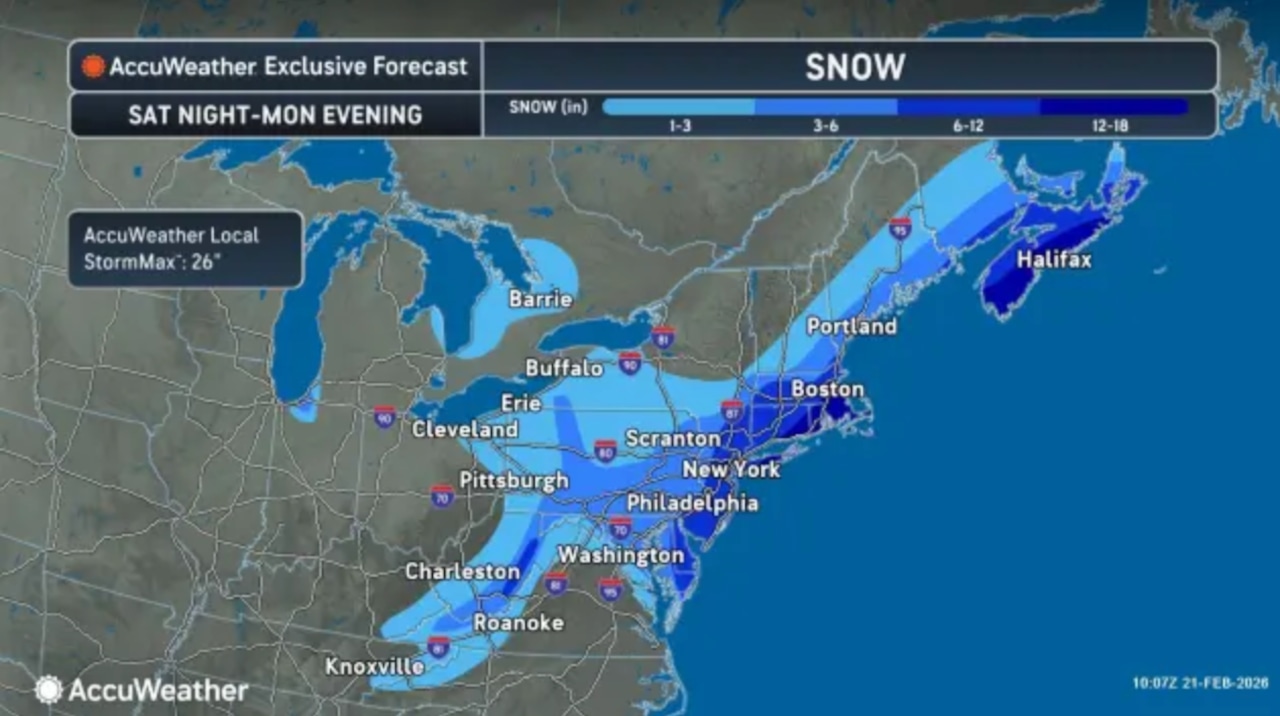
Light precipitation will begin late Saturday night into early Sunday morning, initially falling as rain or a rain-snow mix for areas near and south of the Interstate 78 corridor through midday Sunday.
As colder air moves in Sunday afternoon and evening, precipitation will transition to all snow, with rates potentially exceeding two inches per hour during the heaviest bands. Snowfall is expected to taper off Monday afternoon.
The National Weather Service forecasts widespread accumulations of eight to 18 inches across the region, with the greatest amounts focused across New Jersey and adjacent areas of southeastern Pennsylvania, including the Philadelphia metro area.
Locally higher amounts exceeding 18 inches are possible where more persistent snow banding occurs.
Western and southern portions of eastern Pennsylvania may see lower accumulations, with some areas potentially falling short of warning criteria.
Winds will increase significantly as the storm system deepens Sunday night into Monday, with gusts of 30 to 40 mph expected inland and up to 55 mph possible along the coast.
Blowing and drifting snow will be a major concern, particularly closer to coastal areas. The snow will be heavy and wet early in the event but will become lighter as temperatures drop.
Blizzard Warnings have been issued for coastal areas to highlight the potential for significant blowing and drifting snow, whiteout conditions and strong winds.
A brief area of high pressure will build in Monday night into Tuesday, bringing drier conditions. However, winds may gust upward of 20 to 30 mph, with localized gusts to 35 to 40 mph in the Poconos, before diminishing through Tuesday.
The next system arrives Tuesday night into Wednesday morning, bringing a chance for light snow ahead of a warm front, mainly with a 20 to 30 percent probability. Rain is expected Thursday as a cold front passes through.