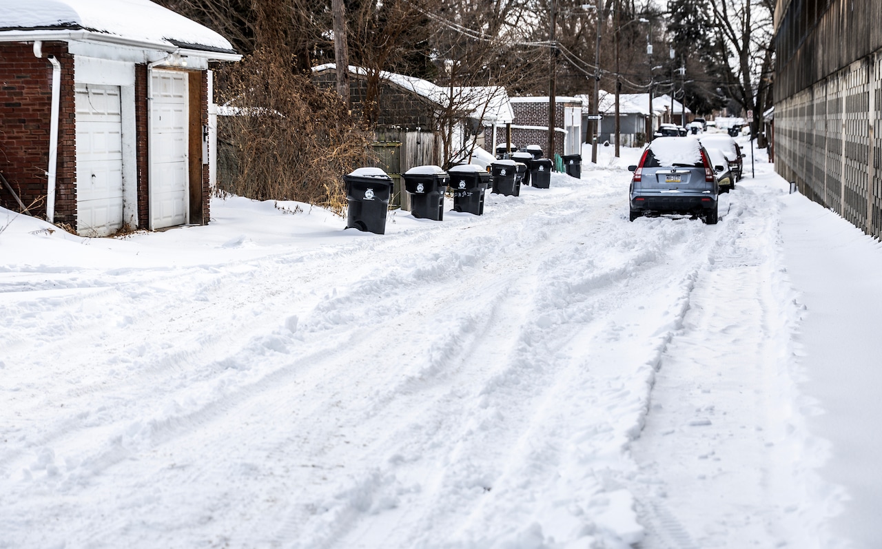
Nearly all of the snow from last month’s snow storm recently melted. Now, forecasters are calling for yet another snow storm across Pennsylvania.
The National Weather Service on Saturday issued a winter storm watch for Dauphin, Lebanon, Adams, York, Lancaster and Schuylkill counties.
The storm watch will remain in effect until Monday afternoon.
Heavy snow, with accumulations between 5 and 10 inches, is expected throughout the region into Monday. Winds gusting as high as 35 mph are also possible Sunday night and Monday.
A snow accumulation map provided by the NWS shows 4 to 6 inches of snow in Harrisburg and 6 to 8 inches of snow in Lancaster and York from Saturday evening through Tuesday morning.
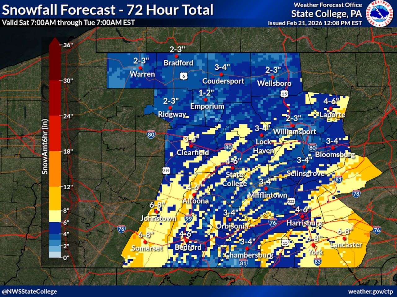 A map of snowfall estimates in central Pennsylvania between 7 a.m. Saturday and 7 a.m. Tuesday.National Weather Service
In Harrisburg, snow is forecast to start falling before 10 a.m. Sunday before rain is mixed in between 10 a.m. and 4 p.m.
After 4 p.m., Harrisburg will see more snow as winds start to gust up to 20 mph into Sunday night. By Monday, snow should stop falling around 1 p.m., forecasters said.
Other parts of central Pennsylvania will also be hit by the winter storm, with accumulations of 4 to 6 inches expected in State College and Altoona, 6 to 8 inches in Johnstown and Somerset and 3 to 4 inches in Bloomsburg.
Eastern parts of Pennsylvania, including Delaware, Philadelphia, Chester, Montgomery and Bucks counties, are expected to be hit the hardest by the winter storm, the NWS said.
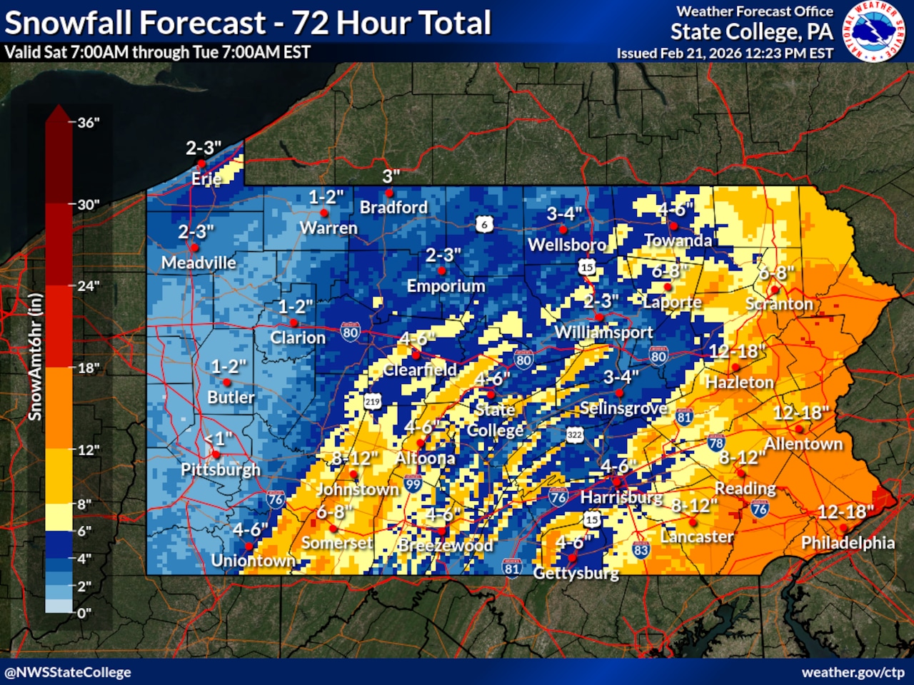 A statewide snowfall total map provided by the NWS. The eastern parts of Pennsylvania could see more than a foot of snow by Tuesday morning.National Weather Service
Total accumulations between 10 and 16 inches, accompanied by winds gusting up to 40 mph, will affect Philadelphia and surrounding areas, including Pottstown, West Chester and Doylestown. Snowfall rates could reach as high as 2 inches per hour, forecasters said.
A snowfall total map for that region shows Philadelphia and Allentown receiving 12 to 18 inches of snow by Tuesday morning.
Forecasters are also predicting 8 to 12 inches in Reading, 6 to 8 inches in Scranton, 12 to 18 inches in Hazleton and 8 to 12 inches in Lancaster throughout the same period.
The winter storm warning for the eastern part of the state will be in effect from 7 a.m. Sunday until 6 p.m. Monday.
Western parts of Pennsylvania should see much less snow, with totals ranging from under 1 inch in Pittsburgh to 2 to 3 inches in Erie.
The NWS noted there is still uncertainty about the winter storm, and westward shifts “may result in higher snowfall amounts.”
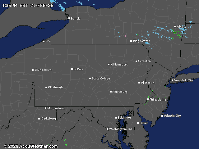
Here is a live, statewide weather radar: