
Multiple counties in southeastern Pennsylvania are now under a winter storm warning as a major nor’easter could dump as much as 18 inches of snow on parts of the state.
A winter storm warning is in effect from 7 a.m. Sunday until 6 p.m. Monday for Delaware, Philadelphia, Chester, Montgomery and Bucks counties. According to the National Weather Service, the areas under the warning will likely see between 10 and 16 inches of snow, though locally higher amounts are possible.
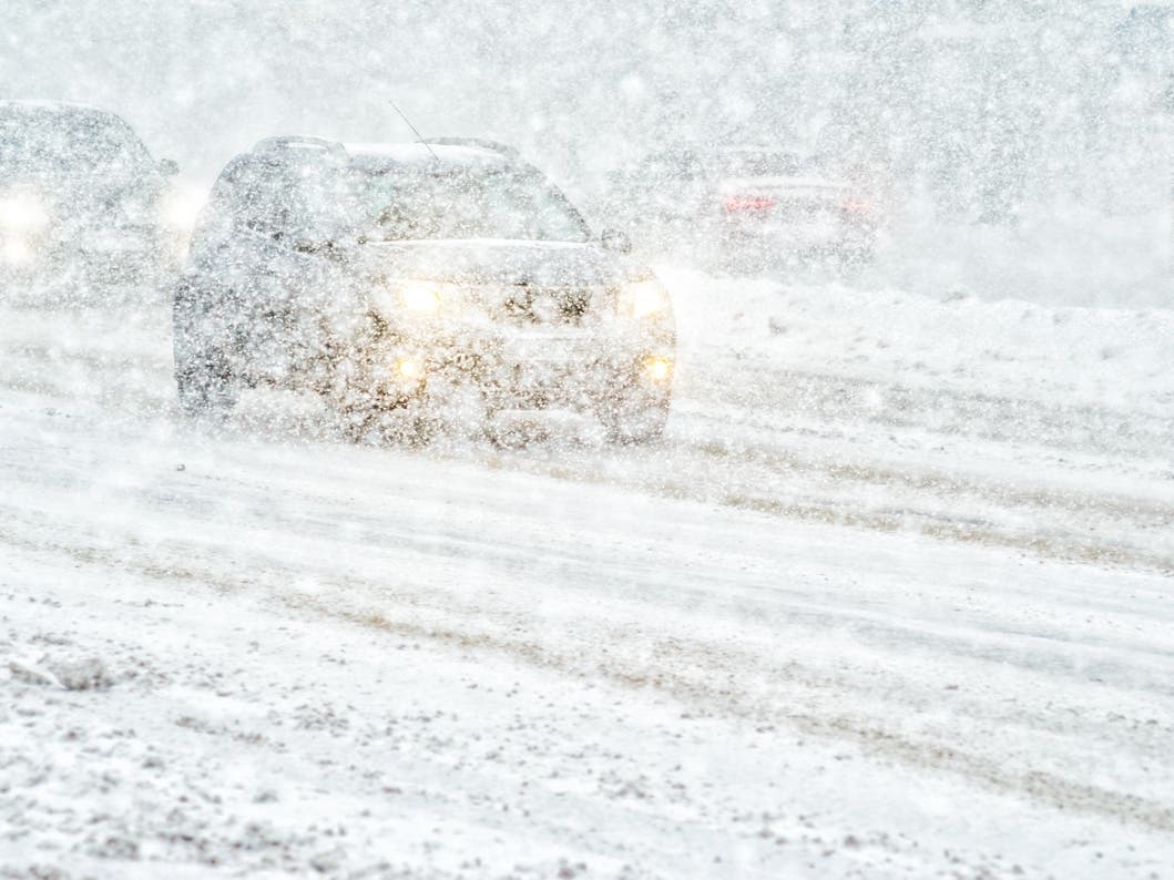
“Snowfall rates could exceed 2 inches per hour,” the National Weather Service wrote. “Blowing and drifting of snow, and whiteout conditions are possible.”

The storm system is expected to move northward from the Gulf Coast this weekend and will strengthen rapidly along the Atlantic Coast, according to AccuWeather, spreading accumulating snow from West Virginia through the mid-Atlantic and into southern New England from Saturday night through Monday.
AccuWeather meteorologists predict the storm will undergo rapid strengthening offshore, producing blizzard conditions in portions of nearby New Jersey.
“Not only will the storm evolve into a significant nor’easter with strong winds and heavy snow along parts of the Atlantic coast, but it may become a bomb cyclone as it begins to move away,” said AccuWeather Senior Meteorologist Chad Merrill.
Snow is expected to arrive in the Philadelphia region as early as Sunday morning, according to the National Weather Service. Precipitation will likely begin as a period of light rain for most areas, before changing over to snow into the late morning and afternoon hours from north to south. For areas north of I-78, precipitation will likely remain all snow.
The snow will likely be wet and heavy, and it will continue to fall through Monday afternoon.
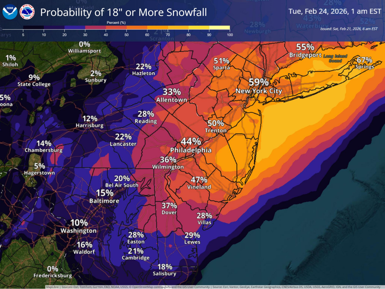
According to forecasters, southeastern Pennsylvania will see the heaviest snowfall Sunday night into Monday morning. Philadelphia has a 44 percent chance of recording more than 18 inches of snow, with the likelihood increasing northeast of the city.
Additionally, northeast winds will begin to increase on Sunday and persist through Monday, possibly into Monday night. Wind gusts up to 40 mph are possible, which could lead to tree damage and power outages.
Major impacts from the storm include slick, snow-covered roads. Gusty winds will reduce visibility and likely cause widespread travel disruptions. Also, widespread closures and disruptions to infrastructure may occur.
Here’s a look at the detailed National Weather Service forecast for the Philadelphia region:
Saturday: Mostly sunny, with a high near 48. Northwest wind around 5 mph.
Saturday Night: A chance of rain, mainly after 3am. Increasing clouds, with a low around 33. Calm wind. Chance of precipitation is 40%.
Sunday: Snow, possibly mixed with rain, becoming all snow after 4pm. High near 37. East wind 5 to 10 mph increasing to 10 to 15 mph in the afternoon. Winds could gust as high as 25 mph. Chance of precipitation is 100%. New snow accumulation of less than one inch possible.
Sunday Night: Snow. The snow could be heavy at times. Patchy blowing snow after 9pm. Low around 29. Blustery, with a northeast wind 15 to 20 mph, with gusts as high as 35 mph. Chance of precipitation is 100%. New snow accumulation of 7 to 11 inches possible.
Monday: Snow likely, mainly before 1pm. Patchy blowing snow before 1pm. Cloudy, with a high near 37. Breezy, with a northwest wind 15 to 20 mph, with gusts as high as 35 mph. Chance of precipitation is 70%. New snow accumulation of 2 to 4 inches possible.
Monday Night: Mostly cloudy, with a low around 24.
Tuesday: Mostly sunny, with a high near 33.
Tuesday Night: Mostly cloudy, with a low around 22.