
Light snow showers Sunday, Chilly Start to week
Sunday is an Impact Day for light snow showers, local accumulations 1-2″
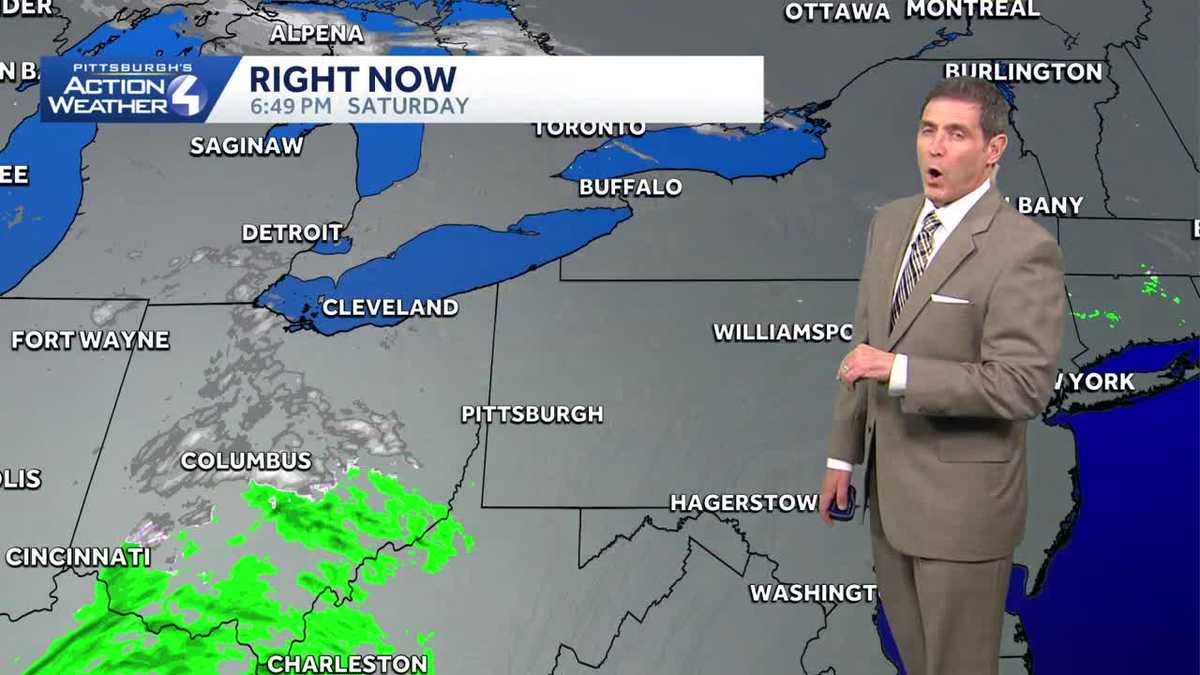
I KNOW THOSE TWO EVENTS ARE FOR A GOOD CAUSE. IT WAS SUNNY, BUT NOT WARM ENOUGH TO DO A POLAR PLUNGE OR UNDIE RUN FOR ME. YEAH, FOR ME TOO. IT COULD BE A LOT WORSE THOUGH. WAS IN THE 40S THIS AFTERNOON, WHICH IS ABOUT WHERE WE SHOULD BE FOR THIS TIME IN FEBRUARY. AND AS WE HEAD THROUGH THE NEXT FEW DAYS, TEMPERATURES WILL TREND COLDER INTO THE EARLY PART OF NEXT WEEK. AND WE’LL ALSO END THE WEEKEND WITH SOME LIGHT SNOW SHOWERS TOMORROW. THE COVERAGE IS GOING TO BE SCATTERED AND INTERMITTENT, SO THERE’LL BE PROBABLY PERIODS OF THE DAY WHEN YOU DON’T SEE FLAKES AND FLURRIES. IN TERMS OF ACCUMULATION, I THINK MOST PLACES MAY COME IN AROUND AN INCH TO MAYBE AN INCH AND A HALF IN SOME ISOLATED SPOTS. IT’S MOSTLY GOING TO BE ON THE GRASS WITH ABOVE FREEZING TEMPERATURES, AS WELL AS WARMER GROUND CONDITIONS. MOST OF WHAT FALLS WON’T STICK ON THE ROADS WILL JUST BE WET. BUT OVER IN THE LAUREL HIGHLANDS, 2 TO 5IN THROUGH THE DAY TOMORROW COULD CAUSE SOME ISSUES WITH SLOWDOWNS THERE. IF YOU’RE TRAVELING IN THAT DIRECTION. 37 THE HIGH TEMPERATURE TOMORROW. THE IMPACT A FEW LEFTOVER FLURRIES, MAINLY IN THE LOWER HIGHLANDS ON MONDAY, AND YOU CAN SEE TEMPERATURES TREND CHILLY THROUGH TUESDAY BEFORE BOUNCING BACK INTO THE 40S. THE MIDDLE PART OF THE WEEK MID TO UPPER 30S RIGHT NOW. STILL IN THE 40S IN GREENSBURG, UNIONTOWN AND WASHINGTON. AND A LITTLE MOISTURE BEGINNING TO APPROACH THE AREA, AT LEAST INITIALLY. THE DRIER AIR IN PLACE WILL BREAK THINGS APART ACROSS PORTIONS OF OHIO, SO I DON’T THINK WE’LL SEE ANYTHING LOCALLY UNTIL PROBABLY AFTER MIDNIGHT TONIGHT, WHEN WE’LL SEE SOME SCATTERED FLURRIES FROM TIME TO TIME, AND THEN INTERMITTENT SCATTERED LIGHT SNOW SHOWERS THROUGH THE DAY TOMORROW. TEMPERATURES WILL STAY IN THE 30S THROUGHOUT THE DAY. THIS IS 1130 TONIGHT. YOU CAN SEE SOME SCATTERED FLURRIES, MOSTLY EAST OF PITTSBURGH AND THEN THROUGH THE DAY TOMORROW. SCATTERED LIGHT ACTIVITY. THOSE ARE TWO IMPORTANT WORDS ARE SCATTERED IN LIGHT THROUGH THE DAY. YOU CAN SEE AT 5:00 SOME HIT AND MISS SNOW SHOWERS ACROSS THE AREA. AND THEN AS WE HEAD INTO THE EARLY PART OF THE DAY ON MONDAY, WHAT’S LEFT IS MAINLY GOING TO BE OVER TOWARD THE LAUREL HIGHLANDS. IN TERMS OF ACCUMULATION. TOMORROW, FROM START UNTIL ABOUT 11 1130, AN INCH OR LESS ACROSS MOST AREAS, BUT AGAIN OVER TOWARD THE LAUREL HIGHLANDS. THOSE NUMBERS COULD BE IN THE RANGE OF 2 TO 5IN BEFORE ALL IS SAID AND DONE. TOMORROW, 34 ON MONDAY. LEFTOVER FLURRIES IN THE MORNING, MAINLY IN THE HIGHLANDS. CHILLY DAY ON TUESDAY BEFORE WE BOUNCE BACK INTO THE 40S MIDWE
Light snow showers Sunday, Chilly Start to week
Sunday is an Impact Day for light snow showers, local accumulations 1-2″

Updated: 9:18 PM EST Feb 21, 2026
Temperatures are trending chillier to end the wekend. Snow showers return on Sunday with higher accumulations expected for the Laurel Highlands. Impact Day Sunday: Light snow showersA Winter Storm Watch has been issued for the Laurel Highlands of Westmoreland, Fayette, Monongalia, Preston and Garrett counties from Sunday morning through Tuesday morning.Locally, there won’t be a whole lot of accumulation — one to two inches, mainly on non paved surfaces. The snow will have a hard time sticking to the pavement due to warm ground temperatures and above freezing air temps. In the Laurel Highlands, 2-5″ will be possible, especially on the western facing slopes and above 1,500 feet. Chilly start to next weekTemperatures are parked in the 30s to begin next week. The chilly temps will only be temporary as highs will trend more seasonal in the mid 40s by mid week.We are tracking back-to-back fast moving systems that will bring periods of rain and perhaps some non-accumualting wet snow. The first arrives Tuesday night with snow ending as rain. Thursday’s clipper will carry impacts primarily from rain. TONIGHT: Mostly cloudy. Light snow showers arrives after midnight. Low: 32°.SUNDAY – Impact Day: Scattered and Intermittent light snow showers. High: 37°, low: 28°.MONDAY: Breezy with leftover snow showers. High: 34°, low: 19°.TUESDAY: Partly Sunny and chilly. High: 32°, low: 28°.
PITTSBURGH —
Temperatures are trending chillier to end the wekend. Snow showers return on Sunday with higher accumulations expected for the Laurel Highlands.
Impact Day Sunday: Light snow showers
A Winter Storm Watch has been issued for the Laurel Highlands of Westmoreland, Fayette, Monongalia, Preston and Garrett counties from Sunday morning through Tuesday morning.

Hearst OwnedHearst
Winter Storm Watch late tonight through late Monday night for the Laurel Highlands.
Locally, there won’t be a whole lot of accumulation — one to two inches, mainly on non paved surfaces. The snow will have a hard time sticking to the pavement due to warm ground temperatures and above freezing air temps. In the Laurel Highlands, 2-5″ will be possible, especially on the western facing slopes and above 1,500 feet.

Hearst OwnedHearst
Two-day snow totals around western Pennsylvania. Greater impacts for the highest elevations for the Laurel Highlands.
Chilly start to next week
Temperatures are parked in the 30s to begin next week. The chilly temps will only be temporary as highs will trend more seasonal in the mid 40s by mid week.
We are tracking back-to-back fast moving systems that will bring periods of rain and perhaps some non-accumualting wet snow. The first arrives Tuesday night with snow ending as rain. Thursday’s clipper will carry impacts primarily from rain.

Hearst OwnedHearst
Back-to-back clipper will usher in periods of rain and snow mid-week.
TONIGHT: Mostly cloudy. Light snow showers arrives after midnight. Low: 32°.
SUNDAY – Impact Day: Scattered and Intermittent light snow showers. High: 37°, low: 28°.
MONDAY: Breezy with leftover snow showers. High: 34°, low: 19°.
TUESDAY: Partly Sunny and chilly. High: 32°, low: 28°.