
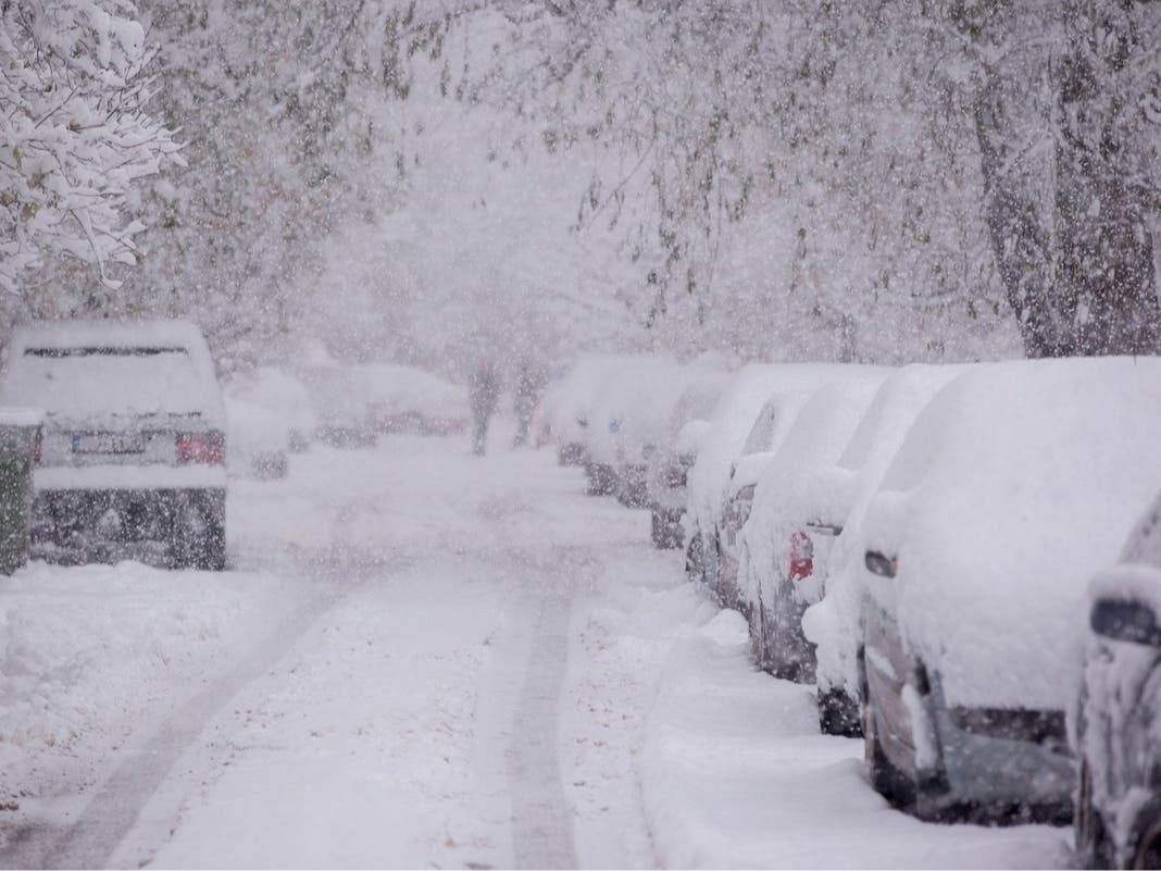
PHILADELPHIA — The Philadelphia area is under a blizzard warning through Monday afternoon as a potentially historic storm is expected to bring as much as two feet of snow to the region, according to the National Weather Service.
Winter storm warnings were upgraded to blizzard warnings for Bucks, Lower Montgomery, Philadelphia, Delaware, Carbon and Monroe counties, the weather service reported Sunday morning.
“Significant snow, strong winds, and coastal flooding may result in life-threatening travel and crippling impacts to infrastructure that last beyond Monday,” the NWS Sunday morning briefing said.
Blowing and drifting snow is expected to result in visibilities of a quarter-mile or less with winds gusting up to 60 mph along the Interstate 95 corridor, with the heaviest snowfall Sunday evening into Monday morning, according to the NWS.
Precipitation is anticipated to start Sunday morning, with the heaviest snowfall reaching rates of 1-2 inches per hour or more overnight and accumulation totals coming in at 18-24 inches for Philadelphia, according to forecasters with the NWS.
“Whiteout conditions expected,” the briefing said. “Travel will be treacherous and life-threatening.”
Once the storm intensifies on Sunday, it could prove significantly more severe than projections made just a few days ago, the NWS warned. Blizzard warnings were in place for New York City and Long Island, Boston and coastal communities in New Jersey, Connecticut, Delaware, Maryland, Rhode Island and Massachusetts.
“While we do get plenty of these nor’easters that produce heavy snow and strong impacts, it’s been several years since we saw one of this magnitude across this large of a region in this very populated part of the country,” said Cody Snell, a meteorologist at the service’s Weather Prediction Center.
Snell said the storm would arrive Sunday morning in areas around Washington before stretching toward Philadelphia and New York City and reaching Boston in the evening.
The Associated Press contributed to this story.