
A blizzard slammed into the greater Philadelphia area this weekend, dropping as much as 21 inches of snow in many parts of the region in one of the more significant winter events in recent history.
Strong winds and thunderstorms accompanied the storm in places, and the height of the blizzard saw two inches or more of accumulation per hour.
As of Monday morning, parts of Bucks County have recorded the highest snowfall accumulations so far. In Morrisville, 21 inches was recorded, according to snowfall totals posted by the National Weather Service. Fairless Hills and Langhorne also received more than 20 inches. Parts of Montgomery County got more than a foot: Willow Grove received more than 13 inches, and Norristown also got more than a foot.
Find out what’s happening in Across Pennsylvaniafor free with the latest updates from Patch.
See full list of local snowfall totals across the Philadelphia region here.
“The blockbuster blizzard has all but shut down travel in a heavily populated, very busy region of the nation with road closures and thousands of flight cancellations and delays from this weekend to Monday,” Accuweather said. “These effects will continue into Tuesday and perhaps Wednesday until aircraft and crews are relocated, schedules changed and crews have a chance to clear the snow.”
Find out what’s happening in Across Pennsylvaniafor free with the latest updates from Patch.2:30 AM Monday: Near blizzard conditions at our office under the main snow band. We are now up to 14.0″ of snowfall. Snowfall rates remain around 2″ per hour under the band. Please do not travel if you are in the Blizzard Warning area! #NJwx pic.twitter.com/t8VCjczG2y
— NWS Mount Holly (@NWS_MountHolly) February 23, 2026
It’s the first storm classified as a “blizzard” by Accuweather in the Philadelphia area in four years.
Here’s a glance at some of the most notable impacts Monday morning.
Roads inundated, vehicle restrictions in place
Officials with the Pennsylvania Department of Transportation are urging residents to avoid travel if at all possible.
Drivers who do take to the roads will see reduced speed limits on all major highways around the greater Philadelphia region, including:
Interstates 76, 95, 295, 476, 676U.S. Routes 1, 30, 202, 422State Routes 63, 100 Spur and 309
Commercial vehicles are not permitted on roadways, nor are school buses, commercial buses, motor coaches, motorcycles, RVs, motorhomes, or any passenger vehicles towing other vehicles.
“Restrictions will be lifted as quickly as possible when conditions are safe,” PennDOT said Monday.
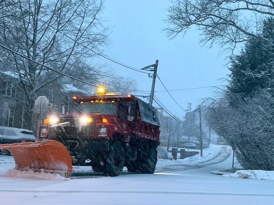
Snow plows worked through the night in many parts of the region, treating the roads and attempting to clear snow.
Power outages
Widespread power outages are in effect around the area, with nearly 10,000 customers impacted as of 9:30 a.m. Monday, according to PECO.
The storm brought down trees and power lines in various parts of the region.
The bulk of those outages are in Delaware (4,624) and Montgomery (2,671) counties, with outages also hitting Bucks (951), Chester (722), and Philadelphia (351).
Restoration times range from a few hours to a few days, depending on the nature of the outage.
SEPTA Regional Rail
SEPTA suspended all bus service — including the G buses and trolleys — at 10 p.m. Sunday. Buses will be suspended until further notice.
Regional Rail service is suspended until safety inspections can be completed.
School closures
Nearly all schools throughout the region have declared either traditional snow day, a remote instruction day, or a flexible instruction day for Monday. Determinations for Tuesday could be made early on Monday given the amount of accumulation and additional inclement weather in the immediate forecast.
More snow on the horizon
Snow could continue through the morning, and “blowing snow” is possible into the evening hours Monday night. Temperatures will drop to 23 overnight, keeping all the recent accumulation cold.
Another round of snow appears likely Tuesday, with less than an inch of new accumulation possible Tuesday night, according to the National Weather Service.
Forecasters believe that could give way to rain by Wednesday morning, with a break in the cold following as highs could reach 45 by the afternoon.
Here’s the full forecast, according to the National Weather Service:
Monday
Snow, mainly before 1 p.m. The snow could be heavy at times. Areas of blowing snow. High near 37. Breezy, with a northwest wind 15 to 25 mph, with gusts as high as 40 mph. Chance of precipitation is 80%. Total daytime snow accumulation of 4 to 8 inches possible.
Monday Night
Areas of blowing snow before midnight. Mostly cloudy, with a low around 23. West wind 10 to 15 mph.
Tuesday
Mostly sunny, with a high near 33. West wind around 10 mph, with gusts as high as 20 mph.
Tuesday Night
Snow likely after 1 a.m. Increasing clouds, with a low around 22. Calm wind becoming south around 5 mph after midnight. Chance of precipitation is 60%. New snow accumulation of less than one inch possible.
Wednesday
A chance of rain and snow before 10 a.m., then a chance of rain between 10 a.m. and 1 p.m. Partly sunny, with a high near 45. South wind around 10 mph, with gusts as high as 20 mph. Chance of precipitation is 40 percent. New snow accumulation of less than a half inch possible.
Wednesday Night
Mostly clear, with a low around 29.
Thursday
Rain and snow likely after 1 p.m. Mostly cloudy, with a high near 44. Chance of precipitation is 60 percent.
Thursday Night
Rain likely, mainly before 1 a.m. Mostly cloudy, with a low around 33. Chance of precipitation is 70%.
Friday
Partly sunny, with a high near 44.
Friday Night
Mostly clear, with a low around 30.
Saturday
Sunny, with a high near 51.
Saturday Night
Mostly clear, with a low around 35.
Sunday
Partly sunny, with a high near 50.
Get more local news delivered straight to your inbox. Sign up for free Patch newsletters and alerts.