
Parts of the Pittsburgh are can expect to see snow tonight and it could linger into tomorrow’s morning commute.
Any Alert Days Ahead? No. Morning temperatures will likely mean not needing one for tonight’s snow. Model data continues to hint at something big next week.
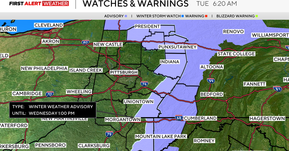
Aware: Winter weather advisory now in place for higher elevations for tonight, where two to four inches of snow is expected
For most, there is some great news when it comes to snow chances over the next 48 hours. The good news is that the chance for school delays is going to be low both on Wednesday morning and Thursday afternoon. I say most, because I know there are some kids out there hoping that they can sleep in a little longer on Wednesday or be out of school and on their devices a little early on Thursday. If that is you, I would make sure to still study and do all your homework, as you’re probably not going to be delayed due to the weather. Sorry, but as a father of a middle schooler, I’m not really.

KDKA Weather Center
Now that we have that part out of the way, let’s talk about what you should expect with tonight’s snow. Most communities will see between an inch to two inches of snow, with up to four inches of snow expected for higher elevations. Temperatures will be hovering near 32° while the snow is falling. I have Pittsburgh slightly above 32°, with most snow melting on contact with hard surfaces. Expect slushy to wet roads to start the day. There will be accumulation on grassy surfaces. Snow is expected to be fairly continuous from 1 a.m. through 7 a.m. Scattered snow showers will remain possible through the rest of the day.
There was a secondary chance for snow and a wintry mix on Thursday, but the track of that system has really moved south over the last 24 hours. This means not much in the way of snow for Pittsburgh. South of I-70 it appears both snow and a wintry mix. Should be expected during the day on Thursday.
Looking ahead, I have a quick warm-up happening this weekend with Saturday highs hitting the mid-50s. Highs on Friday should be in the mid to upper 40s. We may even see some communities hitting 50 degrees on Friday too.

KDKA Weather Center
Looking way ahead, model data all continue to try and develop another major snow event for next week, but there has been little to no agreement model-to-model run and time-to-time on any one model. Be on the lookout for social media guy who will pump out raw model data and say that is what we are getting. It’s simply too early to know what to expect and where to expect it.
More from CBS News