
PHILADELPHIA – Mild temps will help melt snow leftover from Monday’s blizzard, which brought over a foot of slushy snow to parts of the region.
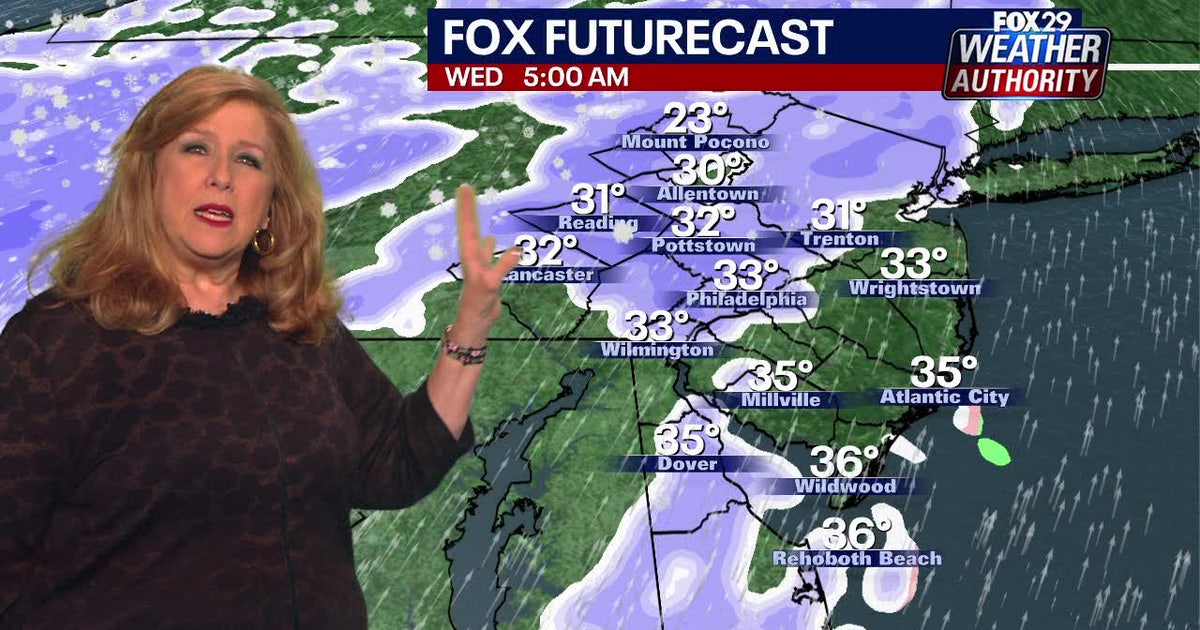
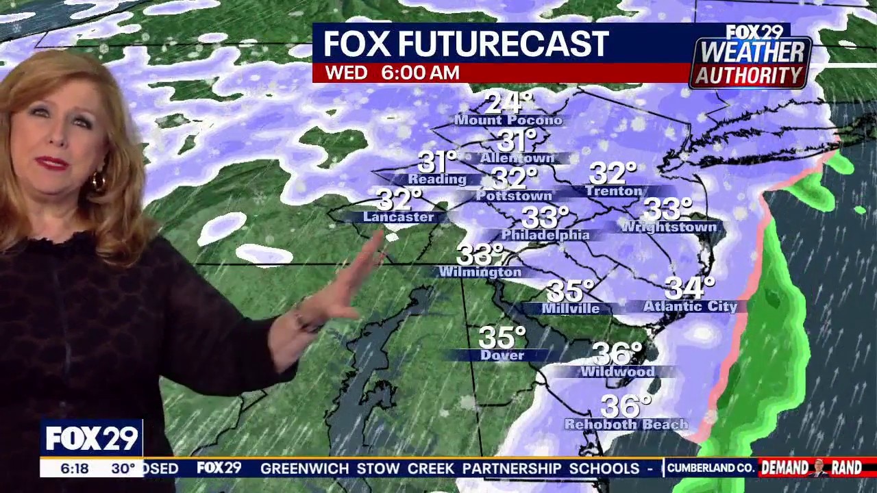
Forecasters say we aren’t quite done with the flurries, however, as a round of flakes Wednesday morning will sweep through the area.
More snow coming
What we know:
Don’t fret: The early Wednesday morning bout of snow is not expected to be anything more than a winter nuisance.
Forecasters expect the flakes to start in areas north and west of Philadelphia around 5 a.m., moving into the city shortly after.
The storm will become more widespread by 6 a.m., covering parts of New Jersey and Delaware before pulling offshore by noon.
Snowfall totals aren’t expected to exceed an inch in Philadelphia or elsewhere.
Mild temperatures
What’s next:
Even with the light snowfall on Wednesday morning, forecasters expect mild temperatures this week to help melt the slushy snow.
Daytime temperatures on Wednesday will reach into the upper 40s, and remain in seasonable with a healthy mix of sun and clouds.
Conditions will continue to improve over the weekend, when temperatures stretch into the 50s with even more bright sunshine.
 Snowfall totals
By the numbers:
While this storm brought the most snow Philadelphia has seen in years, it did not break the city’s all-time records.
The Blizzard of January 1996 remains the largest, with 30.7 inches recorded across the city. Other major storms include February 2010 (28.5 inches), December 2009 (23.2 inches), and January 2016 (22.4 inches).
• January 6–8, 1996: 30.7 inches
• February 5–6, 2010: 28.5 inches
• December 19–20, 2009: 23.2 inches
• January 22–23, 2016: 22.4 inches
• February 11–12, 1983: 21.3 inches
• December 25–26, 1909: 21 inches