
Plan on some morning snow showers around the Philadelphia region for the morning drive Wednesday. Impacts should be relatively minor, but be careful out on the roads.
A jacket will be needed to start the day, but we’ll warm to the mid-40s by the afternoon hours.

CBS News Philadelphia
NEXT big weather changes
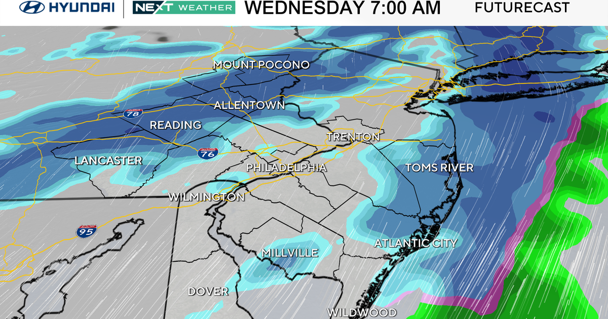
The NEXT Weather Team is tracking a clipper system that will bring snow showers on Wednesday morning. This could have minor impacts on the morning commute. But the chance for any accumulation looks limited to areas north of Interstate 78, with up to an inch for parts of the Lehigh Valley and 1-2 inches for the Poconos.

CBS News Philadelphia
We will monitor this if it looks like it’ll impact the commute near the city, but as of now, it doesn’t look super impactful.
A stronger system will track by to our south Thursday night and will likely bring us rain, but could change over to a brief period of snow or a wintry mix on the northernmost edge of the storm through the overnight hours, with some possible slippery spots.
We’ve issued a NEXT weather alert for this one but it, too, may end up being a minor event if the system trends a bit farther south.
The weekend is looking mild and dry before another big chill moves into the area early next week that has the potential to bring additional accumulating snow to the region, along with cold temps.
Here’s your 7-day forecast:

CBS News Philadelphia
Wednesday: Morning snow shower. High 48, low 26.
Thursday: NEXT Weather Alert for rain and mix. High 42, low 36.
Friday: AM icy spots. High 44, low 28.
Saturday: Mild. High 50, low 28.
Sunday: Partly cloudy. High 48, low 35.
Monday: Rain/snow. High 31, low 27.
Tuesday: Rain/snow. High 37, low 22.
More from CBS News