
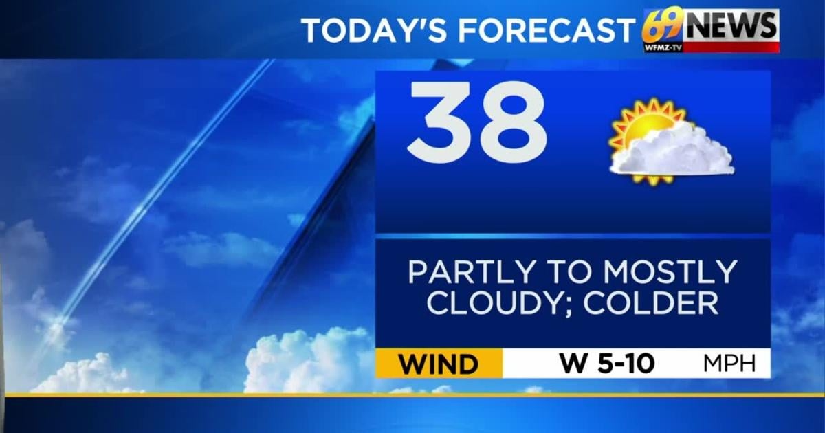
TODAY: Partly to mostly cloudy; flurry. High: 38
TONIGHT: Partly to mostly cloudy. Low: 23
FRIDAY: Clouds break for sunshine; milder. High: 44 Low: 27
THE BIG PICTURE
The rest of the week will feature mainly dry conditions and seasonably cool temperatures. High temperatures today will be in the upper 30s and by Friday highs will be near normal in the mid 40s with nights in the 20s. The weekend will feature a wonderful start on Saturday as high temperatures climb into the lower 50s amid mostly sunny skies – enjoy! Sunday will be a fairly pleasant day as well with partly sunny skies, and temperatures near 40 degrees. Next week will come with a reinforcing shot of colder air. Afternoon highs will drop down to the 30s with nights in the teens. There are some signs of another system to bring some wintry weather next week. One round perhaps late Sunday into Monday and another Tuesday and Wednesday. Details aren’t locked in, but we’ll continue to keep a close eye on it and keep you posted.
FORECAST DETAILS
THURSDAY
Today will feature partly to mostly cloudy skies. As a low pressure system slides south, it may bring a few flurries. especially to the south of the Lehigh Valley. Temperatures will fall back to the upper 30s, so colder air will be in place but no accumulations are expected.
FRIDAY THROUGH SUNDAY
This is probably the nicest stretch of weather of the forecast, and it coincides with the weekend. Soak up a mostly sunny day Saturday then look for a few more clouds Sunday, and some slow and steady snowmelt taking place each day during this stretch. Highs should reach the mid to low 40s Friday, lower 50s Saturday and lower 40s Sunday. Winds kick up later Sunday behind a cold front, which will deliver a shot of colder air to start next week.
EARLY NEXT WEEK
Colder air and highs in the 30s settle in for early next week from Monday through Wednesday, and an active front to our south could provide at least the chance of snow for our area, some time into Monday and Tuesday/Wednesday. So, we’ll begin the month of March a little colder than average with yet another chance for snow, as hopes for an early spring continue to fade. There is the chance for light to moderate accumulations during this time frame, depending on where the front and moisture sets up, so stay tuned.