
It’s a cool start to Thursday in the Philadelphia area, with many of us waking up to temperatures around or even slightly above freezing.
Areas to the north are a bit colder with less cloud cover.
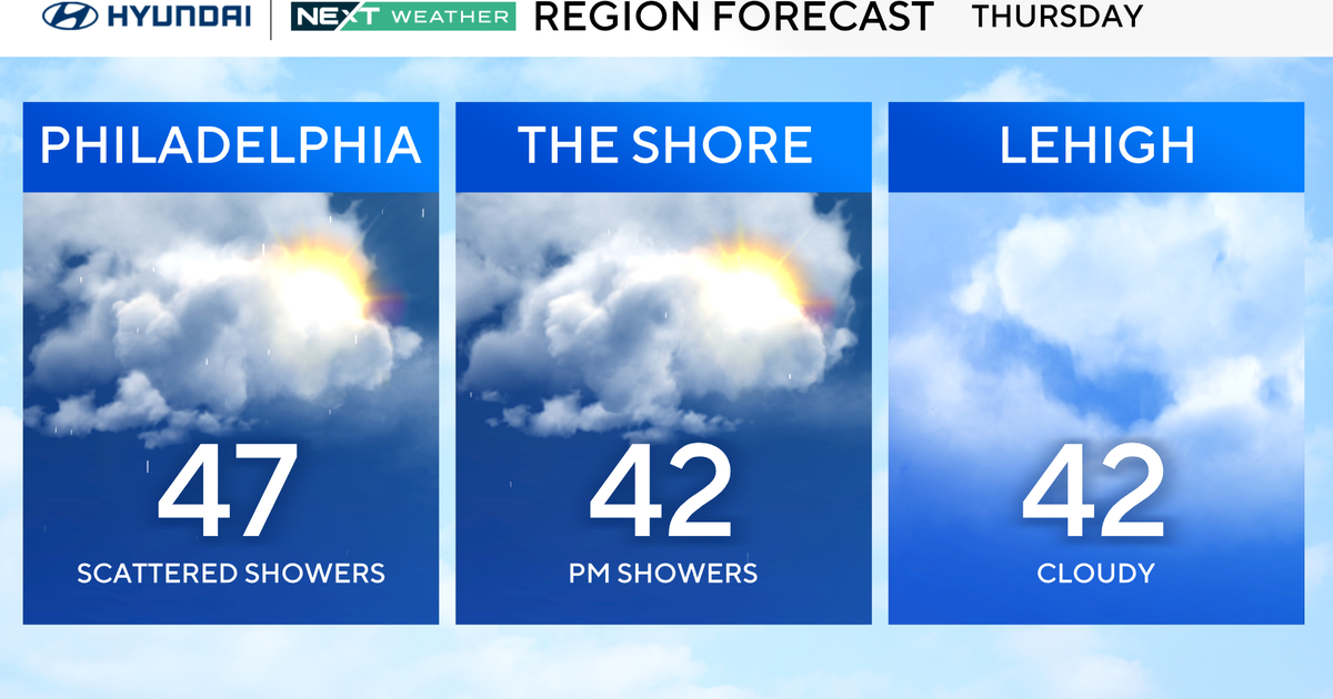
We’ll start the day with some sunshine before clouds thicken in the afternoon, and a system to our south may bring some rain in the form of a couple of spotty showers to the area late this afternoon or this evening.

Showers will be light and mainly limited to areas from the city on south.
NEXT big change
A nice warming trend into the weekend as temperatures surge into the 50s tomorrow and Saturday — even a little taste of spring!
It’s dry and cooler into Sunday, but we will closely monitor the potential for another weather alert early next week.

Don’t put away the heavy coats yet — Monday brings a renewed shot of bitter cold plus the chance to see some light snow or snow showers.
On snow records, and days with snow on the ground
As for snow, as of Wednesday, Feb. 25, Philadelphia has received 30.1 inches of snow, with a total of 34 days having 1 inch or more on the ground. (Wednesday’s snow depth was 7 inches).
The last time we had more, to date, was 2013-2014 season with 40 days.
The 34 days this season (through Feb. 25), makes it tied for the 13th most EVER recorded.
It will be very interesting to see where we end up for the total season. The all-time record is 53 days back 1904-1905.
More recently, say the past 50 seasons, we’ve only had 4 other seasons with more than 34 days of 1-inch-plus of snow on the ground…for the entire season, not just through Feb. 25. They were:
2013-2014: 45 days1995-1996: 45 days2002-2003: 43 days1977-1978: 40 days
Interesting, right?!
Here’s your 7-day forecast:

Thursday: Showers south. High 47, Low 35
Friday: Mostly sunny. High 51, Low 28
Saturday: Mild. High 52, Low 31
Sunday: Clouds increase. High 45, Low 39
Monday: Rain/snow chances. High 32, Low 24
Tuesday: Rain/snow chances. High 39, Low 21
Wednesday: Clearing precipitation. High 48, Low 34
More from CBS News