
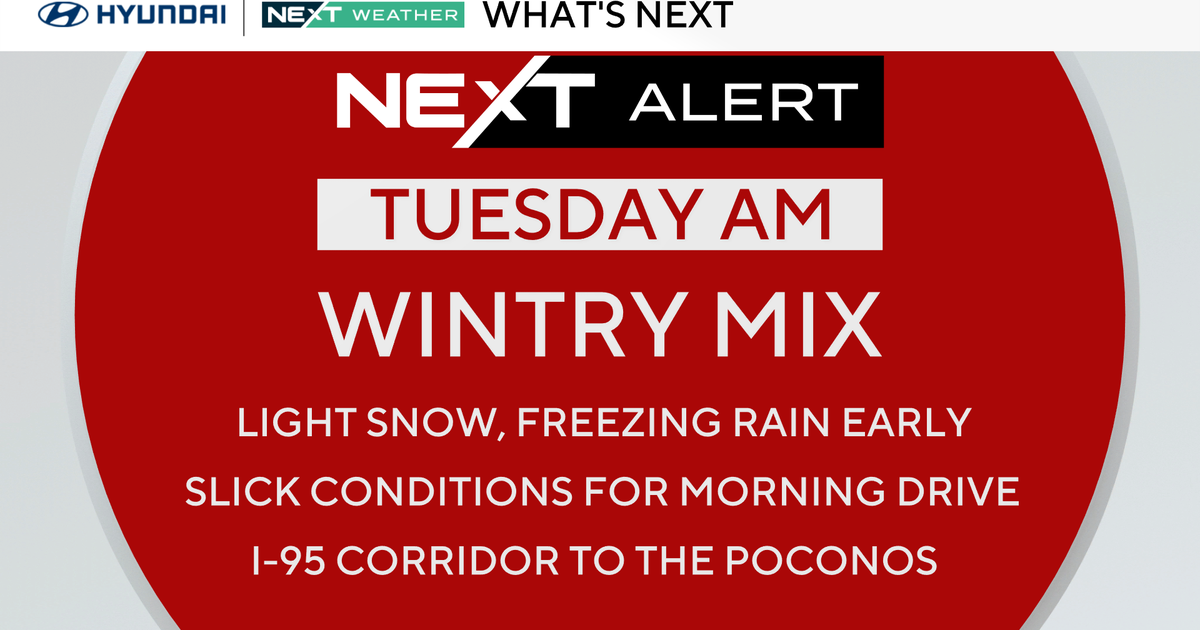
Take time heading out Tuesday morning in the Philadelphia region, as we’ll have a wintry mix through mid-morning. It will change over to cold rain showers by the late morning and afternoon. You’ll want your umbrella, and you’ll want to take your time early.
A winter weather advisory is in effect for the threat of snow (a coating to 1 inch) for most of the region, including Philadelphia and the I-95 corridor.
Because of the threat, we’ve issued a NEXT Weather Alert for Tuesday morning.

CBS News Philadelphia
NEXT big weather changes
By Wednesday, we flip the script and turn more spring-like with highs in the 50s.
Thursday through the weekend, we’ll see a temp transition around the region
Saturday, there may even be a few 70s south of the city, and by Sunday, the 70s will be widespread across the area.
Expect a wetter pattern to arrive as well. Most days have at least a chance of showers.
Here’s your 7-day forecast:

CBS News Philadelphia
Tuesday: NEXT Weather Alert for early mix. High 39, low 31.
Wednesday: Morning showers. High 57, low 37.
Thursday: Clouds and showers. High 53, low 43.
Friday: Mostly cloudy. High 55, low 42.
Saturday: Mild. High 61, low 40.
Sunday: A run at 70. High 72, low 53.
Monday: Mostly cloudy. High 70. Low 53.