
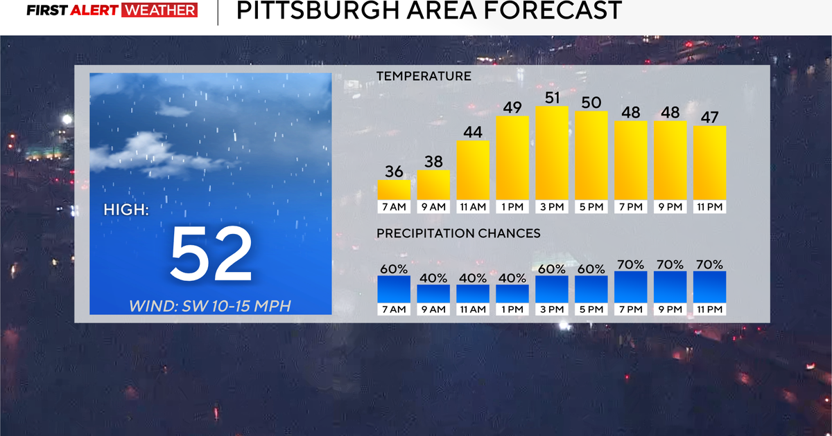
It’s going to be a warmer day in the Pittsburgh area today with chances of rain.
Any Alert Days Ahead? Today is a First Alert Weather Day due to freezing rain.
Aware: Winter weather advisories are in place through 10 a.m. on Tuesday morning.
Freezing rain is possible this morning. There is no official ‘threat’ level when it comes to freezing rain, but if there was one, we’d be at a level 1 out of 5, with five being the highest. Why do I say this? Freezing rain happens anytime it is raining with temperatures at or below 32 degrees. That’s the easy part. As a forecaster, we look at other things like ground temperature (above 32° right now). We ask questions like is it warming? It is. Those are all arguments for this being on the low side for the overall impact. Here’s the thing though, it only takes one slick spot to ruin a person’s day or maybe have something even worse happen. Sometimes that makes days like today even more dangerous, as you don’t know where any icy spots are, and more people are out on the roads. Winter weather advisories go through at least 10 a.m. this morning.

KDKA Weather Center
Warmer air will continue to move through this afternoon with rain chances sticking around. The heaviest rain is expected from around 6 p.m. through 10 p.m. The total rain today will be near a half inch, with as much as four-tenths of an inch falling during this four-hour block. I have scattered showers working their way through the area from 2 p.m. to 6 p.m. Isolated showers from 11 a.m. to 2 p.m. are expected.
Looking ahead, there are two big highlights. The first being a fairly rainy pattern with a chance for rain on every day through Sunday. The second thing is the warm-up we are expecting, including possible record-setting temperatures happening on both Friday and Saturday.

KDKA Weather Center
I have Saturday’s high hitting 77 degrees, with the record high for the day sitting at 76 degrees.
More from CBS News