
We’ll be dealing with one more cloudy & damp day, due to persistent onshore easterly flow. Isolated showers are possible, mainly toward evening. Highs will reach 46 degrees, and winds will be light.Tonight, lows will fall to 40 degrees under cloudy skies. Areas of fog will redevelop.Saturday will feature clouds to start, then breaks of sun by afternoon west of the Susquehanna River. Clouds will linger east. Highs will be warmer, in the low 50s, but those highs might not be hit until late in the day.A cold front will approach from the west Saturday evening, leading to scattered showers, which could be heavy at times. You may also hear rumbles of thunder. Showers will end before sunrise Sunday.As the cold front moves away Sunday morning, look for gradual clearing. Highs will reach the low 60s with a light breeze.Monday and Tuesday will feature partly to mostly sunny skies and highs in the upper 60s to low 70s.A stronger cold front will approach Wednesday, bringing showers across the Susquehanna Valley by evening. Highs will reach the low 70s.Showers wrap up early Thursday, and temperatures will be much cooler. Expect highs in the low 50s with a brisk breeze.A few showers are possible Friday into Saturday, otherwise, expect typical temperatures for mid-March, in the upper 40s to low 50s at the end of the week.
We’ll be dealing with one more cloudy & damp day, due to persistent onshore easterly flow. Isolated showers are possible, mainly toward evening. Highs will reach 46 degrees, and winds will be light.
Tonight, lows will fall to 40 degrees under cloudy skies. Areas of fog will redevelop.
Saturday will feature clouds to start, then breaks of sun by afternoon west of the Susquehanna River. Clouds will linger east. Highs will be warmer, in the low 50s, but those highs might not be hit until late in the day.
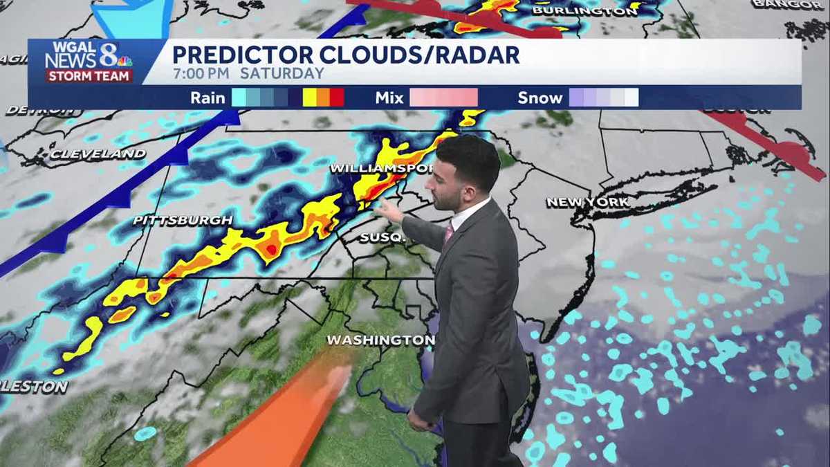
A cold front will approach from the west Saturday evening, leading to scattered showers, which could be heavy at times. You may also hear rumbles of thunder. Showers will end before sunrise Sunday.
As the cold front moves away Sunday morning, look for gradual clearing. Highs will reach the low 60s with a light breeze.
Monday and Tuesday will feature partly to mostly sunny skies and highs in the upper 60s to low 70s.
A stronger cold front will approach Wednesday, bringing showers across the Susquehanna Valley by evening. Highs will reach the low 70s.
Showers wrap up early Thursday, and temperatures will be much cooler. Expect highs in the low 50s with a brisk breeze.
A few showers are possible Friday into Saturday, otherwise, expect typical temperatures for mid-March, in the upper 40s to low 50s at the end of the week.