
PITTSBURGH — Strong storms are expected to impact the Pittsburgh region on Saturday, starting in the early afternoon and lasting through the evening.
TRACK THE STORMS WITH OUR INTERACTIVE RADAR
While the primary risk from storms today will be damaging straight-line winds, hail and even isolated tornadoes are possible. Make sure to have a plan in place and have a way to get severe weather alerts.
Find live updates regarding the severe weather below:
UPDATE 3:30 P.M.: Parts of Butler, Beaver and Lawrence counties are under a Severe Thunderstorm Warning until 4:15 p.m.
UPDATE 3:20 P.M.: Part of Washington County is under a Severe Thunderstorm Warning until 4 p.m.
UPDATE: 3:05 P.M.: Parts of Armstrong, Butler and Clarion counties are under a Severe Thunderstorm Warning until 3:45 p.m.
UPDATE 2:38 P.M.: Parts of Beaver, Butler and Lawrence counties are in a Severe Thunderstorm Warning until 3:15 p.m.
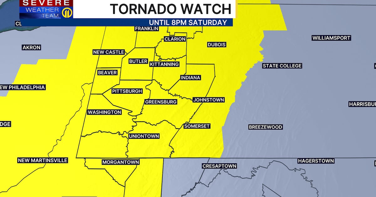
UPDATE 1:30 P.M.: The National Weather Service issued a Tornado Watch for the entire region until 8 p.m.
ORIGINAL STORY
It’s unseasonably warm this morning with temperatures in the 50s and low 60s! Temperatures will jump well into the 70s this afternoon thanks to sunshine and a southwesterly breeze, likely tying or potentially breaking the record high of 76 set back in 1983.
Thunderstorms are expected to move in after 3 p.m., first for areas north and west, closer to New Castle and Slippery Rock, and then gradually spreading southeastward toward Pittsburgh.
While the primary risk from storms today will be damaging straight-line winds, hail and even isolated tornadoes are possible, especially if storms stay “cellular” in nature for longer.

Storms should clear our eastern counties by 7 p.m. or 8 p.m., with just off-and-on showers expected overnight as temperatures fall into the 40s. Clouds and a few showers are expected early Sunday morning, but drier air is expected to move in by the afternoon, accompanied by more sunshine and mild weather.
Temperatures surge closer to 70 on Monday and Tuesday, with dry conditions. The next front approaches on Wednesday, bringing more rain and plummeting temperatures by Thursday.
Make sure to get the latest forecast on Channel 11 News on WPXI. Don’t forget to download the Severe Weather Team 11 App for the latest updates and alerts.
Download the FREE WPXI News app for breaking news alerts.
Follow Channel 11 News on Facebook and Twitter. | Watch WPXI NOW
TOP STORIES FROM CHANNEL 11 NEWS
©2026 Cox Media Group