
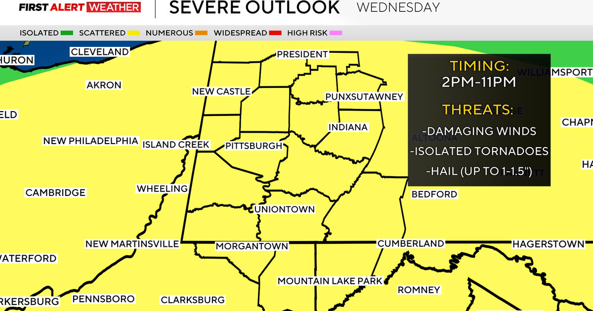
The Pittsburgh area is at a slight risk for severe weather today that could include thunderstorms, damaging winds, or an isolated tornado.
The National Weather Service’s Storm Prediction Center has all of western Pennsylvania, eastern Ohio, and the West Virginia panhandle included in an area of the country under a ‘slight’ risk for severe weather, that is graded as a level two on a scale of one to five.
Rain and thunderstorms are expected to move across the region late tonight into Wednesday. Several waves are possible, with one potentially in the morning into early afternoon, and another from late afternoon into the evening. Storms have the potential to be severe. pic.twitter.com/qhaEPYOTiy
— NWS Pittsburgh (@NWSPittsburgh) March 10, 2026
The National Weather Service said that a slight risk on the scale means there is increased confidence in severe storms occurring and that “a few severe storms could be significant.”
There could be two possible waves of severe weather and storms — one during the morning and another in the late afternoon and evening hours, the NWS said.
Storms could arrive as early as 3 a.m. Wednesday in areas north of Pittsburgh.
In addition to the severe weather chances being possible for the area, the National Weather Service said there is also a marginal risk of excessive rainfall.
In addition to the severe weather threat for the Wed through Wed night period, there is a Marginal Risk of Excessive Rainfall. Here are the rainfall amounts expected as well. While a Flood Watch won’t be needed, there still may be some minor flooding issues in flood prone areas. pic.twitter.com/9O28IARoNt
— NWS Pittsburgh (@NWSPittsburgh) March 11, 2026
“While a Flood Watch won’t be needed, there still may be some minor flooding issues in flood prone areas,” the NWS said.
With the slight of severe weather hitting the Pittsburgh area, the KDKA Weather team has issued a First Alert Weather Day, reminding people to be weather aware.