
Strong wind gusts will continue across the Susquehanna Valley for our Friday evening and overnight with a clearing sky. Gusts up to 45-50 mph are expected at time. The strong winds continue into Saturday morning.The National Weather Service has issued a Wind Advisory for Mifflin, Juniata, Perry, Cumberland, Dauphin, Lebanon, and Franklin counties until 11 am Saturday.Saturday will be mainly sunny with wind gusts up to 35-40 mph. The strongest gusts will occur in the morning before relaxing a little in the afternoon. The wind will calm down during the evening and overnight hours. High temperatures on Saturday will be near-average around 50°.Sunday will feature more clouds with breezy conditions returning in the afternoon. High temperatures on Sunday will reach the low 50s. Scattered showers will develop late Sunday night and into Monday morning.IMPACT DAY MONDAY: STRONG & SEVERE THUNDERSTORMS POSSIBLEAnother round of strong & severe thunderstorms are expected on Monday for the Susquehanna Valley. We will begin Monday with scattered rain showers. This morning round of showers will be an important factor in the afternoon. Morning rain can hinder severe thunderstorms from developing if the showers and clouds remain across the area.In the afternoon, temperatures will reach the mid-60s with strong southerly non-thunderstorm winds with gusts up to 30-35 mph. Scattered showers and thunderstorms are expected to develop ahead and along a cold front during the afternoon and evening. Some of these storms may be strong or severe with damaging winds and locally heavy rain are the main concerns. There is also a low chance for tornadoes. Changes are still possible in the forecast. Stay tuned for updates.Behind the cold front, temperatures will drop into the upper 30s for Tuesday. Gusty winds out of the west and northwest will lead to wind chill values in the 20s. The rest of the week is mainly dry with temperatures slowly increasing to near-average by Friday for the first day of Spring.
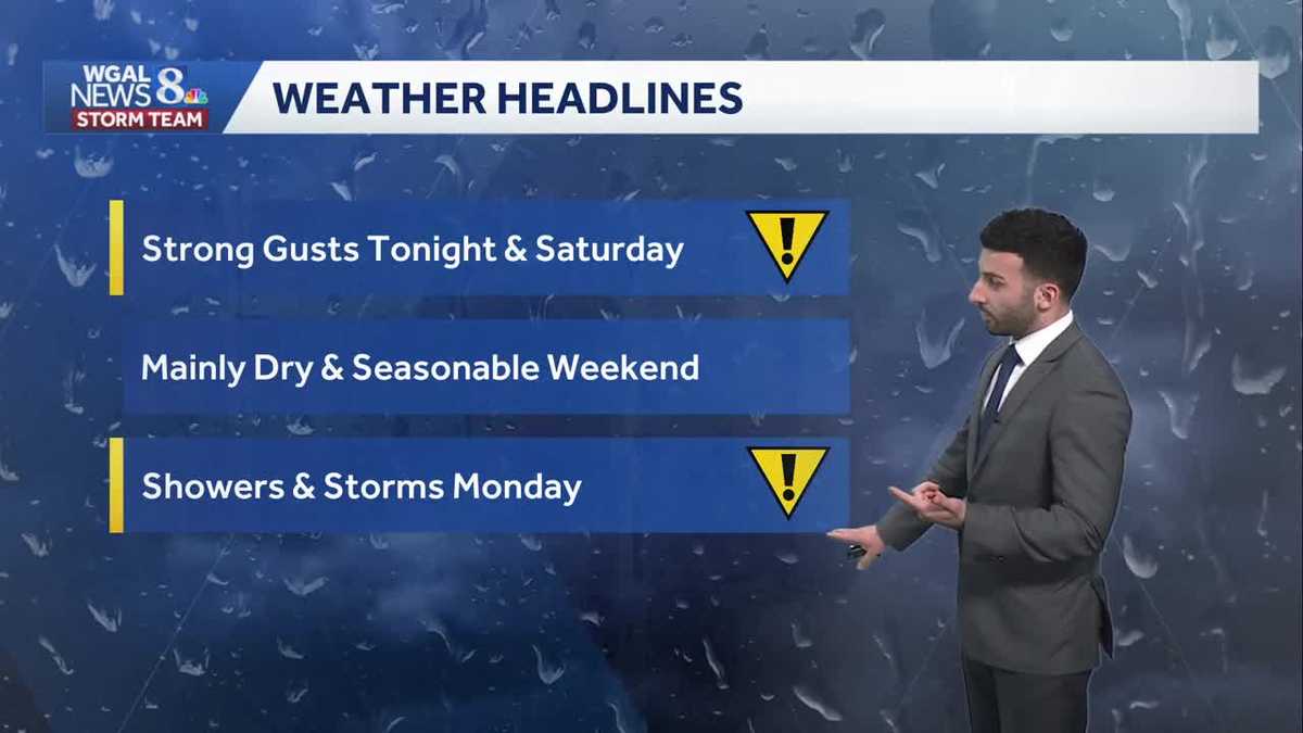
Strong wind gusts will continue across the Susquehanna Valley for our Friday evening and overnight with a clearing sky. Gusts up to 45-50 mph are expected at time. The strong winds continue into Saturday morning.
The National Weather Service has issued a Wind Advisory for Mifflin, Juniata, Perry, Cumberland, Dauphin, Lebanon, and Franklin counties until 11 am Saturday.
Saturday will be mainly sunny with wind gusts up to 35-40 mph. The strongest gusts will occur in the morning before relaxing a little in the afternoon. The wind will calm down during the evening and overnight hours. High temperatures on Saturday will be near-average around 50°.
Sunday will feature more clouds with breezy conditions returning in the afternoon. High temperatures on Sunday will reach the low 50s. Scattered showers will develop late Sunday night and into Monday morning.
IMPACT DAY MONDAY: STRONG & SEVERE THUNDERSTORMS POSSIBLE
Another round of strong & severe thunderstorms are expected on Monday for the Susquehanna Valley. We will begin Monday with scattered rain showers. This morning round of showers will be an important factor in the afternoon. Morning rain can hinder severe thunderstorms from developing if the showers and clouds remain across the area.
In the afternoon, temperatures will reach the mid-60s with strong southerly non-thunderstorm winds with gusts up to 30-35 mph. Scattered showers and thunderstorms are expected to develop ahead and along a cold front during the afternoon and evening. Some of these storms may be strong or severe with damaging winds and locally heavy rain are the main concerns. There is also a low chance for tornadoes. Changes are still possible in the forecast. Stay tuned for updates.
Behind the cold front, temperatures will drop into the upper 30s for Tuesday. Gusty winds out of the west and northwest will lead to wind chill values in the 20s. The rest of the week is mainly dry with temperatures slowly increasing to near-average by Friday for the first day of Spring.