
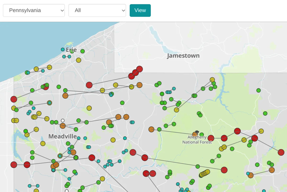
The National Oceanic and Atmospheric Administration has been tracking tornadoes for decades. This interactive map from the USA TODAY Network, which contains NOAA data starting in January 1950, pinpoints where a tornado touched down in Pennsylvania and traces its path of destruction.
May 31, 1985: ‘I heard a noise like a train.’ Remembering the Albion-Cranesville tornado
For more recent tornadoes, clicking deeper provides more details, damage estimates and whether someone was injured or killed in the storm.
Advertisement
Advertisement
Discover more interactive graphics about Pennsylvania and beyond at Data Central.
This article originally appeared on Erie Times-News: PA tornado history since 1950, see every touchdown, destructive path