
Winds pick up again today, and winds will gust around 30-40mph with partly sunny skies and highs getting back to or near 70.

Wind gusts throughout the day – March 15, 2026
KDKA Weather Center
That’s why parts of the region, north of I-80 and in the Laurel Highlands and ridges, are under a Wind Advisory until 8 a.m. Monday.

Wind advisory in our area through Monday morning
KDKA Weather Center
That may be extended, but if not, it’ll still be windy throughout the day on Monday.
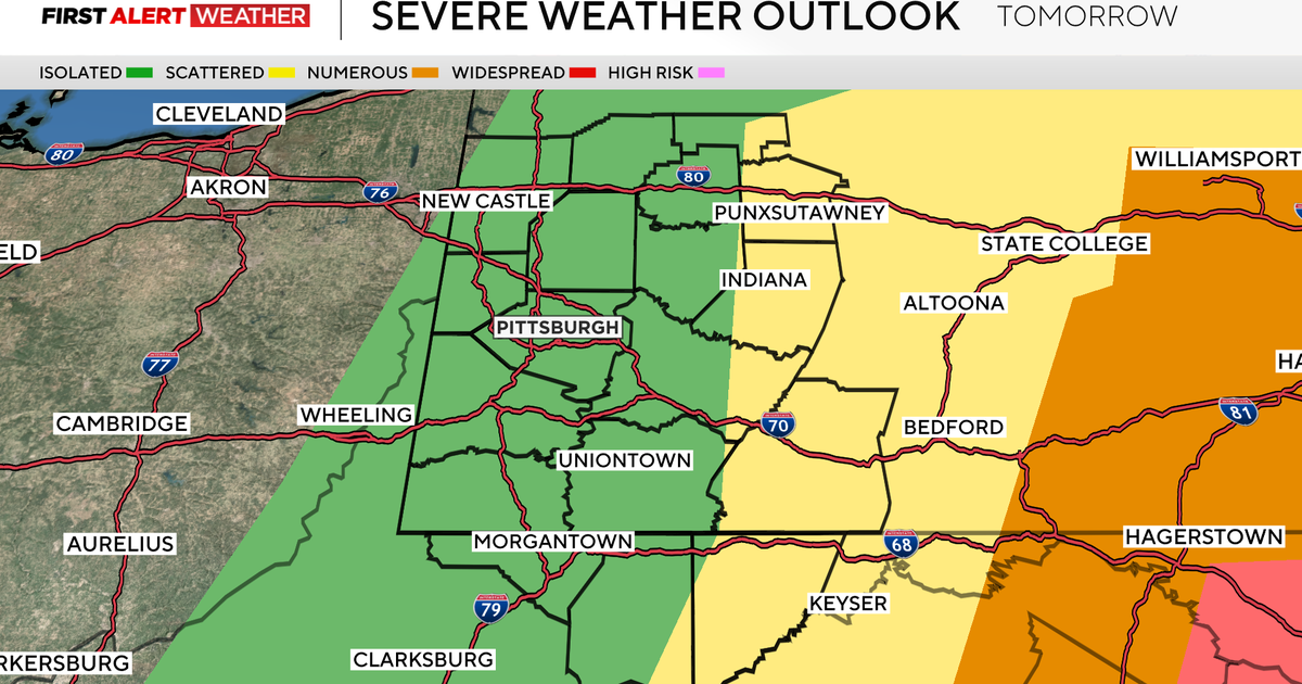
Rain arrives tonight and Monday morning, with some storms possible. We are under a “marginal” and “slight” risk for severe weather areas east, meaning a high confidence that scattered strong to severe storms are possible in parts of the region. The chance increases as storms strengthen when they move east.

Temperatures and precipitation chances through Tuesday morning
KDKA Weather Center
Highs start off in the 60s at midnight and then fall to the 30s throughout the day, which will also switch from rain to snow showers in the afternoon. Little to no accumulation is expected, but a few areas east in the higher elevations may get 1-2″.
Our highs on Tuesday will be below freezing, right around 30 degrees, and our lows will be back in the 20s through Wednesday morning and stay at or near freezing Thursday morning. We will have wind chills in the teens for many, with winds picking up again.
Our highs will be back to the 50s on Thursday through Saturday!

7-day forecast: March 15, 2026
KDKA Weather Center