
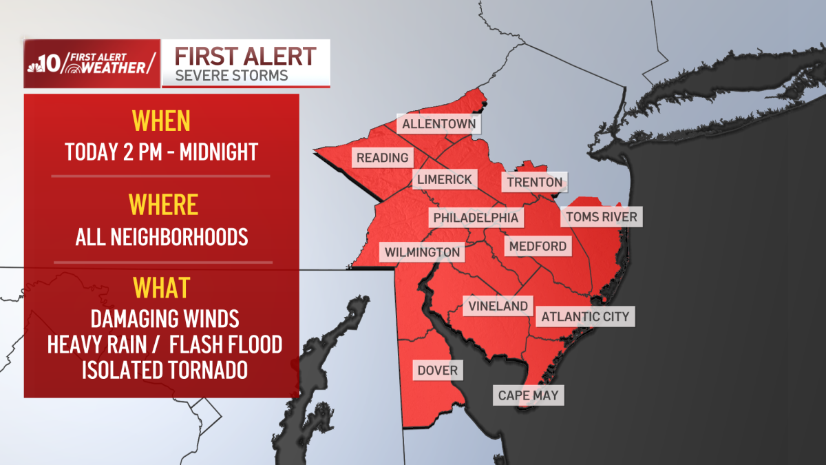
What to KnowA Tornado Watch is in effect for the Philadelphia region, South Jersey and Delaware on Monday, March 16, 2026, as severe storms bringing heavy rain and wind move through the area. A FIRST ALERT is also in effect for the entire region from 2 p.m. through midnight due to the storms which are expected to bring damaging winds, heavy rain leading to flash flooding and a threat for isolated tornadoes.The system’s primary threats will be damaging winds before strong storms take shape Monday afternoon through the evening. The winds are expected to gust up to 50 mph in parts of the region, leading to tree damage and power outages.A powerful cold front will also lead to severe thunderstorms Monday afternoon. The downpours could lead to flash flooding and isolated tornadoes cannot be ruled out with this storm system.We reach into the upper 60s Monday afternoon, then temperatures plunge as that cold front comes through. We may even see some snow on the backside of the front early Tuesday morning with no accumulation. Conditions will be windy and cold on Tuesday.Get the latest weather updates by downloading the NBC10 app and following the NBC10 First Alert Weather team.
A Tornado Watch is in effect for the Philadelphia region, surrounding Pennsylvania suburbs, South Jersey and Delaware on Monday, March 16, 2026, as severe storms bringing gusty winds, heavy rain and flooding move through. Get live updates below: