
Pittsburgh: Weekend warm up, Alert Day Sunday afternoon
Scattered strong/storms before sunset Sunday – damaging winds are the top threat.
ACTION SPORTS. I’M RYAN RECKER HAVE A GREAT SATURDAY. TURNING NOW TO PITTSBURGH’S ACTION WEATHER 4. WE’RE JOINED BY METEOROLOGIST JILL SZWED HERE WITH YOUR CERTIFIED MOST ACCURATE FORECAST. QUITE THE INTERESTING WEEK WE’VE HAD. BUT OF COURSE, IT’S NOT OVER JUST YET FOR FOLKS KNOW, RIGHT? WE’RE STILL BRINGING ON SPRING AS WE GO THROUGH THIS WEEKEND, APPROPRIATELY ENOUGH, FOR THE FIRST FULL WEEKEND OF SPRING, WE’VE GOT WARMING TEMPERATURES, BUT ALSO THE NOT SO FUN SIDE OF SPRING, THOSE SPRINGTIME STORMS THAT PROMPT TOMORROW’S SEVERE WEATHER ALERT DAY. MOST OF YOUR SUNDAY IS GOING TO BE OKAY, BUT IT’S GOING TO GET REALLY WARM. SO WE WILL BE COOKING UP INGREDIENTS FOR THOSE STORMS TO FIRE UP. AFTER ABOUT 4 OR 5 P.M. TOMORROW. DAMAGING WINDS AND HEAVY RAIN ARE LEADING THE WAY WITH OUR THREATS. I’LL GIVE YOU A FULL BREAKDOWN HERE IN JUST A MOMENT. STILL WORKING THROUGH SOME STUBBORN CLOUDS HERE AS WE’RE GETTING CLOSE TO THE TOP OF THE 10:00 HOUR. BUT YOU CAN SEE SOME OF THOSE RAYS OF SUNSHINE ARE COMING THROUGH, BEATING DOWN ON DOWNTOWN PITTSBURGH AS WE GET YOUR SATURDAY UNDERWAY. BY THIS AFTERNOON, MORE BLUE SKY TEMPERATURES, VERY COMFORTABLE. AROUND 60 IN A NUMBER OF NEIGHBORHOODS FROM PITTSBURGH ON SOUTH, INCLUDING NOT ONLY THE CITY, BUT WASHINGTON AND GREENSBURG. HOW ABOUT 62 IN UNIONTOWN, 58 FOR CRANBERRY AND KITTANNING, 57 OVER TOWARDS INDIANA? HERE’S YOUR 4-DAY PLUS 4 MORE FORECAST SO COMFORTABLY COOL FOR MOST OF THE DAY TODAY, YOU’LL STILL BE HAVING THOSE LONG SLEEVES, MAYBE A HOODIE. IF YOU’RE GOING TO BE OUT IN THE YARD DOING A LITTLE BIT OF CLEANUP OR JUST ENJOYING THE FRESH SPRING AIR TOMORROW. MUCH WARMER. HOW ABOUT THE MID TO EVEN UPPER 70S IN SPOTS? BUT THAT DOES BRING OUR SEVERE WEATHER ALERT DAY, ESPECIALLY AFTER ABOUT 4:05 P.M. THIS FRONT IS GOING TO MEAN BUSINESS NOT ONLY BRINGING THE STORMS BUT ALSO TUMBLING TEMPERATURES. ONLY 44 ON MONDAY. SO NOT QUITE JUST YET. ARE WE PUTTING AWAY THOSE HEAVIER WINTER COATS? TEMPERATURES WILL EVEN OUT IN THE 50S AND 60S FOR THE BETTER PART OF NEXT WEEK. LET’S TALK ABOUT TOMORROW’S STORM THREATS. I THINK WE REALLY NEED TO CLUE IN FROM THE CITY OF PITTSBURGH ON SOUTH FOR MORE OF THOSE SCATTERED SEVERE STORMS. THAT’S A BIT OF A CHANGE FROM YESTERDAY, AS THAT THREAT WAS BASICALLY AREA WIDE. THAT’S NOT TO SAY THAT THOSE OF YOU FROM BEAVER INTO NEW CASTLE, BUTLER, KITTANNING IN INDIANA ARE COMPLETELY OUT OF THE WOODS. MORE OF AN ISOLATED CHANCE FOR STRONG STORMS. ALL OF THE MODES OF SEVERE WEATHER, ALL THOSE THREATS ARE ON THE TABLE, BUT DAMAGING WINDS BY FAR WILL BE THE BIGGEST CONCERN. ALSO, DOWNPOURS THAT COULD LEAD TO LOCALIZED FLOODING, LARGE HAIL AND THAT SMALL RISK FOR BRIEF SPIN UP TORNADO. IF WE HAPPEN TO SEE ANY SPIN UPS, IT WILL BE JUST AS THE STORMS START TO POP LATE TOMORROW AFTERNOON INTO THE EVENING, WE SEE THOSE INDIVIDUAL STORMS THAT WE HAVE TO BE CAUTIOUS OF. SOME SPINNING IN THE ATMOSPHERE. EVENTUALLY, A LINE OF STORMS WILL SET UP, ESPECIALLY FROM THE CITY ON SOUTH. THAT’S WHEN THE DAMAGING WIND THREAT REALLY OPENS UP. REALLY, THE STORM THREAT WILL BE WANING AS WE GET CLOSER TO MIDNIGHT, BUT STILL ONE FINAL PUSH OF HEAVY RAIN, RUMBLES OF THUNDER WILL CROSS THROUGH THE WEE HOURS OF THE MORNING. EVERYBODY, THOUGH, SHOULD BE DRYING OUT BY THE TIME WE WAKE UP. HEAD OUT THE DOOR ON MONDAY, MAYBE JUST AVOIDING SOME OF THOSE DOWNED TREES, POTENTIALLY FROM SOME OF THOSE STRAIGHT LINE DAMAGING WINDS. 60 TODAY, 76 TOMORROW FOR OUR SEVERE WEATHER ALERT DAY. THEN WE DROP BIG TIME MONDAY. STARTING IN THE 30S, ONLY THE MID 40S. BY THE AFTERNOON YOUR 4-DAY PLUS 4 MORE FORECAST CONTINUES WITH MORE COMFORTABLY COOL DAYS. TUESDAY AND WEDNESDAY. LOW TO MID 50S. A FEW MORE SPRINGTIME SHOWERS ON THURSDAY WITH HIGHS IN THE LOW 60S WILL COOL DOWN AGAIN BY THE TIME WE HIT NEXT WEEKEND. SO STILL SPRING HAS SHOWN US ALL IT’S GOT HERE AS WE CONTINUE ON THROUGH THESE FINAL DAYS OF MARCH.
Pittsburgh: Weekend warm up, Alert Day Sunday afternoon
Scattered strong/storms before sunset Sunday – damaging winds are the top threat.

Updated: 10:14 AM EDT Mar 21, 2026
The first weekend of spring will feature plenty of spring weather. You’ll have time to enjoy the warming temperatures, especially today and early tomorrow afternoon. Sunday is a Severe Weather Alert Day for afternoon and evening scattered severe thunderstorms. All modes of severe weather are possible with damaging winds as the leading threat.Weekend warm up A pleasant first full day of spring is on tap for western Pennsylvania. Sunshine returns this afternoon with highs around 60 degrees. Sunday is even warmer. High temperatures should reach the lower to mid 70s. The only exception could be along Interstate 80 where highs may remain in the 60s with clouds and rain arriving sooner.Severe Weather Alert Day SundayA cold front will approach Western PA during the afternoon and early evening Sunday. The most active hours for rain and thunderstorms will be between 5 p.m. and 10 p.m. Areas south of US-422 will have the better storm threat. All modes of severe weather will be possible, especially if storms can remain “discrete,” or isolated, before forming into a line, with damaging wind and heavy downpours becoming our primary concerns.Rain and thunder will continue into the night with heavy rain at times. We should be drying out by the Monday morning commute. Rainfall amounts could potentially reach one inch by the time rain comes to an end.More seasonal next weekMore seasonal air blows in behind Sunday’s storm potential and cold front. Monday will be the coolest day of the upcoming work week with highs only in the mid 40s. High temperatures will hover near 50° through mid-week. Warmer temperatures and rain return Thursday with another passing front.TODAY: Morning clouds, partly cloudy afternoon. Comfortable, high: 60°.TONIGHT: Fair skies and mild. Low: 50°.SUNDAY – Severe Weather Alert Day: Warmer with afternoon and evening rain with strong to severe thunderstorms. High: 76°, low: 37°.MONDAY: Early morning rain, then clearing. Brisk breeze. High: 44°, low: 27°.TUESDAY: Chilly start, cool finish. Sunny skies. High: 50°, low: 35°.
PITTSBURGH —
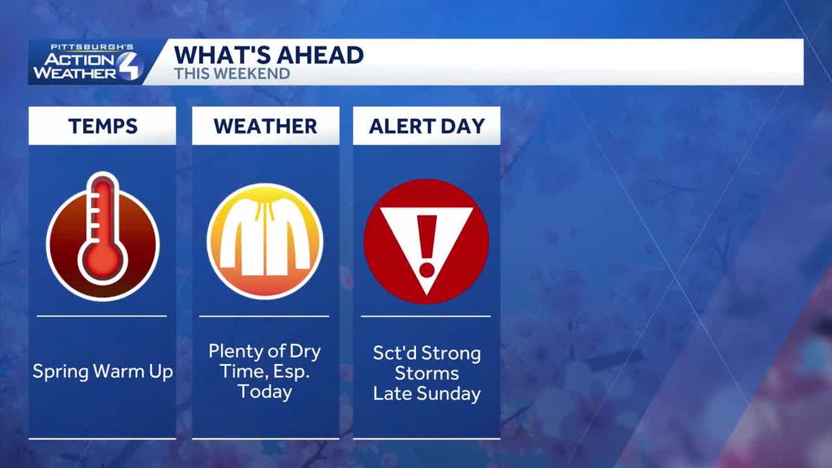
The first weekend of spring will feature plenty of spring weather. You’ll have time to enjoy the warming temperatures, especially today and early tomorrow afternoon. Sunday is a Severe Weather Alert Day for afternoon and evening scattered severe thunderstorms. All modes of severe weather are possible with damaging winds as the leading threat.
Weekend warm up
A pleasant first full day of spring is on tap for western Pennsylvania. Sunshine returns this afternoon with highs around 60 degrees.

Hearst OwnedHearst
Comfortable temperatures for the first full day of spring around the Pittsburgh area.
Sunday is even warmer. High temperatures should reach the lower to mid 70s. The only exception could be along Interstate 80 where highs may remain in the 60s with clouds and rain arriving sooner.
Severe Weather Alert Day Sunday
A cold front will approach Western PA during the afternoon and early evening Sunday. The most active hours for rain and thunderstorms will be between 5 p.m. and 10 p.m.

Hearst OwnedHearst
Scattered severe thunderstorms are possible late Sunday, especially from Pittsburgh to the West Virginia border.
Areas south of US-422 will have the better storm threat. All modes of severe weather will be possible, especially if storms can remain “discrete,” or isolated, before forming into a line, with damaging wind and heavy downpours becoming our primary concerns.

Hearst OwnedHearst
A stationary boundary sparks Sunday’s strong thunderstorm threat.
Rain and thunder will continue into the night with heavy rain at times. We should be drying out by the Monday morning commute. Rainfall amounts could potentially reach one inch by the time rain comes to an end.

Hearst OwnedHearst
Rain ends before the Monday morning commute. Localized flooding is possible.
More seasonal next week
More seasonal air blows in behind Sunday’s storm potential and cold front. Monday will be the coolest day of the upcoming work week with highs only in the mid 40s. High temperatures will hover near 50° through mid-week. Warmer temperatures and rain return Thursday with another passing front.

Hearst OwnedHearst
A sharp cool down settles in behind Sunday’s stronger storm threat.
TODAY: Morning clouds, partly cloudy afternoon. Comfortable, high: 60°.
TONIGHT: Fair skies and mild. Low: 50°.
SUNDAY – Severe Weather Alert Day: Warmer with afternoon and evening rain with strong to severe thunderstorms. High: 76°, low: 37°.
MONDAY: Early morning rain, then clearing. Brisk breeze. High: 44°, low: 27°.
TUESDAY: Chilly start, cool finish. Sunny skies. High: 50°, low: 35°.