
Large hail, flooding and even a tornado could accompany severe thunderstorms forecast for Sunday afternoon and evening in eastern Pennsylvania, according to the National Weather Service.
The service predicted possible isolated to scattered storms across the region, with the greatest threat between 4-10 p.m.
“Damaging winds and hail up to 2″ in diameter will be the main threats,” the NWS Mount Holly X account posted Sunday morning. “An isolated tornado can’t be ruled out for far western portions of the area.”
Heavy rainfall could also cause localized flash flooding along and north of Interstate 95, according to the weather service, with some corridors possibly seeing over 1 inch of rainfall.
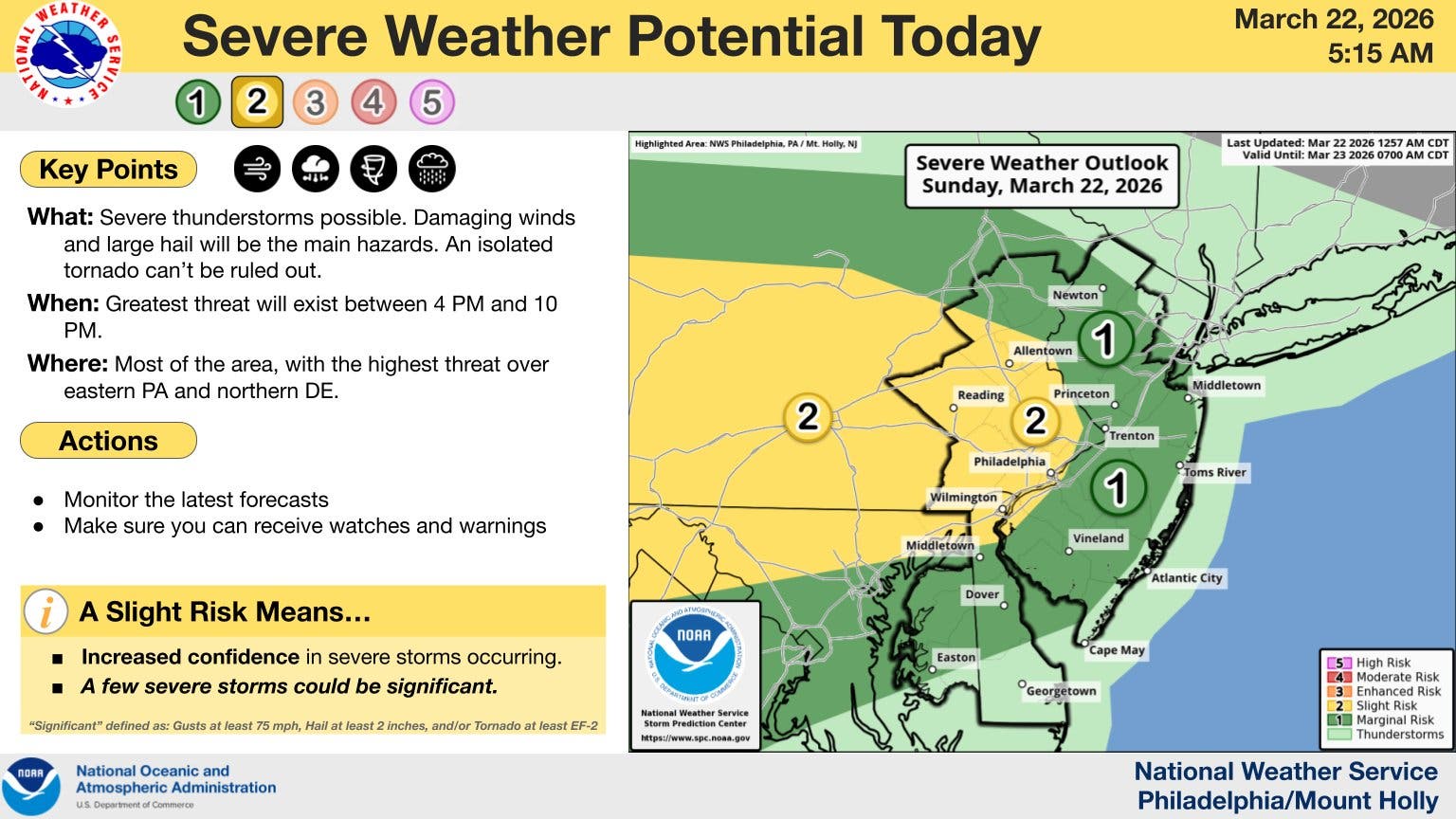 The National Weather Service predicted possible isolated to scattered storms across the region, with the greatest threat between 4-10 p.m. (National Weather Service)
“The model forecast soundings indicate instability developing within the warm sector, especially west of our area heading into central PA,” according to the weather service’s area forecast discussion for Sunday morning.
“It’s there where storms are likely to initially fire this afternoon with a good chance of at least some being severe as lapse rates are steep through the low and mid levels and the shear and wind fields are very strong. These showers/storms should then move east and southeastward into the area through the late afternoon and evening, likely as a line or one or more line segments.”
While the most severe weather is expected Sunday night, showers are predicted to linger through the early morning hours into Monday, possibly until early afternoon, according to the weather service.