
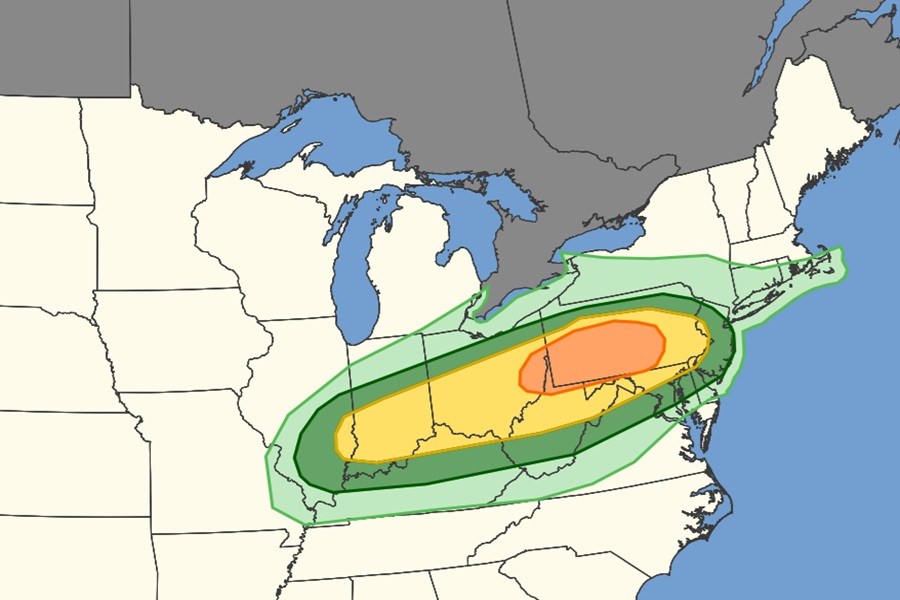
 The shaded areas represent different risk levels of thunderstorm activity through the PM hours today. While thundershowers are possible in the light green areas, they could be severe in the dark green areas. The yellow feature has a higher risk of severe thunderstorm activity while the orange area has the highest risk today. Image: SPC
Late day / early PM thunderstorms continue to break out across Pennsylvania and nearby areas, prompting NOAA’s Storm Prediction Center to issue a Severe Thunderstorm Watch for much of the area until 10 pm local time. Beyond damaging wind gusts, the risk of large hail, and the possibility of isolated tornadoes, this weather system will also produce heavy downpours which could create localized flash flood issues.
Scattered severe thunderstorms appear likely this afternoon and evening across parts of the Ohio Valley into the Mid-Atlantic,
particularly from far eastern Ohio into central Pennsylvania. Large to very large hail and damaging winds should be the main threats, but a tornado or two may also occur.
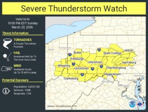 A Severe Thunderstorm Watch is in effect for the yellow area. Image: NWS SPC
According to the Storm Prediction Center (SPC), while limited low-level moisture is expected to temper instability across the region, local atmospheric soundings showed the presence of very steep mid and low-level lapse rates amid strong unidirectional vertical wind profiles. This environment should support scattered damaging gusts, and large to very large hail from any initially discrete supercell structures.
Today’s weather is being driven by a surface low pressure moving eastward from the Great Lakes and into southern New England along a frontal zone. Another weak low is also developing along the front and within the elongated pressure trough setting the stage for today’s severe weather. The actual strong cold front tied to this system will move across the Mid Atlantic later tonight bringing colder air into the area.