
Pleasant & seasonable for Sunday; active pattern setting up next week for south-central Pennsylvania
A wind shift for tomorrow will allow for the mid 50s to return. An active pattern is setting up for next week with most days having a chance for showers.
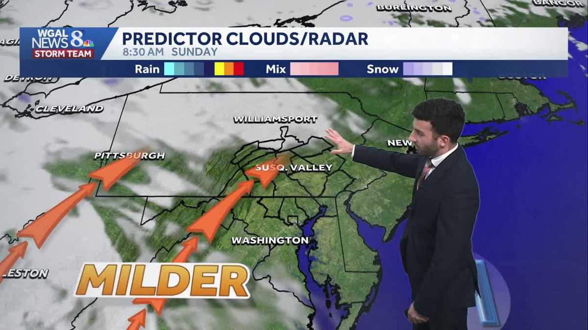
SOCIETY, YOU KIND OF HAVE TO BE THE ONE TO BRING THE CHANGE. NOW, THE WGAL NEWS EIGHT STORM TEAM FORECAST WITH METEOROLOGIST RYAN ARGENTI SOME PARTLY CLOUDY SKIES RIGHT NOW ACROSS THE SUSQUEHANNA VALLEY. YOU CAN SEE LIVE OVER CHOCOLATETOWN IN HERSHEY, PENNSYLVANIA. YOU CAN SEE THE WINDS HAVE STARTED TO DIE DOWN A LITTLE BIT. YOU STILL SEE THE FLAG IN THE BACKGROUND, STILL WAVING SLIGHTLY IN THE DISTANCE, BUT DEFINITELY A BIT OF A CHILLY NIGHT, I WOULD SAY ACROSS THE SUSQUEHANNA VALLEY. LOOK AT THIS. TEMPERATURES INTO THE 30S. YOU SEE 39 IN LEBANON, 37 IN CARLISLE, 39 IN GETTYSBURG, 37. LEWISTOWN INTO THE UPPER 20S WILL GO FOR YORK, 35 IN LANCASTER, 37 IN HARRISBURG. RIGHT NOW, A LITTLE BIT OF A LITTLE BIT OF A REVIEW OVER ACROSS SUSQUEHANNA VALLEY, BUT A LITTLE BIT MORE SEASONABLE AS WE HEAD INTO THE SECOND HALF OF THE WEEKEND. STILL LOOKING DRY, A FEW MORE PUFFY CLOUDS, I WOULD SAY, BUT REMAINING PLEASANT FOR OUR SUNDAY. SO IF YOU HAVE ANY PLANS FOR TOMORROW, IT’S DEFINITELY GOING TO BE A GOOD DAY TO GET OUTSIDE AND GET SOME, GET SOME EXERCISE AND GET SOME SUNSHINE IN THE IN THE SYSTEM. BUT MORE CHANCES FOR RAIN WILL BE ON TAP FOR US AS WE GET INTO THE WEEK. IT WILL BE MILDER AND DEFINITELY UNSETTLED. AND THEN AS WE HEAD INTO NEXT WEEKEND, STILL LOOKING UNSETTLED. AS OF RIGHT NOW, EASTER SUNDAY IS LOOKING A LITTLE BIT MORE WET THAN DRY, SO I FIGURED I’D GIVE YOU A LITTLE BIT OF A PREVIEW HEADING INTO NEXT WEEKEND. TEMPERATURES WE HIT RIGHT AROUND 47 DEGREES AT HARRISBURG INTERNATIONAL AIRPORT 56. THAT’S WHAT WE EXPECT FOR THIS TIME OF THE YEAR. AND IN TERMS OF OVERNIGHT LOWS, YOU CAN SEE WE’RE SEASONABLE, SLIGHTLY LESS SEASONABLE I WOULD SAY. BUT 36 IS WHAT WE EXPECT FOR THIS TIME OF THE YEAR. BUT OVERNIGHT TONIGHT, EXPECT PARTLY CLOUDY CONDITIONS, CHILLY LIGHT TO CALM WINDS OUT OF THE WEST NORTHWEST 26 TO 30 DEGREES AND THEN HEADING INTO TOMORROW WE’LL SEE SOME PARTLY SUNNY CONDITIONS. INCREASING WINDS STILL CHILLY THOUGH, 36 TO 40 DEGREES FOR THE MORNING. AND THEN ONCE WE GET INTO THE AFTERNOON, THE BREEZE REALLY STARTS TO PICK UP. WE’LL STILL SEE THOSE PLEASANT CONDITIONS AND A MIX OF SUN AND CLOUDS 54 TO 58 DEGREES FOR THE AFTERNOON. BUT HERE’S OUR PRECIPITATION CHANCES FOR THE NEXT SEVERAL DAYS, SO WE’RE DRY FOR SUNDAY. MOST OF THE DRY. MOST OF THIS. EXCUSE ME MOST OF THE DAY. MONDAY STAYS DRY. BUT THEN ONCE WE GET INTO OUR TUESDAY, WEDNESDAY, THURSDAY, EVEN INTO THE NEXT WEEKEND, BIT UNSETTLED, WE COULD SEE A CHANCE OF SOME THUNDERSHOWERS AS WE GET INTO OUR WEDNESDAY AFTERNOON. BY THE WAY, TEMPERATURES YOU CAN SEE INTO THE 30S. WE REVIEWED EARLIER INTO THE UPPER 30S FOR LEBANON 34 LEWISTOWN. BUT WINDS HAVE CALMED. I WOULD SAY THEY’RE LIGHT AND VARIABLE AT THIS TIME, BUT WE WILL START TO SEE THOSE WINDS PICK BACK UP ONCE WE GET INTO THE AFTERNOON. SO THANKS TO THANKS TO A HIGH PRESSURE ACROSS THE AREA, THAT’S WHAT’S REALLY KEEPING OUR SKIES MAINLY CLEAR. BUT WE’LL START TO SEE SOME PARTLY CLOUDY CONDITIONS DEVELOP OVERNIGHT TONIGHT. AND THEN AS HIGH PRESSURE SHIFTS, SHIFTS OFFSHORE, THAT’S GOING TO BE ALLOWING SOME MILDER AIR FROM THE SOUTH TO USHER IN. AND THEN JUST ALOFT IN THE CLOUDS, YOU CAN SEE THE THE SATELLITE IMAGERY LOOKS LIKE WE COULD SEE THAT MIX OF SOME SUN AND CLOUDS. SO BUT STILL, WE’LL SEE SOME BREAKS OF SOME SUNSHINE FOR OUR SUNDAY. LOOKING AHEAD INTO MONDAY MORNING TO START YOUR MONDAY MORNING COMMUTE. STILL LOOKING MAINLY CLEAR, I WOULD SAY. I THINK IT LOOKS LIKE IT COULD BE MAINLY CLEAR. I DO THINK THERE’S GOING TO SEE SOME MORE CLOUDS IN THE MIX HERE. BUT THEN ONCE WE GET INTO CLOSER TO THE EVENING, HERE COMES THIS WARM FRONT THAT’S OFF TOWARDS OUR NORTHWEST. THAT’S GOING TO COME BY TO THE SUSQUEHANNA VALLEY. AND THAT’S GOING TO HELP TO TRIGGER SOME LATE EVENING SHOWERS, AS YOU’LL SEE IN THE TEN DAY FORECAST HERE IN A SECOND. BUT 8 TO 14 DAY TEMPERATURE OUTLOOK FOR APRIL 5TH THROUGH THE 11TH, LOOKING SLIGHTLY ABOVE AVERAGE IN TERMS OF TEMPERATURES. AND YOU CAN SEE THAT’S REFLECTED IN OUR TEN DAY FORECAST FOR THE NEXT SEVERAL DAYS HERE. GETTING INTO OUR TUESDAY AND WEDNESDAY ESPECIALLY. SO THERE IS THAT CHANCE OF SOME THUNDERSHOWERS FOR WEDNESDAY. THAT COLD FRONT IS GOING TO ALLOW FOR SOME INSTABILITY TO POTENTIALLY DEVELOP THURSDAY DOWN INTO THE 50S. AND A CHANCE OF SOME SHOWERS FROM THURSDAY INTO NEX
Pleasant & seasonable for Sunday; active pattern setting up next week for south-central Pennsylvania
A wind shift for tomorrow will allow for the mid 50s to return. An active pattern is setting up for next week with most days having a chance for showers.

Updated: 11:42 PM EDT Mar 28, 2026
Thanks to an area of high pressure, dry weather remains for the rest of tonight. Some clouds bubble up overnight & we’ll see partly cloudy conditions through the overnight period. Temperatures will bottom out in the upper 20s with light & variable winds.Sunday, expect a mix of sunshine and clouds from time to time. Temperatures will moderate back to the mid-50s. Winds will shift and become southerly with breezy conditions expected between 10-15 mph.SEVERAL RAIN CHANCES AND BIG TEMPERATURE SWINGSHeading into the work week, Monday is mainly dry with showers possible towards evening. Highs return to the mid 60s. With a warm front lifting through late, there may be a few showers late Monday night.A better chance for showers is overnight until early Tuesday. The wet weather moves out leaving partly sunny skies, and much warmer temperatures in the mid to upper 70s.Rain chances go up Wednesday, as a cold front pushes through the Valley. Highs are still warm in the lower 70s, but chillier air pushes in behind the departing system. There may be a chance for storms Wednesday afternoon.COOLER WITH MORE RAIN CHANCESCooler temperatures prevail Thursday with highs back to the 50s. The next system brings back a chance for showers in the evening, with a better chance of rain on Good Friday. Highs will struggle to reach 50 degrees.EASTER WEEKENDUnfortunately, shower chances are possible both Saturday and Sunday. It’s difficult to determine this far out which day will be the wettest. Highs will remain near or slightly above average in the low 60s.Have a great rest of your Saturday night!~ Ryan
Thanks to an area of high pressure, dry weather remains for the rest of tonight. Some clouds bubble up overnight & we’ll see partly cloudy conditions through the overnight period. Temperatures will bottom out in the upper 20s with light & variable winds.
Sunday, expect a mix of sunshine and clouds from time to time. Temperatures will moderate back to the mid-50s. Winds will shift and become southerly with breezy conditions expected between 10-15 mph.
SEVERAL RAIN CHANCES AND BIG TEMPERATURE SWINGS
Heading into the work week, Monday is mainly dry with showers possible towards evening. Highs return to the mid 60s. With a warm front lifting through late, there may be a few showers late Monday night.
A better chance for showers is overnight until early Tuesday. The wet weather moves out leaving partly sunny skies, and much warmer temperatures in the mid to upper 70s.
Rain chances go up Wednesday, as a cold front pushes through the Valley. Highs are still warm in the lower 70s, but chillier air pushes in behind the departing system. There may be a chance for storms Wednesday afternoon.
COOLER WITH MORE RAIN CHANCES
Cooler temperatures prevail Thursday with highs back to the 50s. The next system brings back a chance for showers in the evening, with a better chance of rain on Good Friday. Highs will struggle to reach 50 degrees.
EASTER WEEKEND
Unfortunately, shower chances are possible both Saturday and Sunday. It’s difficult to determine this far out which day will be the wettest. Highs will remain near or slightly above average in the low 60s.
Have a great rest of your Saturday night!
~ Ryan