
Near 80° Tuesday; Rain Chances Increase Midweek In South Central Pennsylvania
Southerly winds will push temperatures into the 70s for a couple of days, but a cold front dropping in from the north brings a return to more seasonable air by Thursday.
GOING TO TRY AND GET BACK SAFELY AND LAND IN THE PACIFIC OCEAN. THAT’S WHAT REALLY MATTERS TO US. THAT’S WHAT WE SHOULD BE FOCUSED ON NOW. THE WGAL NEWS EIGHT STORM TEAM FORECAST WITH METEOROLOGIST MIKE SUSKO, AND THAT LAUNCH WINDOW WILL OPEN UP AT 624 IN THE EVENING ON WEDNESDAY. CAPE CANAVERAL HERE’S A LOOK AT THE FORECAST FOR FLORIDA. WE ARE EXPECTING IT TO BE BREEZY, BUT THE GOOD NEWS IS IT DOES LOOK LIKE THE WINDS ARE GOING TO BE BELOW THE THRESHOLD THEY NEED TO LAUNCH HERE. SO WE WILL BE WATCHING THE WEATHER CLOSELY. BUT THAT TWO HOUR WINDOW FOR LAUNCHING, AT LEAST RIGHT NOW IN CAPE CANAVERAL, LOOKING GOOD HERE FOR WEDNESDAY. NOW BACK HERE AT HOME, IT’S GOING TO BE A WARMER TUESDAY. WE GOT INTO THE 60S AND LOW 70S. TODAY WE’RE GOING TO BE MAKING A RUN TO THE UPPER 70S AND LOW 80S TOMORROW. AND WITH THAT, WE DO SEE THE RAIN CHANCES INCREASE, ESPECIALLY ON WEDNESDAY. THAT’S OUR BEST CHANCE TO GET SOME RAIN HERE WITHIN THE NEXT COUPLE OF DAYS. ACROSS THE SUSQUEHANNA VALLEY. WE WILL ALSO KEEP THAT RAIN CHANCE AROUND FOR THE WEEKEND. IT DOES LOOK LIKE RAIN. CHANCES ARE STILL POSSIBLE ON SATURDAY AND SUNDAY, WITH SUNDAY BEING THE RAINIER OF THE TWO DAYS. BUT RIGHT NOW LOOKING QUIET, TEMPERATURES ARE STILL IN THE 60S, 64 IN YORK AT THE MOMENT, 63 FOR LANCASTER. AND CARLISLE, AS WELL AS CHAMBERSBURG AND 65 IN THE CAPITAL. THE WINDS ARE STILL ELEVATED ANYWHERE FROM AROUND TEN TO NEARLY 15MPH IN SOME CASES. SO WE ARE SEEING THE WINDS BEGIN TO RELAX A LITTLE BIT, BUT STILL PRETTY BREEZY OUT THERE AND SOME SPOTS. STORM TEAM RADIO NETWORK FAIRLY QUIET. GOT A FEW SPRINKLES THERE. UP BY LEWISTOWN AND MIFFLIN COUNTY, BUT ANY SHOWERS AND THUNDERSTORMS TONIGHT SHOULD STAY TO THE NORTH NEAR PENNSYLVANIA NEW YORK BORDER THERE UP TO THE NORTH. SO THEY WILL BE GETTING THE RAIN. WE WILL BE GETTING A LITTLE BIT MORE OF THE DRIER WEATHER ACROSS OUR AREA. TOMORROW MORNING WE’LL BE SEEING SUN AND CLOUDS AS YOU HEAD OFF TO WORK, AND SCHOOL WILL BE GETTING INTO THE LOW 60S PRETTY QUICKLY. THE WINDS WILL INCREASE ONCE AGAIN FOR TOMORROW AND IN THE AFTERNOON. PARTLY SUNNY WITH A FEW EVENING SHOWERS AND THUNDERSTORMS POSSIBLE. AS WE WILL BE GETTING INTO THE AFTERNOON. SOME STORMS COULD BUBBLE UP THERE DURING THE DAYTIME HEATING AS WE HEAD TOWARDS SUNSET. SO LET’S TIME THIS ALL OUT FOR YOU. THERE’S THE SHOWERS ACROSS NORTHERN PENNSYLVANIA RIGHT NOW. LIKE I SAID, THAT STAYS TO THE NORTH FOR THE MOST PART TOMORROW MORNING, STARTING OFF A LOT OF SUNSHINE ACROSS THE REGION. MAYBE AN ISOLATED SHOWER FOR OUR NORTHERN COUNTIES RIGHT AROUND LUNCHTIME. BUT IT’S REALLY GOING TO BE LATE AFTERNOON AND EVENING WHERE WE’RE WATCHING FOR A COUPLE SHOWERS AND THUNDERSTORMS TO TRY TO BUBBLE UP THERE. AND THE HEATING OF THE DAY. AND THEN WE’LL BE WATCHING A LINE THAT FORMS OFF IN NORTHWESTERN PENNSYLVANIA DURING THE EVENING HOURS AS THAT PUSHES INTO THE SUSQUEHANNA VALLEY AFTER SUNSET, IT WILL BE ON A WEAKENING TREND, BUT COULD STILL PRODUCE SOME GUSTY WINDS. SO WE WILL BE WATCHING FOR THAT, ESPECIALLY NORTH OF THE TURNPIKE FOR TOMORROW AS WE HEAD INTO WEDNESDAY. WEDNESDAY, MORE SHOWERS ARE POSSIBLE A LITTLE BIT IN THE MORNING. THEN WE GET A BREAK AS WE HEAD INTO THE AFTERNOON. BUT NOTICE ALL THIS THAT YOU SEE DOWN TO THE SOUTH AND WEST THAT’S GOING TO MOVE TO THE NORTH AND INTERACT WITH THIS COLD FRONT. AND AS IT DOES SO, IT KIND OF BLOWS UP A LITTLE BIT OVER OUR AREA. SO WE’LL BE WATCHING FOR SHOWERS AND THUNDERSTORMS TO DEVELOP AS WE HEAD INTO WEDNESDAY AFTERNOON AND EVENING AS WELL. THEY COULD PRODUCE SOME LOCALLY HEAVY RAIN AS WELL, SOME GUSTY WINDS WITH THAT ONE. THIS IS THE SEVERE WEATHER OUTLOOK THOUGH FOR TOMORROW. SO TUESDAY YOU CAN SEE WE DO HAVE A HIGHER RISK FOR OUR NORTHERN AREAS. SO ALONG I-80 INTO THE NORTH THAT’S WHERE YOU GET THAT LEVEL TWO OUT OF FIVE. BUT ALONG AND NORTH OF THE TURNPIKE WE STILL HAVE ONE OUT OF FIVE. SO A COUPLE STRONG STORMS ARE POSSIBLE. NOT EXPECTING ANYTHING WIDESPREAD OR TOO SEVERE, BUT YOU MAY GET GUSTY WINDS OR TWO WITH SOME OF THOSE STORMS TOMORROW EVENING AND OVERNIGHT. SO JUST SOMETHING THAT WE NEED TO WATCH AS WE GO INTO YOUR TUESDAY EVENING FOR THE WEEKEND. IF YOU’RE TRYING WEEKEND PLANS, FRIDAY AND SATURDAY ARE GOING TO BE THE WARMEST WILL BE IN THE MID TO UPPER 70S HERE EVERY DAY DOES HAVE A CHANCE FOR RAIN, BUT SUNDAY IS GOING TO BE OUR BEST CHANCE FOR RAIN AS A COLD FRONT WILL PUSH THROUGH THE AREA. ONCE WE GET THROUGH THE REST OF THE WEEKEND. THE TEMPERATURES ARE IN THE 70S WITH THE EXCEPTION OF THURSDAY. THAT COLD FRONT ON SUNDAY WILL KNOCK US BACK DOWN IN
Near 80° Tuesday; Rain Chances Increase Midweek In South Central Pennsylvania
Southerly winds will push temperatures into the 70s for a couple of days, but a cold front dropping in from the north brings a return to more seasonable air by Thursday.

Updated: 10:59 PM EDT Mar 30, 2026
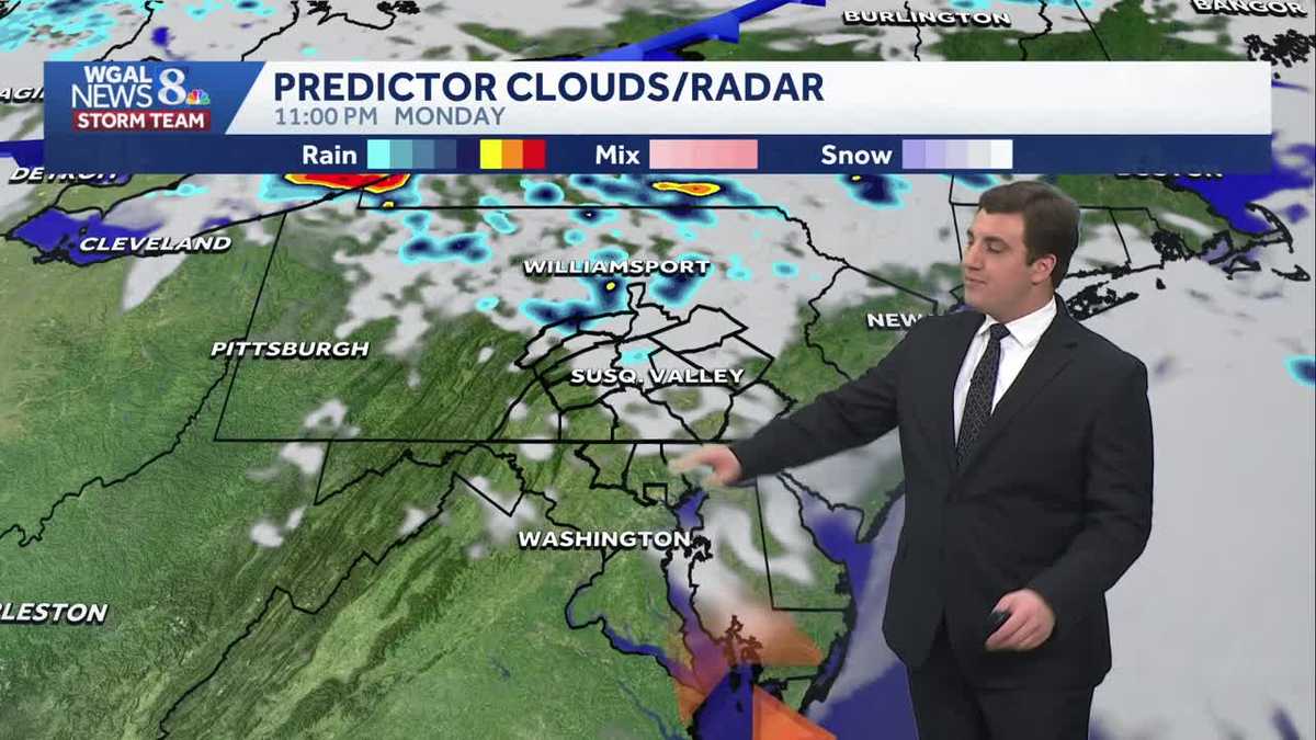
Good evening,Tonight, stray showers are possible mainly north of the Turnpike; otherwise, look for mostly cloudy skies and mild temperatures in the upper 50s.SURGE OF WARMTHTuesday, we’re seeing brighter skies with more sunshine mixing in and out of the clouds. Highs in the upper 70s to near 80 degrees—more typical of late May—are expected as southwesterly winds increase to 10 to 20 mph.There is a chance for a few evening and overnight showers and thunderstorms. However, the Storm Prediction Center has Mifflin, Juniata, Perry, Dauphin, Cumberland, and Lebanon Counties outlooked in a Marginal Risk for possible gusty winds, small hail, and locally heavy rainfall. Right now, the strongest storms stay to our north.INCREASING RAIN CHANCESA cold front brings a better chance for showers on Wednesday, with a few thunderstorms possible. It stays warm, with highs in the low to mid 70s. Cooler temperatures prevail on Thursday with high temperatures stuck in the 50s. Plus, rain threatens both Thursday and Friday.EASTER WEEKENDMost of Saturday is looking dry and warm in the low 70s. A warm front lifting north late in the day towards evening brings the next threat for showers. They may linger overnight but are gone before sunrise Sunday. So, it is looking drier for church services. A cold front will bring a better chance for showers during the afternoon. A cooler, more seasonable trend follows for the first full week of April.Have a great night!
Good evening,
Tonight, stray showers are possible mainly north of the Turnpike; otherwise, look for mostly cloudy skies and mild temperatures in the upper 50s.
SURGE OF WARMTH
Tuesday, we’re seeing brighter skies with more sunshine mixing in and out of the clouds. Highs in the upper 70s to near 80 degrees—more typical of late May—are expected as southwesterly winds increase to 10 to 20 mph.
There is a chance for a few evening and overnight showers and thunderstorms. However, the Storm Prediction Center has Mifflin, Juniata, Perry, Dauphin, Cumberland, and Lebanon Counties outlooked in a Marginal Risk for possible gusty winds, small hail, and locally heavy rainfall. Right now, the strongest storms stay to our north.
INCREASING RAIN CHANCES
A cold front brings a better chance for showers on Wednesday, with a few thunderstorms possible. It stays warm, with highs in the low to mid 70s. Cooler temperatures prevail on Thursday with high temperatures stuck in the 50s. Plus, rain threatens both Thursday and Friday.
EASTER WEEKEND
Most of Saturday is looking dry and warm in the low 70s. A warm front lifting north late in the day towards evening brings the next threat for showers. They may linger overnight but are gone before sunrise Sunday. So, it is looking drier for church services. A cold front will bring a better chance for showers during the afternoon. A cooler, more seasonable trend follows for the first full week of April.
Have a great night!