
Much cooler this afternoon, 70s return tomorrow in south-central Pennsylvania
Rain chances are minimal the next few days, then rain is likely Easter morning. Cooler & breezy as we head into next week.
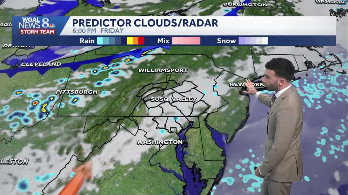
MAKING IT ONE OF THE LARGEST IPOS IN HISTORY. NOW, THE WGAL NEWS EIGHT STORM TEAM FORECAST, WITH METEOROLOGIST RYAN ARGENTI A BIT OF A WET START FOR SOME COMMUNITIES THIS MORNING. HERE’S THE TIME LAPSE FROM EARLIER THIS MORNING. SOME DRIZZLE ON THE CAMERA LENS. FAST FORWARDING. YOU SEE A LITTLE BIT MORE DRIZZLE FOR THE MIDDLE OF THE MORNING. NOW AS WE GET INTO THE AFTERNOON, LOOKING AT SOME MOSTLY CLOUDY CONDITIONS, TEMPERATURES RIGHT NOW SITTING RIGHT AROUND 50 DEGREES WITH WINDS OUT OF THE EAST, RIGHT AROUND EIGHT MILES PER HOUR SO FAR THIS AFTERNOON. SO A BIT OF A COOL DAY. CERTAINLY A COOL DAY. IT’S BEEN. THAT’S REALLY THE STORY FOR THIS AFTERNOON. WE’RE INTO THE 70S YESTERDAY. NOW WE’RE GETTING NOW INTO THE 50S FOR THIS AFTERNOON. BUT WE’LL HAVE MORE SEASONABLE TEMPERATURES FOR THE AFTERNOON WARM WITH MORE RAIN CHANCES FOR EASTER WEEKEND, AND THEN DRIER AND COOLER FOR NEXT WEEK WITH TEMPERATURES CONSISTENTLY INTO THE 50S. BEFORE WE GO BACK TO THE 70S FOR LATE NEXT WEEK. SO FOR TODAY, EXPECT CLOUDY SKIES. A SHOWER DRIZZLE CAN’T BE RULED OUT, BUT MOST OF THE AREA SHOULD BE STAYING DRY. BUT IT’S MUCH COOLER INTO THE LOWER 50S. AS YOU CAN SEE TONIGHT, 42 TO 46 DEGREES. SOME FOG MAY DEVELOP. MIGHT SEE SOME PATCHY DRIZZLE TOO, WITH SOME CLOUDY SKIES WITH SOUTHEASTERLY, 5 TO 10 MILE PER HOUR BREEZE. AND THEN WE’LL HAVE SOME CLOUDS WITH A MIX OF SOME SUNSHINE. WE’LL HAVE A FEW SHOWERS ON TAP FOR THE AFTERNOON WARMER INTO THE 70S LOWER 70S. AS A MATTER OF FACT, WITH WITH THOSE SOUTHEASTERLY BREEZE TURNING SOUTHWESTERLY BETWEEN 5 AND 15MPH. SO TEMPERATURES INTO THE 40S. RIGHT NOW WE’RE 48 IN LANCASTER, 49 IN HARRISBURG, 50 IN YORK, GETTYSBURG AND CHAMBERSBURG. CERTAINLY A MUCH DIFFERENT STORY COMPARED TO YESTERDAY. LET ME SHOW YOU. OVER THE LAST 24 HOURS, THE CHANGE IN TEMPERATURES FOR SOME COMMUNITIES, A CHANGE OF 24 DEGREES OVER THE LAST 24 HOURS FOR LANCASTER, A CHANGE IN 25 DEGREES IN GETTYSBURG, FOR EXAMPLE, IT’S AT LEAST A 20 DEGREE DIFFERENCE COMPARED TO YESTERDAY. SO STORM TEAM, LIVE RADAR NETWORK, JUST SEEING SOME SHOWERS PASSING IN THROUGH OUR WESTERN COMMUNITIES NOW ENTERING JUNIATA AND PERRY COUNTIES. ALSO PORTIONS OF NORTHERN FRANKLIN COUNTY. BUT OVERALL, MOST OF THE AREA LOOKING DRY WITH SOME WITH MAINLY SOME HIGH, MID MIDDLE TO HIGH LEVEL CLOUDS FOR TODAY. BUT YOU CAN SEE THERE’S A WARM FRONT JUST TOWARDS OUR SOUTH. AND THAT’S GOING TO BE THERE’S COOLER AIR THAT’S JUST AHEAD OF THIS WARM FRONT. BUT ONCE THIS WARM FRONT STARTS TO MOVE NORTH, THAT’S WHEN WE’LL START TO SEE THE MILDER TREND IN TEMPERATURES. AS YOU CAN SEE, AS WE HEAD INTO OUR FRIDAY. AND THEN WE’LL SEE SOME PARTLY TO MOSTLY CLOUDY CONDITIONS AS WE HEAD INTO OUR EVENING FOR OUR FRIDAY. AND THEN WE ALSO SEE JUST ANOTHER SLIGHT CHANCE OF A SHOWER AS WE HEAD INTO LATER FRIDAY INTO SATURDAY. BUT LOOK AT THIS. TEMPERATURES INTO THE 70S FOR YOUR FRIDAY 78 ON YOUR SATURDAY, 66 FOR EASTER SUNDAY, THEN BACK TO SEASONABLE LEVELS AS WE GET INTO NEXT WEEK. CERTAINLY BREEZY AND COOLER AS WE HEAD INTO MONDAY AND TUESDAY. BUT IF YOU LOOK AHEAD TO THE TO THE END OF THE TEN DAY FORECAS
Much cooler this afternoon, 70s return tomorrow in south-central Pennsylvania
Rain chances are minimal the next few days, then rain is likely Easter morning. Cooler & breezy as we head into next week.

Updated: 12:33 PM EDT Apr 2, 2026
A cold front will settle along the PA/MD state line this morning, leading to cloudy skies and cooler temperatures, due to winds out of the east. Temperatures will hover in the low 50s for most of the day. Drizzle is possible this morning, and a few showers may develop later.Tonight, lows will fall to the low 40s under cloudy skies. You may see areas of drizzle and patchy fog.A warm front will lift north Friday, and temperatures will rebound to the low 70s. A few showers can’t be ruled out, but most of the day will be dry under partly to mostly cloudy skies.EASTER WEEKENDSaturday will be the warmer half of the weekend, with highs in the upper 70s and a few showers around. Sunday’s cold front has sped up, leading to a better chance of rain early in the day, then a drier afternoon and evening. Highs on Easter will reach the mid-60s.NEXT WEEKTemperatures will be below average for early April. Expect highs in the low 50s Monday and Tuesday. Lows will be cooler, in the low-to-mid 30s. Temperatures will trend warmer toward the end of the week, and could approach 70 degrees by Friday.
A cold front will settle along the PA/MD state line this morning, leading to cloudy skies and cooler temperatures, due to winds out of the east. Temperatures will hover in the low 50s for most of the day. Drizzle is possible this morning, and a few showers may develop later.
Tonight, lows will fall to the low 40s under cloudy skies. You may see areas of drizzle and patchy fog.
A warm front will lift north Friday, and temperatures will rebound to the low 70s. A few showers can’t be ruled out, but most of the day will be dry under partly to mostly cloudy skies.
EASTER WEEKEND
Saturday will be the warmer half of the weekend, with highs in the upper 70s and a few showers around. Sunday’s cold front has sped up, leading to a better chance of rain early in the day, then a drier afternoon and evening. Highs on Easter will reach the mid-60s.
NEXT WEEK
Temperatures will be below average for early April. Expect highs in the low 50s Monday and Tuesday. Lows will be cooler, in the low-to-mid 30s. Temperatures will trend warmer toward the end of the week, and could approach 70 degrees by Friday.