
Cool & breezy start to the work week; back to the 70s late week across south-central Pennsylvania
Expect a cool & breezy start to the work week, then warmer conditions return late this week
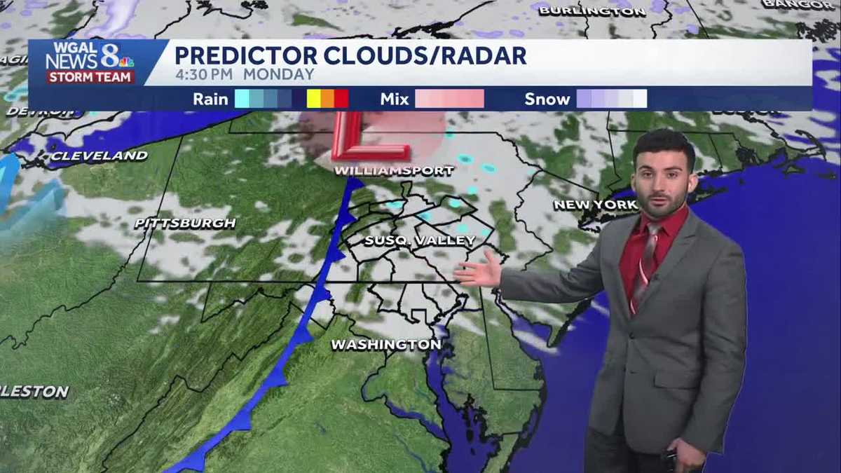
DUMPSTER, SHE SAYS. THE BEARS SPENT THREE NIGHTS AT THEIR HOME. NOW THE WGAL NEWS EIGHT STORM TEAM FORECAST WITH METEOROLOGIST RYAN ARGENTI. IN TERMS OF THE WEATHER HEADLINES FOR THE REST OF THE NIGHT TONIGHT, CLOUDS ARE STILL HANGING TOUGH OUT THERE, BUT WE’LL SOON START TO SEE THOSE SKIES CLEAR AS WE HEAD INTO THE OVERNIGHT PERIOD. BIG COOLDOWN AS WE GET INTO EARLY THIS COMING WEEK AND THEN 70S MAKE A RETURN AS WE HEAD TO THE END OF THE WEEK, WE’LL SEE THOSE 70S RETURNING RIGHT AROUND FRIDAY IS WHEN I’M EXPECTING TO SEE THOSE 70S RETURN. SO ALMANAC FOR THE DAY TODAY HIT A HIGH OF 57 DEGREES. THAT’S WHAT WE EXPECT FOR THIS TIME OF YEAR 59 IS WHAT WE EXPECT, BUT WE’RE RIGHT AROUND PAR FOR THIS TIME OF THE YEAR 47. THAT WAS EARLIER THIS MORNING’S LOW 39 IS WHAT WE EXPECT. WE HAD ABOUT 0.47IN OF SOME RAIN. SO JUST JUST SHY OF THAT HALF INCH MARK AT HARRISBURG INTERNATIONAL AIRPORT FROM EARLIER. BUT HERE’S IN TERMS OF OUTSIDE OF HARRISBURG INTERNATIONAL AIRPORT HAD OTHER AREAS RANGING FROM ABOUT A HALF INCH UP TO OR ABOVE THREE QUARTERS OF AN INCH, ALMOST GETTING TO THAT ONE INCH MARK OF SOME RAIN, ESPECIALLY FOR GREENCASTLE, HAD ABOUT 8/10 OF AN INCH. DOVER JUST JUST UNDER 7/10 OF AN INCH OF SOME RAIN, 0.61IN FOR CASHTOWN AND ABOUT 0.58IN FOR MOUNT HOLLY SPRINGS. BUT WEATHER PLANNER FOR THE REST OF THE NIGHT TONIGHT, EXPECT MOSTLY CLEAR CONDITIONS, BUT IT’S STILL GOING TO BE BREEZY THROUGH THE OVERNIGHT PERIOD, WITH TEMPERATURES BOTTOMING OUT RIGHT AROUND THE UPPER 30S 42 FOR TOMORROW MORNING. MOSTLY SUNNY, COOL, AND BREEZY. IT WILL STILL BE A COOLER DAY. 54 DEGREES FOR THE AFTERNOON WITH PARTLY SUNNY CONDITIONS. NOW I DID ADD A SHOWER ICON FOR TOMORROW AFTERNOON. I DO THINK THERE’S GOING TO BE A CHANCE OF AN ISOLATED SHOWER, BUT THE CHANCE IS SO ISOLATED THAT I BELIEVE, I THINK THAT MOST OF THE DAY IS GOING TO BE STAYING DRY. WE’LL SEE SOME. WE’LL SEE SUNSHINE FOR THE MAJORITY OF THE DAY. JUST CAN’T RULE OUT THAT STRAY ISOLATED SHOWER CHANCE WITH A BIT OF A CLIPPER SYSTEM THAT’S GOING TO SCOOCH BY. I’LL SHOW YOU THAT HERE IN THE PREDICTOR IN JUST A FEW MINUTES. BUT YOU CAN SEE BRIGHT SUNSHINE IF YOU’RE HEADED TO THE EXCELLENT CELEBRATION AT DUTCH WONDERLAND THEME PARK, WE’RE GOING TO HAVE BRIGHT SUNSHINE TO START THE DAY. PARTLY SUNNY CONDITIONS FOR THE AFTERNOON, AND THEN WE’LL HAVE THAT CHANCE OF AN ISOLATED SHOWER FOR LATER ON IN THE EVENING WEATHER FOR THE DAY TOMORROW. HIGH. TREE POLLEN LEVELS, LOW LEVELS ARE GOING TO BE LOW. AIR QUALITY IS GOOD. MODERATE UV INDEX ABOUT A 40 MINUTE BURN TIME. TEMPERATURES STILL INTO THE LOWER 50S. YOU CAN SEE THOUGH 49 IN LANCASTER, 46 IN LEWISTOWN. WE ARE 51 IN LEBANON AT THIS TIME. YOU CAN SEE CURRENT WINDS OUT OF THE WEST NORTHWEST. I’D SAY GENERALLY BETWEEN 10 AND 15MPH, BUT SOME AREAS COULD BE GUSTING TO 20 TO 25MPH AT TIMES. YOU CAN SEE AS WE GET INTO THE NEXT 12 HOURS, THAT’S WHEN WE CAN SEE THOSE THOSE GUSTS GETTING UPWARDS TO ABOUT 30MPH. STORM TEAM, LIVE RADAR NETWORK. JUST SEEING SOME CLOUDS RIGHT NOW, JUST CROSSING OVER THE AREA. BUT WITH THIS AIR, THIS DRIER AIR USHERING IN FROM HIGH PRESSURE THAT’S BUILDING IN FROM THE SOUTH, THAT’S GOING TO HELP CLEAR OUR SKIES OR KEEP THEM CLEAR FOR THE MAJORITY OF THE DAY. NOW HERE COMES THIS BRIEF PASSING CLIPPER SYSTEM THAT’S GOING TO COME BY. SEE A LITTLE SHOWER CHANCE. AGAIN, IT’S ISOLATED. SO ISOLATED THAT IS. AND NOTICE HOW THE MAJORITY OF THE AREA IS GOING TO BE DRY. THAT’S WHY I WANTED TO ADD THAT ICON IN THERE, JUST TO ACCOUNT FOR THERE BEING AN ISOLATED SHOWER CHANCE. AS WE GET INTO THE REST OF THE AS WE GET INTO OUR TUESDAY, STILL SEEING SOME MAINLY CLEAR CONDITIONS, HIGH PRESSURE USHERING IN THAT COOLER AIR FROM THE NORTH. AND THAT’S WHAT’S GOING TO BE KEEPING OUR TEMPERATURES DOWN INTO THE UPPER 40S. AS A MATTER OF FACT, FOR OUR TUESDAY AFTERNOON, WEDNESDAY, 5260 FOR YOUR THURSDAY, GETTING UP TO THE 60S AND INTO THE 70S AS YOU CAN, AS YOU CAN SEE REFLECTED IN OUR TEN DAY FORECAST, GETTING TO THE UPPER 60S FOR FRIDAY, IT’S GOING TO BE WARMER 70 BY THE TIME WE GET TO SATURDAY AGAIN, AND THEN WE HAVE A COUPLE RAIN CHANCES AS WE GET INTO SUNDAY AND INTO THE FOLLOWING WEEK. BUT LO
Cool & breezy start to the work week; back to the 70s late week across south-central Pennsylvania
Expect a cool & breezy start to the work week, then warmer conditions return late this week

Updated: 11:22 PM EDT Apr 5, 2026
Tonight, expect partly cloudy skies to turn to mainly clear skies with breezy conditions. Lows will bottom out in the upper 30s. Winds will remain elevated between 10-20 mph overnight.EARLY WEEKSkies are bright early Monday before a weak clipper brings some cloud cover during the afternoon. There may be some isolated showers, but the chance is low and most of the day should stay dry. Temperatures will trend below normal in the mid 50s, and even colder, in the 40s ,on Tuesday. The weather conditions are expected to remain dry the rest of the week.REST OF WEEK INTO WEEKENDWhile the quiet weather pattern persists, temperatures slowly turning around. High temperatures are more seasonable in the low 60s on Thursday, then they climb to the 70s Friday.Next weekend will continue to be warm in the low to mid 70s. Showers don’t return until later Monday and Tuesday.Have a great rest of your night!~ Ryan
Tonight, expect partly cloudy skies to turn to mainly clear skies with breezy conditions. Lows will bottom out in the upper 30s. Winds will remain elevated between 10-20 mph overnight.
EARLY WEEK
Skies are bright early Monday before a weak clipper brings some cloud cover during the afternoon. There may be some isolated showers, but the chance is low and most of the day should stay dry. Temperatures will trend below normal in the mid 50s, and even colder, in the 40s ,on Tuesday. The weather conditions are expected to remain dry the rest of the week.
REST OF WEEK INTO WEEKEND
While the quiet weather pattern persists, temperatures slowly turning around. High temperatures are more seasonable in the low 60s on Thursday, then they climb to the 70s Friday.
Next weekend will continue to be warm in the low to mid 70s. Showers don’t return until later Monday and Tuesday.
Have a great rest of your night!
~ Ryan