
A cold front will move through the Lehigh Valley on Wednesday, bringing gusty northwest winds and clearing conditions.
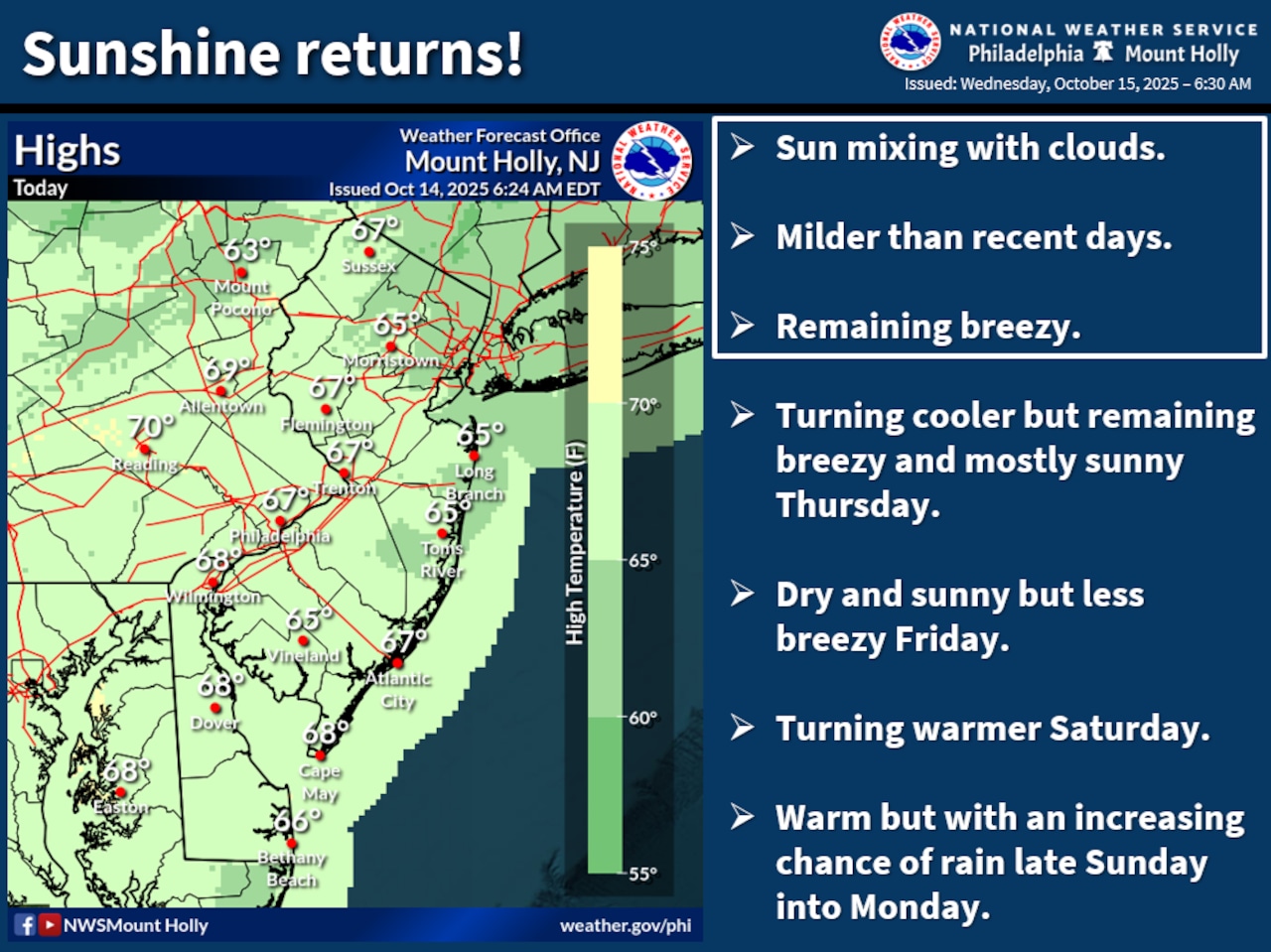
Temperatures will remain mild in the upper 60s during the day, with overnight lows dropping to around 40.
The morning will start with lingering low clouds that will gradually dissipate, giving way to increasing sunshine by the afternoon, according to the National Weather Service forecast. Northwest winds are expected at around 5-15 mph. Despite the cold front’s passage, no precipitation is expected in the Lehigh Valley region.
Overnight into Thursday, skies will become mostly clear with continued northwest winds as temperatures bottom out around 40. The Pocono areas may experience the coolest temperatures, with some locations potentially dropping into the upper 30s. However, the National Weather Service does not anticipate widespread frost due to ongoing wind activity.
Looking ahead, Thursday will bring continued sunny conditions with highs in the upper 50s to lower 60s. Gusts out of the north-northwest could reach 20-30 mph on Thursday. Another couple of cold nights are in store overnight into Friday and Saturday, again with lows dipping to the upper 30s.
The weekend will see a gradual warming trend, with temperatures climbing back into the mid-60s to low 70s Saturday and Sunday. A potential rain system is forecast to approach the region Sunday night into Monday.
Residents should be prepared for cooler temperatures and windy conditions, particularly on Wednesday and Thursday. Light jackets and layers will be advisable when heading outdoors during this period.
Follow your local forecast from AccuWeather at lehighvalleylive.com/weather with National Weather Service watches, warnings and other advisories available as they’re issued at lehighvalleylive.com/weather-alerts.
Current weather radar
Generative AI was used to produce an initial draft of this story, which was reviewed and edited by lehighvalleylive.com staff.
If you purchase a product or register for an account through a link on our site, we may receive compensation. By using this site, you consent to our User Agreement and agree that your clicks, interactions, and personal information may be collected, recorded, and/or stored by us and social media and other third-party partners in accordance with our Privacy Policy.