
Low clouds have developed, mainly east of the Susquehanna River overnight. Just like yesterday, the clouds will clear by mid-to-late morning. Temperatures aren’t as chilly as the past few days. Expect morning temperatures in the 40s.We’re in for plentiful sunshine, a southerly breeze, and highs around 72 degrees this afternoon. Clouds will gradually increase this evening ahead of a cold front. The front will pass overnight, leading to a few showers between 11 p.m. and 3 a.m. Rain totals will only amount to a few hundredths of an inch. Expect mild lows near 50 degrees and clearing toward sunrise. Saturday will be bright and pleasant, with a light breeze and seasonable highs around 64 degrees. Sunday will feature partly sunny skies and comfortable highs around 66. We’re in for a summerlike stretch next week. Temperatures will rebound to the mid-to-upper 70s Monday with a few showers possible. Highs will soar to the low-to-mid 80s Tuesday through Thursday. It may even turn a little sticky, as dew points climb to near 60 degrees on Tuesday and Wednesday. Rain chances will be minimal.A cold front will slowly approach toward the end of next week. A slightly higher chance of showers arrives Thursday and again Sunday. Highs at the end of the week will hover in the 70s.
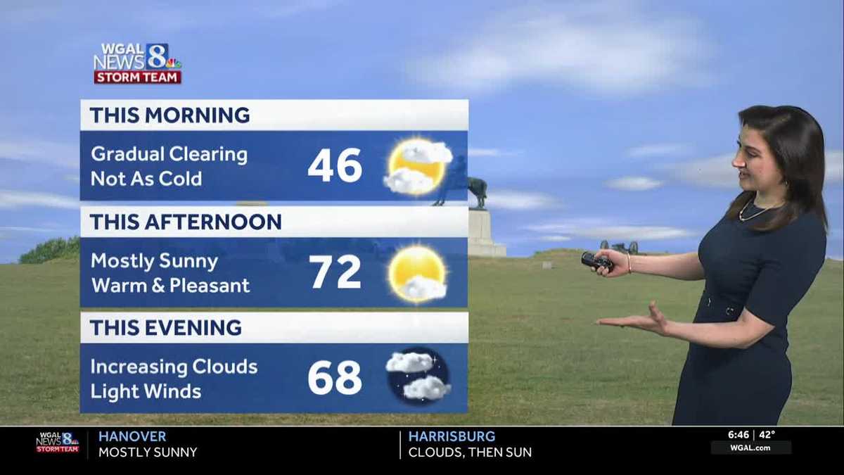
Low clouds have developed, mainly east of the Susquehanna River overnight. Just like yesterday, the clouds will clear by mid-to-late morning. Temperatures aren’t as chilly as the past few days. Expect morning temperatures in the 40s.
We’re in for plentiful sunshine, a southerly breeze, and highs around 72 degrees this afternoon. Clouds will gradually increase this evening ahead of a cold front.
The front will pass overnight, leading to a few showers between 11 p.m. and 3 a.m. Rain totals will only amount to a few hundredths of an inch. Expect mild lows near 50 degrees and clearing toward sunrise.
Saturday will be bright and pleasant, with a light breeze and seasonable highs around 64 degrees. Sunday will feature partly sunny skies and comfortable highs around 66.
We’re in for a summerlike stretch next week. Temperatures will rebound to the mid-to-upper 70s Monday with a few showers possible.
Highs will soar to the low-to-mid 80s Tuesday through Thursday. It may even turn a little sticky, as dew points climb to near 60 degrees on Tuesday and Wednesday. Rain chances will be minimal.
A cold front will slowly approach toward the end of next week. A slightly higher chance of showers arrives Thursday and again Sunday. Highs at the end of the week will hover in the 70s.